Perm elevation
Perm, Russia elevation is 149 meters and Perm elevation in feet is 489 ft above sea level [src 1]. Perm is a seat of a first-order administrative division (feature code) with elevation that is 50 meters (164 ft) smaller than average city elevation in Russia.
Below is the Elevation map of Perm, which displays elevation range with different colors. Scale of the first map is from 86 to 176 m (282 to 577 ft) with average elevation of 129.9 meters (=426 ft) [note 1]
These maps also provides idea of topography and contour of this city, they are displayed at different zoom levels. More info about maps, scale and edge coordinates you can find below images.
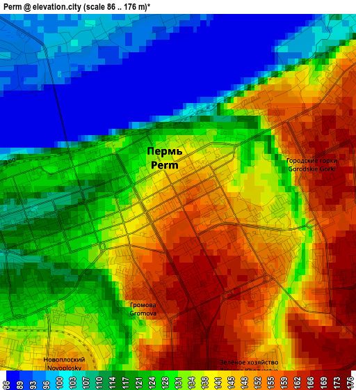
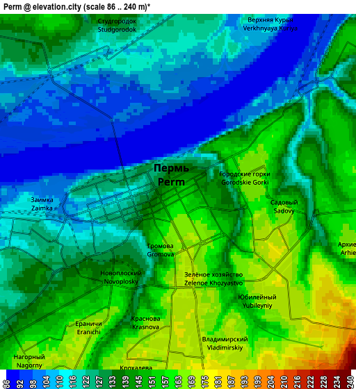
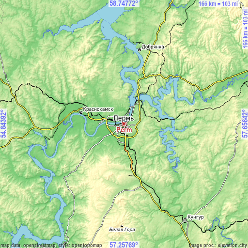
| \ | Map #1 | Map #2 | Topo.Map |
| Scale [m] | 86..176 m | 86..240 m | × |
| Scale [ft] | 282..577 ft | 282..787 ft | × |
| Average | 129.9 m = 426 ft | 133.5 m = 438 ft | × |
| Width | 5.18 km = 3.2 mi | 10.35 km = 6.4 mi | 165.7 km = 103 mi |
| Height | 5.18 km = 3.2 mi | 10.35 km = 6.4 mi | 165.7 km = 103 mi |
| ↑Max Latitude | 58.033733° | 58.056991° | 58.74772° |
| Latitude at center | 58.01046° | 58.01046° | 58.01046° |
| ↓Min Latitude | 57.987172° | 57.963868° | 57.25769° |
| ← Min Longitude | 56.206225° | 56.162279° | 54.84392° |
| Longitude center | 56.25017° | 56.25017° | 56.25017° |
| →Max Longitude | 56.294115° | 56.338061° | 57.65642° |
Nearby cities:
Cities around Perm sort by population:
• Krasnokamsk elevation 108 m
30.1 km,  284°
284°
• Zvëzdnyy 220 m
31.1 km,  172°
172°
• Novyye Lyady 175 m
21.8 km,  76°
76°
• Sylva 170 m
30.8 km,  85°
85°
• Kondratovo 96 m
9.1 km,  248°
248°
• Overyata 100 m
24 km,  289°
289°
• Gamovo 148 m
18.3 km,  207°
207°
• Kultayevo 120 m
22.5 km,  235°
235°
• Lobanovo 132 m
17.1 km, 169°
• Ferma 109 m
12.6 km,  164°
164°
• Froly 118 m
10 km, 172°
• Sokol 118 m
16.1 km,  228°
228°
Multilingual:
 En español:
Perm elevación 149 m.
 En France:
Perm élévation 149 m.


Sources and notes:
- [note 1] Map square and city borders are not equal. Map elevation data is calculated only from area inside that square.
- [src 1] Elevation data from geonames database provided with same terms of usage.
- [src 2] The elevation map of Perm is generated using elevation data from NASA's 3 arcsec (90m) resolution SRTM data.
- [src 3] Base (background) map © OpenStreetMap contributors tiles are generated by Geofabrik and OpenTopoMap.
Copyright & License:
This Perm Elevation Map is licensed under CC BY-SA. You may reuse any part from this page, if you give a proper credit by linking to this URL:
 More info on terms of use page.