Rumyantsevo elevation
Rumyantsevo (Moscow Oblast), Russia elevation is 212 meters and Rumyantsevo elevation in feet is 696 ft above sea level [src 1]. Rumyantsevo is a populated place (feature code) with elevation that is 13 meters (43 ft) bigger than average city elevation in Russia.
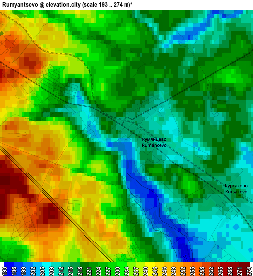
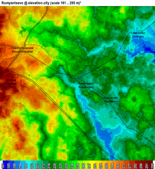
Below is the Elevation map of Rumyantsevo, which displays elevation range with different colors. Scale of the first map is from 193 to 274 m (633 to 899 ft) with average elevation of 226.4 meters (=743 ft) [note 1]
These maps also provides idea of topography and contour of this city, they are displayed at different zoom levels. More info about maps, scale and edge coordinates you can find below images.
| \ | Map #1 | Map #2 | Topo.Map |
| Scale [m] | 193..274 m | 181..295 m | × |
| Scale [ft] | 633..899 ft | 594..968 ft | × |
| Average | 226.4 m = 743 ft | 231.9 m = 761 ft | × |
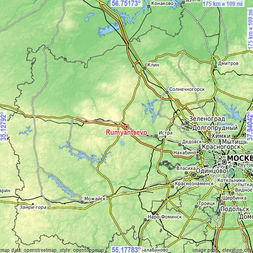
| Width | 5.47 km = 3.4 mi | 10.94 km = 6.8 mi | 175 km = 108.7 mi |
| Height | 5.47 km = 3.4 mi | 10.94 km = 6.8 mi | 175 km = 108.7 mi |
| ↑Max Latitude | 55.997363° | 56.021931° | 56.75173° |
| Latitude at center | 55.97278° | 55.97278° | 55.97278° |
| ↓Min Latitude | 55.948181° | 55.923566° | 55.17783° |
| ← Min Longitude | 36.490225° | 36.446279° | 35.12792° |
| Longitude center | 36.53417° | 36.53417° | 36.53417° |
| →Max Longitude | 36.578115° | 36.622061° | 37.94042° |
Nearby cities:
Cities around Rumyantsevo sort by population:
• Istra elevation 175 m
21.6 km,  105°
105°
• Zvenigorod 178 m
33.4 km,  142°
142°
• Yershovo 205 m
30.4 km, 138°
• Novopetrovskoye 262 m
4.5 km,  299°
299°
• Snegiri 216 m
31.9 km, 107°
• Sychëvo 237 m
19.1 km,  264°
264°
• Kostrovo 183 m
13.3 km,  131°
131°
• Krivtsovo 195 m
29.3 km,  47°
47°
• Karinskoye 167 m
30.8 km,  161°
161°
• Teryayevo 156 m
33.5 km,  310°
310°
• Savvinskaya Sloboda 151 m
32.4 km,  148°
148°
• Nudol’ 208 m
14.2 km,  355°
355°
Multilingual:
 En español:
Rumyantsevo elevación 212 m.
 En France:
Rumyantsevo élévation 212 m.
 Auf Deutsch:
Rumyantsevo höhe über dem Meeresspiegel ist 212 m.

Sources and notes:
- [note 1] Map square and city borders are not equal. Map elevation data is calculated only from area inside that square.
- [src 1] Elevation data from geonames database provided with same terms of usage.
- [src 2] The elevation map of Rumyantsevo is generated using elevation data from NASA's 3 arcsec (90m) resolution SRTM data.
- [src 3] Base (background) map © OpenStreetMap contributors tiles are generated by Geofabrik and OpenTopoMap.
Copyright & License:
This Rumyantsevo Elevation Map is licensed under CC BY-SA. You may reuse any part from this page, if you give a proper credit by linking to this URL:
 More info on terms of use page.