Serebryanyye Prudy elevation
Serebryanyye Prudy (Moscow Oblast), Russia elevation is 133 meters and Serebryanyye Prudy elevation in feet is 436 ft above sea level [src 1]. Serebryanyye Prudy is a populated place (feature code) with elevation that is 66 meters (217 ft) smaller than average city elevation in Russia.
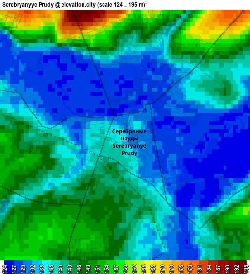
Below is the Elevation map of Serebryanyye Prudy, which displays elevation range with different colors. Scale of the first map is from 124 to 195 m (407 to 640 ft) with average elevation of 140.4 meters (=461 ft) [note 1]
These maps also provides idea of topography and contour of this city, they are displayed at different zoom levels. More info about maps, scale and edge coordinates you can find below images.
| \ | Map #1 | Map #2 | Topo.Map |
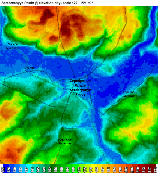
| Scale [m] | 124..195 m | 122..221 m | × |
| Scale [ft] | 407..640 ft | 400..725 ft | × |
| Average | 140.4 m = 461 ft | 156.6 m = 514 ft | × |
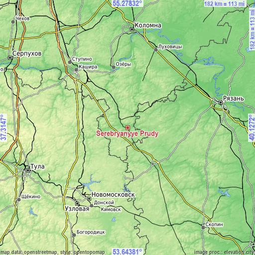
| Width | 5.68 km = 3.5 mi | 11.36 km = 7.1 mi | 181.7 km = 112.9 mi |
| Height | 5.68 km = 3.5 mi | 11.36 km = 7.1 mi | 181.7 km = 112.9 mi |
| ↑Max Latitude | 54.49476° | 54.520275° | 55.27832° |
| Latitude at center | 54.46923° | 54.46923° | 54.46923° |
| ↓Min Latitude | 54.443684° | 54.418121° | 53.64381° |
| ← Min Longitude | 38.677005° | 38.633059° | 37.3147° |
| Longitude center | 38.72095° | 38.72095° | 38.72095° |
| →Max Longitude | 38.764895° | 38.808841° | 40.1272° |
Nearby cities:
Cities around Serebryanyye Prudy sort by population:
• Ozëry elevation 132 m
44.8 km,  345°
345°
• Zaraysk 167 m
33.9 km,  17°
17°
• Severo-Zadonsk 232 m
52.6 km,  203°
203°
• Venëv 191 m
31.9 km,  246°
246°
• Mikhaylov 125 m
33.2 km,  143°
143°
• Ozherel’ye 220 m
46.3 km,  320°
320°
• Gritsovskiy 215 m
51.8 km,  224°
224°
• Oktyabr’skiy 187 m
29.2 km,  157°
157°
• Uzunovo 152 m
10.2 km, 319°
• Zakharovo 158 m
37.9 km,  107°
107°
• Bagramovo 124 m
54.9 km,  59°
59°
• Vilenka 172 m
25.6 km,  150°
150°
Multilingual:
 En español:
Serebryanyye Prudy elevación 133 m.
 En France:
Serebryanyye Prudy élévation 133 m.
 Auf Deutsch:
Serebryanyye Prudy höhe über dem Meeresspiegel ist 133 m.

Sources and notes:
- [note 1] Map square and city borders are not equal. Map elevation data is calculated only from area inside that square.
- [src 1] Elevation data from geonames database provided with same terms of usage.
- [src 2] The elevation map of Serebryanyye Prudy is generated using elevation data from NASA's 3 arcsec (90m) resolution SRTM data.
- [src 3] Base (background) map © OpenStreetMap contributors tiles are generated by Geofabrik and OpenTopoMap.
Copyright & License:
This Serebryanyye Prudy Elevation Map is licensed under CC BY-SA. You may reuse any part from this page, if you give a proper credit by linking to this URL:
 More info on terms of use page.