Sertolovo elevation
Sertolovo (Leningradskaya Oblast'), Russia elevation is 48 meters and Sertolovo elevation in feet is 157 ft above sea level [src 1]. Sertolovo is a populated place (feature code) with elevation that is 151 meters (495 ft) smaller than average city elevation in Russia.
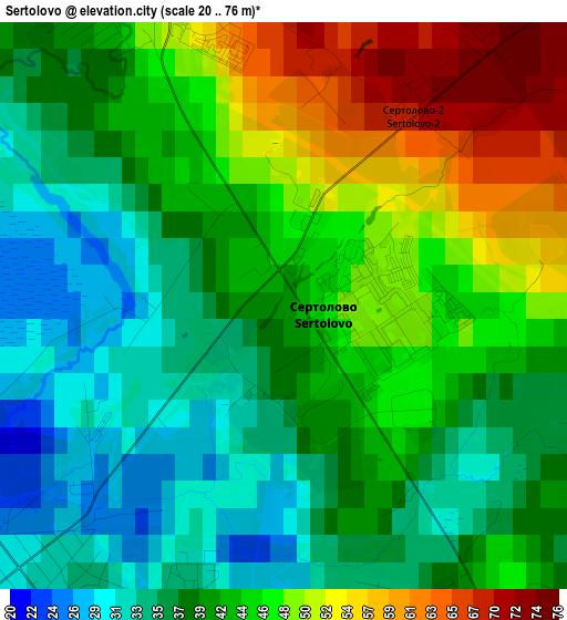
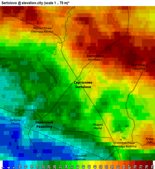
Below is the Elevation map of Sertolovo, which displays elevation range with different colors. Scale of the first map is from 20 to 76 m (66 to 249 ft) with average elevation of 42.2 meters (=138 ft) [note 1]
These maps also provides idea of topography and contour of this city, they are displayed at different zoom levels. More info about maps, scale and edge coordinates you can find below images.
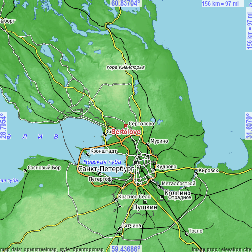
| \ | Map #1 | Map #2 | Topo.Map |
| Scale [m] | 20..76 m | 1..79 m | × |
| Scale [ft] | 66..249 ft | 3..259 ft | × |
| Average | 42.2 m = 138 ft | 41.3 m = 135 ft | × |
| Width | 4.86 km = 3 mi | 9.73 km = 6 mi | 155.7 km = 96.7 mi |
| Height | 4.86 km = 3 mi | 9.73 km = 6 mi | 155.7 km = 96.7 mi |
| ↑Max Latitude | 60.166269° | 60.188124° | 60.83704° |
| Latitude at center | 60.1444° | 60.1444° | 60.1444° |
| ↓Min Latitude | 60.122516° | 60.100618° | 59.43686° |
| ← Min Longitude | 30.157705° | 30.113759° | 28.7954° |
| Longitude center | 30.20165° | 30.20165° | 30.20165° |
| →Max Longitude | 30.245595° | 30.289541° | 31.6079° |
Nearby cities:
Cities around Sertolovo sort by population:
• Ozerki elevation 24 m
13.2 km,  152°
152°
• Parnas 22 m
11.6 km,  135°
135°
• Kolomyagi 9 m
14.1 km,  160°
160°
• Sestroretsk 8 m
14.1 km,  248°
248°
• Pargolovo 38 m
8.2 km, 149°
• Pesochnyy 25 m
3.2 km,  221°
221°
• Bugry 23 m
13.3 km,  127°
127°
• Shuvalovo 26 m
11.8 km, 154°
• Agalatovo 84 m
9.3 km,  25°
25°
• Levashovo 17 m
4.5 km,  176°
176°
• Beloostrov 11 m
11.1 km,  273°
273°
• Luppolovo 75 m
4.5 km,  76°
76°
Multilingual:
 En español:
Sértolovo elevación 48 m.
 En France:
Sertolovo élévation 48 m.
 Auf Deutsch:
Sertolowo höhe über dem Meeresspiegel ist 48 m.

Sources and notes:
- [note 1] Map square and city borders are not equal. Map elevation data is calculated only from area inside that square.
- [src 1] Elevation data from geonames database provided with same terms of usage.
- [src 2] The elevation map of Sertolovo is generated using GMTED2010 database with 7.5 arcsec (225m) resolution.
- [src 3] Base (background) map © OpenStreetMap contributors tiles are generated by Geofabrik and OpenTopoMap.
Copyright & License:
This Sertolovo Elevation Map is licensed under CC BY-SA. You may reuse any part from this page, if you give a proper credit by linking to this URL:
 More info on terms of use page.