Kolomyagi elevation
Kolomyagi (St.-Petersburg), Russia elevation is 9 meters and Kolomyagi elevation in feet is 30 ft above sea level [src 1]. Kolomyagi is a section of populated place (feature code) with elevation that is 190 meters (623 ft) smaller than average city elevation in Russia.
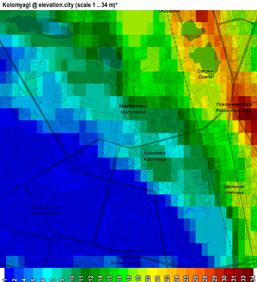
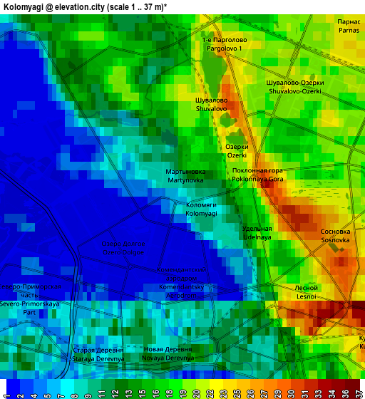
Below is the Elevation map of Kolomyagi, which displays elevation range with different colors. Scale of the first map is from 1 to 34 m (3 to 112 ft) with average elevation of 9.2 meters (=30 ft) [note 1]
These maps also provides idea of topography and contour of this city, they are displayed at different zoom levels. More info about maps, scale and edge coordinates you can find below images.
| \ | Map #1 | Map #2 | Topo.Map |
| Scale [m] | 1..34 m | 1..37 m | × |
| Scale [ft] | 3..112 ft | 3..121 ft | × |
| Average | 9.2 m = 30 ft | 12.3 m = 40 ft | × |
| Width | 4.88 km = 3 mi | 9.77 km = 6.1 mi | 156.3 km = 97.1 mi |
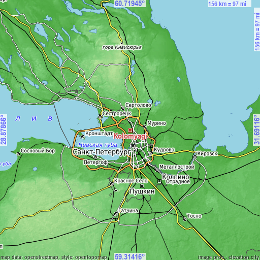
| Height | 4.88 km = 3 mi | 9.77 km = 6.1 mi | 156.2 km = 97.1 mi |
| ↑Max Latitude | 60.046219° | 60.068154° | 60.71945° |
| Latitude at center | 60.02427° | 60.02427° | 60.02427° |
| ↓Min Latitude | 60.002306° | 59.980328° | 59.31416° |
| ← Min Longitude | 30.240965° | 30.197019° | 28.87866° |
| Longitude center | 30.28491° | 30.28491° | 30.28491° |
| →Max Longitude | 30.328855° | 30.372801° | 31.69116° |
Nearby cities:
Cities around Kolomyagi sort by population:
• Ozerki elevation 24 m
2.2 km,  40°
40°
• Svetlanovskiy 19 m
3.5 km,  133°
133°
• Komendantsky aerodrom 1 m
2.3 km,  193°
193°
• Sosnovka 23 m
3.7 km,  103°
103°
• Chernaya Rechka 9 m
4.4 km,  166°
166°
• Untolovo 1 m
4.4 km,  252°
252°
• Sampsonievskiy 14 m
5.4 km,  143°
143°
• Staraya Derevnya 5 m
4.6 km,  210°
210°
• Novaya Derevnya 12 m
4.1 km,  178°
178°
• Shuvalovo 26 m
2.8 km,  9°
9°
• Udel’naya 17 m
2 km,  115°
115°
• Kushelevka 27 m
5.6 km, 128°
Multilingual:
 En español:
Kolomyagi elevación 9 m.
 En France:
Kolomyagi élévation 9 m.


Sources and notes:
- [note 1] Map square and city borders are not equal. Map elevation data is calculated only from area inside that square.
- [src 1] Elevation data from geonames database provided with same terms of usage.
- [src 2] The elevation map of Kolomyagi is generated using GMTED2010 database with 7.5 arcsec (225m) resolution.
- [src 3] Base (background) map © OpenStreetMap contributors tiles are generated by Geofabrik and OpenTopoMap.
Copyright & License:
This Kolomyagi Elevation Map is licensed under CC BY-SA. You may reuse any part from this page, if you give a proper credit by linking to this URL:
 More info on terms of use page.