Shakhovskaya elevation
Shakhovskaya (Moscow Oblast), Russia elevation is 249 meters and Shakhovskaya elevation in feet is 817 ft above sea level [src 1]. Shakhovskaya is a populated place (feature code) with elevation that is 50 meters (164 ft) bigger than average city elevation in Russia.
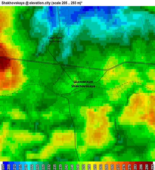
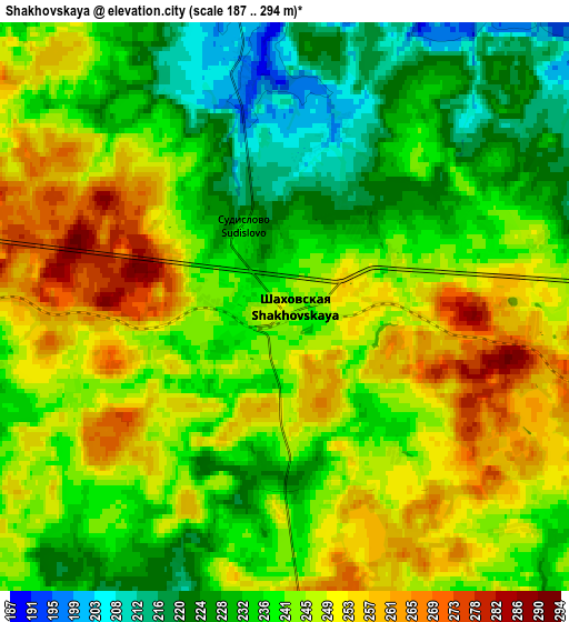
Below is the Elevation map of Shakhovskaya, which displays elevation range with different colors. Scale of the first map is from 205 to 293 m (673 to 961 ft) with average elevation of 241.9 meters (=794 ft) [note 1]
These maps also provides idea of topography and contour of this city, they are displayed at different zoom levels. More info about maps, scale and edge coordinates you can find below images.
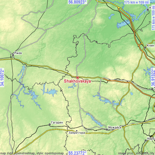
| \ | Map #1 | Map #2 | Topo.Map |
| Scale [m] | 205..293 m | 187..294 m | × |
| Scale [ft] | 673..961 ft | 614..965 ft | × |
| Average | 241.9 m = 794 ft | 241.2 m = 791 ft | × |
| Width | 5.46 km = 3.4 mi | 10.92 km = 6.8 mi | 174.7 km = 108.6 mi |
| Height | 5.46 km = 3.4 mi | 10.92 km = 6.8 mi | 174.7 km = 108.6 mi |
| ↑Max Latitude | 56.056016° | 56.080547° | 56.80923° |
| Latitude at center | 56.03147° | 56.03147° | 56.03147° |
| ↓Min Latitude | 56.006908° | 55.982331° | 55.23772° |
| ← Min Longitude | 35.463025° | 35.419079° | 34.10072° |
| Longitude center | 35.50697° | 35.50697° | 35.50697° |
| →Max Longitude | 35.550915° | 35.594861° | 36.91322° |
Nearby cities:
Cities around Shakhovskaya sort by population:
• Volokolamsk elevation 179 m
28.7 km,  89°
89°
• Ruza 183 m
56.7 km,  130°
130°
• Zubtsov 157 m
59.1 km,  285°
285°
• Lotoshino 154 m
24.1 km,  20°
20°
• Novopetrovskoye 262 m
60.1 km, 94°
• Arkhangel’skoye 264 m
22.6 km,  209°
209°
• Uvarovka 258 m
56.3 km,  173°
173°
• Sychëvo 237 m
45.6 km,  100°
100°
• Ostashëvo 190 m
29.6 km, 130°
• Teryayevo 156 m
41.3 km,  68°
68°
• Mikulino 145 m
47.2 km,  7°
7°
• Yaropolets 164 m
23.2 km,  60°
60°
Multilingual:
 En español:
Shakhovskaya elevación 249 m.
 En France:
Shakhovskaya élévation 249 m.
 Auf Deutsch:
Shakhovskaya höhe über dem Meeresspiegel ist 249 m.

Sources and notes:
- [note 1] Map square and city borders are not equal. Map elevation data is calculated only from area inside that square.
- [src 1] Elevation data from geonames database provided with same terms of usage.
- [src 2] The elevation map of Shakhovskaya is generated using elevation data from NASA's 3 arcsec (90m) resolution SRTM data.
- [src 3] Base (background) map © OpenStreetMap contributors tiles are generated by Geofabrik and OpenTopoMap.
Copyright & License:
This Shakhovskaya Elevation Map is licensed under CC BY-SA. You may reuse any part from this page, if you give a proper credit by linking to this URL:
 More info on terms of use page.