Voskresenskoye elevation
Voskresenskoye (Nizhny Novgorod Oblast, Voskresenskiy Rayon), Russia elevation is 102 meters and Voskresenskoye elevation in feet is 335 ft above sea level [src 1]. Voskresenskoye is a populated place (feature code) with elevation that is 97 meters (318 ft) smaller than average city elevation in Russia.
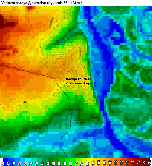
Below is the Elevation map of Voskresenskoye, which displays elevation range with different colors. Scale of the first map is from 65 to 124 m (213 to 407 ft) with average elevation of 87.2 meters (=286 ft) [note 1]
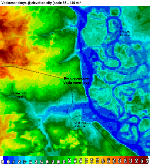
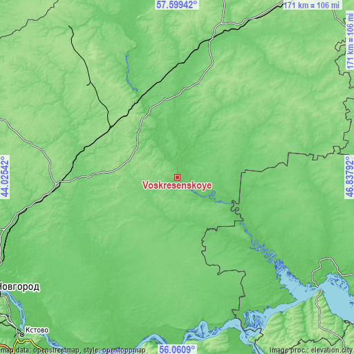
These maps also provides idea of topography and contour of this city, they are displayed at different zoom levels. More info about maps, scale and edge coordinates you can find below images.
| \ | Map #1 | Map #2 | Topo.Map |
| Scale [m] | 65..124 m | 65..146 m | × |
| Scale [ft] | 213..407 ft | 213..479 ft | × |
| Average | 87.2 m = 286 ft | 91.4 m = 300 ft | × |
| Width | 5.35 km = 3.3 mi | 10.69 km = 6.6 mi | 171.1 km = 106.3 mi |
| Height | 5.35 km = 3.3 mi | 10.69 km = 6.6 mi | 171 km = 106.3 mi |
| ↑Max Latitude | 56.862091° | 56.886106° | 57.59942° |
| Latitude at center | 56.83806° | 56.83806° | 56.83806° |
| ↓Min Latitude | 56.814014° | 56.789952° | 56.0609° |
| ← Min Longitude | 45.387725° | 45.343779° | 44.02542° |
| Longitude center | 45.43167° | 45.43167° | 45.43167° |
| →Max Longitude | 45.475615° | 45.519561° | 46.83792° |
Nearby cities:
Cities around Voskresenskoye sort by population:
• Semënov elevation 117 m
57.4 km,  264°
264°
• Uren’ 103 m
71.9 km,  17°
17°
• Krasnyye Baki 101 m
36.5 km,  333°
333°
• Sharanga 149 m
77 km,  60°
60°
• Sukhobezvodnoye 150 m
40.4 km,  305°
305°
• Linda 94 m
85.2 km,  253°
253°
• Tonkino 120 m
86.1 km,  46°
46°
• Vetluzhskiy 105 m
41.7 km, 333°
• Ar’ya 115 m
79.5 km, 23°
• Yurino 65 m
80.7 km,  138°
138°
• Varnavino 123 m
66.1 km,  341°
341°
• Vladimirskoye 123 m
19.2 km, 263°
Multilingual:
 En español:
Voskresenskoye elevación 102 m.
 En France:
Voskresenskoye élévation 102 m.
 Auf Deutsch:
Voskresenskoye höhe über dem Meeresspiegel ist 102 m.

Sources and notes:
- [note 1] Map square and city borders are not equal. Map elevation data is calculated only from area inside that square.
- [src 1] Elevation data from geonames database provided with same terms of usage.
- [src 2] The elevation map of Voskresenskoye is generated using elevation data from NASA's 3 arcsec (90m) resolution SRTM data.
- [src 3] Base (background) map © OpenStreetMap contributors tiles are generated by Geofabrik and OpenTopoMap.
Copyright & License:
This Voskresenskoye Elevation Map is licensed under CC BY-SA. You may reuse any part from this page, if you give a proper credit by linking to this URL:
 More info on terms of use page.