LMS elevation
LMS (Moscow, Troitsky Administrative Okrug), Russia elevation is 198 meters and LMS elevation in feet is 650 ft above sea level [src 1]. LMS is a seat of a third-order administrative division (feature code) with elevation that is 1 meters (3 ft) smaller than average city elevation in Russia.
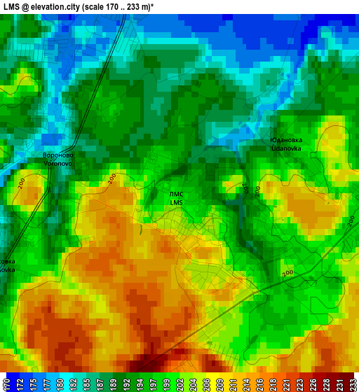
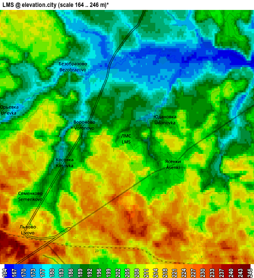
Below is the Elevation map of LMS, which displays elevation range with different colors. Scale of the first map is from 170 to 233 m (558 to 764 ft) with average elevation of 198.1 meters (=650 ft) [note 1]
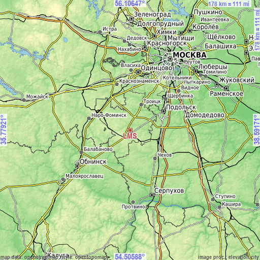
These maps also provides idea of topography and contour of this city, they are displayed at different zoom levels. More info about maps, scale and edge coordinates you can find below images.
| \ | Map #1 | Map #2 | Topo.Map |
| Scale [m] | 170..233 m | 164..246 m | × |
| Scale [ft] | 558..764 ft | 538..807 ft | × |
| Average | 198.1 m = 650 ft | 200.9 m = 659 ft | × |
| Width | 5.56 km = 3.5 mi | 11.12 km = 6.9 mi | 178 km = 110.6 mi |
| Height | 5.56 km = 3.5 mi | 11.12 km = 6.9 mi | 177.9 km = 110.5 mi |
| ↑Max Latitude | 55.33925° | 55.364235° | 56.10647° |
| Latitude at center | 55.31425° | 55.31425° | 55.31425° |
| ↓Min Latitude | 55.289234° | 55.264202° | 54.50588° |
| ← Min Longitude | 37.141515° | 37.097569° | 35.77921° |
| Longitude center | 37.18546° | 37.18546° | 37.18546° |
| →Max Longitude | 37.229405° | 37.273351° | 38.59171° |
Nearby cities:
Cities around LMS sort by population:
• Klimovsk elevation 176 m
22.5 km,  75°
75°
• Troitsk 170 m
20.5 km,  22°
22°
• Selyatino 202 m
25.9 km,  329°
329°
• L’vovskiy 183 m
21.4 km,  88°
88°
• Kievskiy 198 m
23.9 km,  302°
302°
• Vatutinki 161 m
22.2 km, 24°
• Stolbovaya 187 m
20.7 km,  110°
110°
• Dubrovitsy 143 m
23.6 km,  53°
53°
• Shishkin Les 172 m
10.7 km,  1°
1°
• Lyubuchany 158 m
24.1 km, 106°
• Krasnaya Pahra 185 m
14.2 km, 22°
• Kurilovo 182 m
13.7 km,  61°
61°
Multilingual:
 En español:
LMS elevación 198 m.
 En France:
LMS élévation 198 m.


Sources and notes:
- [note 1] Map square and city borders are not equal. Map elevation data is calculated only from area inside that square.
- [src 1] Elevation data from geonames database provided with same terms of usage.
- [src 2] The elevation map of LMS is generated using elevation data from NASA's 3 arcsec (90m) resolution SRTM data.
- [src 3] Base (background) map © OpenStreetMap contributors tiles are generated by Geofabrik and OpenTopoMap.
Copyright & License:
This LMS Elevation Map is licensed under CC BY-SA. You may reuse any part from this page, if you give a proper credit by linking to this URL:
 More info on terms of use page.