Lyubuchany elevation
Lyubuchany (Moscow Oblast), Russia elevation is 158 meters and Lyubuchany elevation in feet is 518 ft above sea level [src 1]. Lyubuchany is a populated place (feature code) with elevation that is 41 meters (135 ft) smaller than average city elevation in Russia.
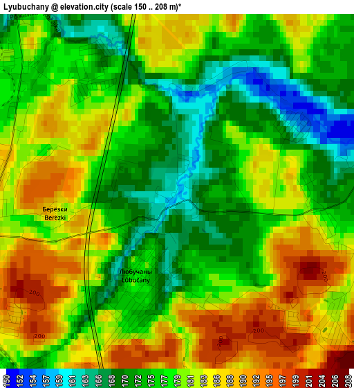
Below is the Elevation map of Lyubuchany, which displays elevation range with different colors. Scale of the first map is from 150 to 208 m (492 to 682 ft) with average elevation of 178.8 meters (=587 ft) [note 1]
These maps also provides idea of topography and contour of this city, they are displayed at different zoom levels. More info about maps, scale and edge coordinates you can find below images.
| \ | Map #1 | Map #2 | Topo.Map |
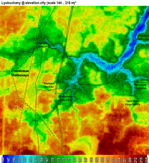
| Scale [m] | 150..208 m | 144..218 m | × |
| Scale [ft] | 492..682 ft | 472..715 ft | × |
| Average | 178.8 m = 587 ft | 185.1 m = 607 ft | × |
| Width | 5.57 km = 3.5 mi | 11.14 km = 6.9 mi | 178.3 km = 110.8 mi |
| Height | 5.57 km = 3.5 mi | 11.14 km = 6.9 mi | 178.2 km = 110.7 mi |
| ↑Max Latitude | 55.27592° | 55.300945° | 56.04437° |
| Latitude at center | 55.25088° | 55.25088° | 55.25088° |
| ↓Min Latitude | 55.225824° | 55.200752° | 54.44123° |
| ← Min Longitude | 37.505935° | 37.461989° | 36.14363° |
| Longitude center | 37.54988° | 37.54988° | 37.54988° |
| →Max Longitude | 37.593825° | 37.637771° | 38.95613° |
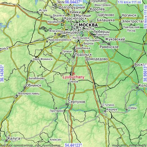
Nearby cities:
Cities around Lyubuchany sort by population:
• Podolsk elevation 162 m
19.3 km,  0°
0°
• Chekhov 174 m
12.4 km,  201°
201°
• Klimovsk 176 m
12.6 km,  354°
354°
• L’vovskiy 183 m
7.7 km, 347°
• Belyye Stolby 176 m
21.2 km,  65°
65°
• Stolbovaya 187 m
3.6 km,  268°
268°
• Barybino 173 m
21.8 km,  85°
85°
• Dubrovitsy 143 m
21.4 km, 349°
• Melikhovo 185 m
16.4 km,  157°
157°
• Novyy Byt 179 m
21.8 km,  169°
169°
• Popovo 137 m
20.9 km, 159°
• Kurilovo 182 m
17.4 km,  321°
321°
Multilingual:
 En español:
Lyubuchany elevación 158 m.
 En France:
Lyubuchany élévation 158 m.
 Auf Deutsch:
Lyubuchany höhe über dem Meeresspiegel ist 158 m.

Sources and notes:
- [note 1] Map square and city borders are not equal. Map elevation data is calculated only from area inside that square.
- [src 1] Elevation data from geonames database provided with same terms of usage.
- [src 2] The elevation map of Lyubuchany is generated using elevation data from NASA's 3 arcsec (90m) resolution SRTM data.
- [src 3] Base (background) map © OpenStreetMap contributors tiles are generated by Geofabrik and OpenTopoMap.
Copyright & License:
This Lyubuchany Elevation Map is licensed under CC BY-SA. You may reuse any part from this page, if you give a proper credit by linking to this URL:
 More info on terms of use page.