Lesnoy elevation
Lesnoy (Sverdlovsk), Russia elevation is 122 meters and Lesnoy elevation in feet is 400 ft above sea level [src 1]. Lesnoy is a populated place (feature code) with elevation that is 77 meters (253 ft) smaller than average city elevation in Russia.
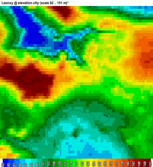
Below is the Elevation map of Lesnoy, which displays elevation range with different colors. Scale of the first map is from 82 to 151 m (269 to 495 ft) with average elevation of 112.7 meters (=370 ft) [note 1]
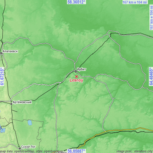
These maps also provides idea of topography and contour of this city, they are displayed at different zoom levels. More info about maps, scale and edge coordinates you can find below images.
| \ | Map #1 | Map #2 | Topo.Map |
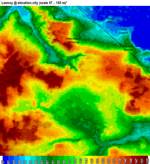
| Scale [m] | 82..151 m | 57..155 m | × |
| Scale [ft] | 269..495 ft | 187..509 ft | × |
| Average | 112.7 m = 370 ft | 109.1 m = 358 ft | × |
| Width | 5.23 km = 3.2 mi | 10.47 km = 6.5 mi | 167.5 km = 104.1 mi |
| Height | 5.23 km = 3.2 mi | 10.47 km = 6.5 mi | 167.5 km = 104.1 mi |
| ↑Max Latitude | 57.643327° | 57.666838° | 58.36512° |
| Latitude at center | 57.6198° | 57.6198° | 57.6198° |
| ↓Min Latitude | 57.596258° | 57.572701° | 56.85887° |
| ← Min Longitude | 63.034455° | 62.990509° | 61.67215° |
| Longitude center | 63.0784° | 63.0784° | 63.0784° |
| →Max Longitude | 63.122345° | 63.166291° | 64.48465° |
Nearby cities:
Cities around Lesnoy sort by population:
• Alapayevsk elevation 133 m
86 km,  287°
287°
• Irbit 71 m
5.7 km,  355°
355°
• Artëmovskiy 181 m
78 km,  247°
247°
• Talitsa 88 m
78.3 km,  149°
149°
• Turinsk 100 m
59.8 km,  37°
37°
• Bulanash 139 m
75 km,  239°
239°
• Troitskiy 78 m
74.1 km, 147°
• Pyshma 88 m
74.9 km,  172°
172°
• Baykalovo 88 m
48 km,  120°
120°
• Turinskaya Sloboda 64 m
77.8 km,  89°
89°
• Krasnogvardeyskiy 107 m
52.6 km, 239°
• Zaykovo 66 m
20.2 km, 251°
Multilingual:
 En español:
Lesnoy elevación 122 m.
 En France:
Lesnoy élévation 122 m.


Sources and notes:
- [note 1] Map square and city borders are not equal. Map elevation data is calculated only from area inside that square.
- [src 1] Elevation data from geonames database provided with same terms of usage.
- [src 2] The elevation map of Lesnoy is generated using elevation data from NASA's 3 arcsec (90m) resolution SRTM data.
- [src 3] Base (background) map © OpenStreetMap contributors tiles are generated by Geofabrik and OpenTopoMap.
Copyright & License:
This Lesnoy Elevation Map is licensed under CC BY-SA. You may reuse any part from this page, if you give a proper credit by linking to this URL:
 More info on terms of use page.