Il’inka elevation
Il’inka (Buryatiya Republic), Russia elevation is 487 meters and Il’inka elevation in feet is 1598 ft above sea level [src 1]. Il’inka is a populated place (feature code) with elevation that is 288 meters (945 ft) bigger than average city elevation in Russia.
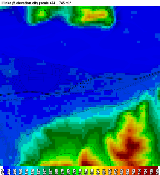
Below is the Elevation map of Il’inka, which displays elevation range with different colors. Scale of the first map is from 474 to 745 m (1555 to 2444 ft) with average elevation of 519.4 meters (=1704 ft) [note 1]
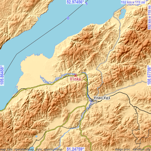
These maps also provides idea of topography and contour of this city, they are displayed at different zoom levels. More info about maps, scale and edge coordinates you can find below images.
| \ | Map #1 | Map #2 | Topo.Map |
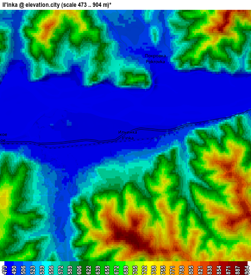
| Scale [m] | 474..745 m | 473..904 m | × |
| Scale [ft] | 1555..2444 ft | 1552..2966 ft | × |
| Average | 519.4 m = 1704 ft | 588.3 m = 1930 ft | × |
| Width | 6 km = 3.7 mi | 12 km = 7.5 mi | 192 km = 119.3 mi |
| Height | 6 km = 3.7 mi | 12 km = 7.5 mi | 192 km = 119.3 mi |
| ↑Max Latitude | 52.146415° | 52.173374° | 52.97456° |
| Latitude at center | 52.11944° | 52.11944° | 52.11944° |
| ↓Min Latitude | 52.092449° | 52.065441° | 51.24759° |
| ← Min Longitude | 107.226885° | 107.182939° | 105.86458° |
| Longitude center | 107.27083° | 107.27083° | 107.27083° |
| →Max Longitude | 107.314775° | 107.358721° | 108.67708° |
Nearby cities:
Cities around Il’inka sort by population:
• Ulan-Ude elevation 528 m
39.8 km,  144°
144°
• Onokhoy 534 m
58.5 km,  111°
111°
• Zarechnyy 497 m
34.6 km,  150°
150°
• Ivolginsk 544 m
41.2 km,  178°
178°
• Turuntayevo 518 m
27.1 km,  70°
70°
• Kabansk 467 m
43 km,  259°
259°
• Sokol 508 m
37.4 km,  161°
161°
• Sotnikovo 499 m
29.9 km, 150°
• Istok 453 m
69.9 km,  267°
267°
• Tataurovo 489 m
11.8 km,  77°
77°
• Nizhniy Sayantuy 503 m
45.6 km, 158°
• Nikolayevskiy 687 m
63.1 km, 144°
Multilingual:
 En español:
Il’inka elevación 487 m.
 En France:
Il’inka élévation 487 m.


Sources and notes:
- [note 1] Map square and city borders are not equal. Map elevation data is calculated only from area inside that square.
- [src 1] Elevation data from geonames database provided with same terms of usage.
- [src 2] The elevation map of Il’inka is generated using elevation data from NASA's 3 arcsec (90m) resolution SRTM data.
- [src 3] Base (background) map © OpenStreetMap contributors tiles are generated by Geofabrik and OpenTopoMap.
Copyright & License:
This Il’inka Elevation Map is licensed under CC BY-SA. You may reuse any part from this page, if you give a proper credit by linking to this URL:
 More info on terms of use page.