Lazo elevation
Lazo (Primorskiy (Maritime) Kray), Russia elevation is 236 meters and Lazo elevation in feet is 774 ft above sea level [src 1]. Lazo is a populated place (feature code) with elevation that is 37 meters (121 ft) bigger than average city elevation in Russia.
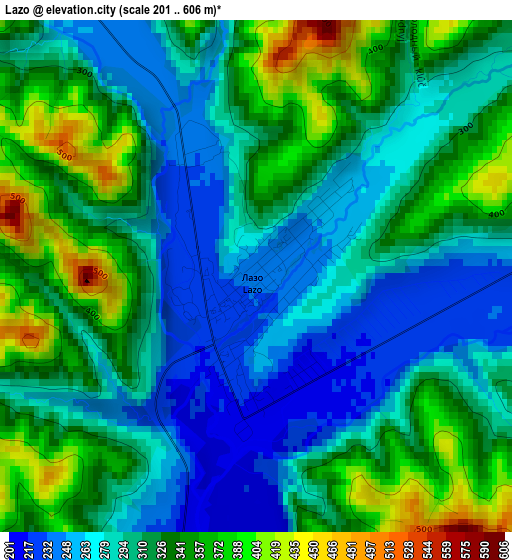
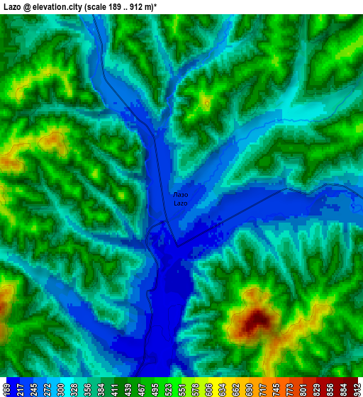
Below is the Elevation map of Lazo, which displays elevation range with different colors. Scale of the first map is from 201 to 606 m (659 to 1988 ft) with average elevation of 311.5 meters (=1022 ft) [note 1]
These maps also provides idea of topography and contour of this city, they are displayed at different zoom levels. More info about maps, scale and edge coordinates you can find below images.
| \ | Map #1 | Map #2 | Topo.Map |
| Scale [m] | 201..606 m | 189..912 m | × |
| Scale [ft] | 659..1988 ft | 620..2992 ft | × |
| Average | 311.5 m = 1022 ft | 380.7 m = 1249 ft | × |
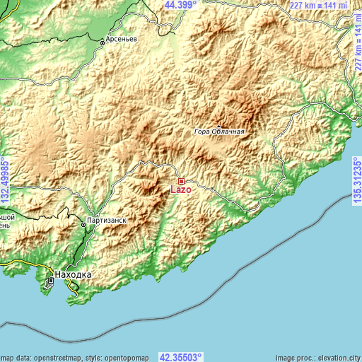
| Width | 7.1 km = 4.4 mi | 14.2 km = 8.8 mi | 227.3 km = 141.2 mi |
| Height | 7.1 km = 4.4 mi | 14.2 km = 8.8 mi | 227.3 km = 141.2 mi |
| ↑Max Latitude | 43.417559° | 43.449471° | 44.399° |
| Latitude at center | 43.38563° | 43.38563° | 43.38563° |
| ↓Min Latitude | 43.353684° | 43.321722° | 42.35503° |
| ← Min Longitude | 133.862155° | 133.818209° | 132.49985° |
| Longitude center | 133.9061° | 133.9061° | 133.9061° |
| →Max Longitude | 133.950045° | 133.993991° | 135.31235° |
Nearby cities:
Cities around Lazo sort by population:
• Nakhodka elevation 50 m
105.2 km,  232°
232°
• Arsen’yev 179 m
99.1 km,  329°
329°
• Partizansk 163 m
69.8 km,  245°
245°
• Vrangel’ 12 m
98.9 km,  222°
222°
• Chuguyevka 266 m
86.9 km,  357°
357°
• Preobrazheniye 29 m
53.9 km,  180°
180°
• Uglekamensk 121 m
57.6 km, 251°
• Vladimiro-Aleksandrovskoye 21 m
86.8 km, 230°
• Sergeyevka 209 m
44.4 km,  264°
264°
• Novosysoyevka 160 m
103.9 km,  335°
335°
• Anuchino 187 m
93.8 km,  313°
313°
• Yekaterinovka 24 m
86.3 km, 233°
Multilingual:
 En español:
Lazo elevación 236 m.
 En France:
Lazo élévation 236 m.


Sources and notes:
- [note 1] Map square and city borders are not equal. Map elevation data is calculated only from area inside that square.
- [src 1] Elevation data from geonames database provided with same terms of usage.
- [src 2] The elevation map of Lazo is generated using elevation data from NASA's 3 arcsec (90m) resolution SRTM data.
- [src 3] Base (background) map © OpenStreetMap contributors tiles are generated by Geofabrik and OpenTopoMap.
Copyright & License:
This Lazo Elevation Map is licensed under CC BY-SA. You may reuse any part from this page, if you give a proper credit by linking to this URL:
 More info on terms of use page.