Preobrazheniye elevation
Preobrazheniye (Primorskiy (Maritime) Kray), Russia elevation is 29 meters and Preobrazheniye elevation in feet is 95 ft above sea level [src 1]. Preobrazheniye is a populated place (feature code) with elevation that is 170 meters (558 ft) smaller than average city elevation in Russia.
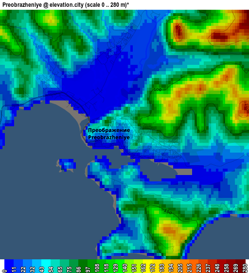
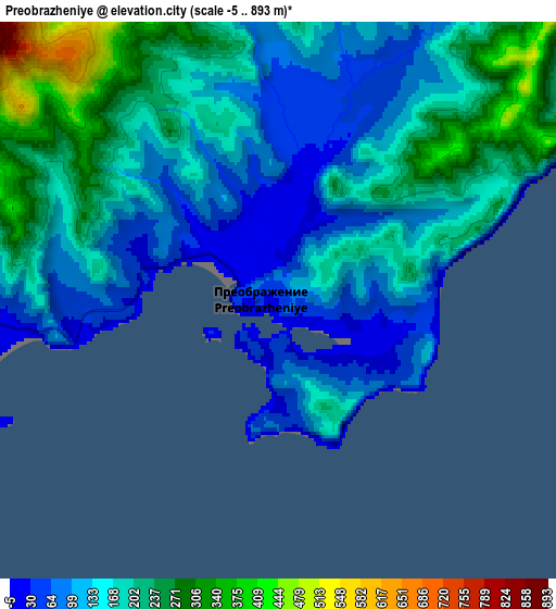
Below is the Elevation map of Preobrazheniye, which displays elevation range with different colors. Scale of the first map is from 0 to 280 m (0 to 919 ft) with average elevation of 67.3 meters (=221 ft) [note 1]
These maps also provides idea of topography and contour of this city, they are displayed at different zoom levels. More info about maps, scale and edge coordinates you can find below images.
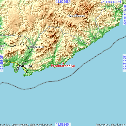
| \ | Map #1 | Map #2 | Topo.Map |
| Scale [m] | 0..280 m | -5..893 m | × |
| Scale [ft] | 0..919 ft | -16..2930 ft | × |
| Average | 67.3 m = 221 ft | 161.4 m = 530 ft | × |
| Width | 7.16 km = 4.4 mi | 14.32 km = 8.9 mi | 229.1 km = 142.4 mi |
| Height | 7.16 km = 4.4 mi | 14.32 km = 8.9 mi | 229.1 km = 142.4 mi |
| ↑Max Latitude | 42.933353° | 42.965519° | 43.92268° |
| Latitude at center | 42.90117° | 42.90117° | 42.90117° |
| ↓Min Latitude | 42.86897° | 42.836754° | 41.86245° |
| ← Min Longitude | 133.860355° | 133.816409° | 132.49805° |
| Longitude center | 133.9043° | 133.9043° | 133.9043° |
| →Max Longitude | 133.948245° | 133.992191° | 135.31055° |
Nearby cities:
Cities around Preobrazheniye sort by population:
• Nakhodka elevation 50 m
84.6 km,  263°
263°
• Partizansk 163 m
68.1 km,  291°
291°
• Fokino 22 m
122.3 km,  273°
273°
• Vrangel’ 12 m
69.6 km,  254°
254°
• Livadiya 14 m
100.3 km, 267°
• Uglekamensk 121 m
65.1 km,  302°
302°
• Vladimiro-Aleksandrovskoye 21 m
67.3 km, 269°
• Sergeyevka 209 m
66.6 km,  318°
318°
• Volchanets 3 m
93 km, 270°
• Yekaterinovka 24 m
69.7 km, 272°
• Lazo 236 m
53.9 km,  0°
0°
• Putyatin 14 m
121.4 km, 267°
Multilingual:
 En español:
Preobrazheniye elevación 29 m.
 En France:
Preobrazheniye élévation 29 m.
 Auf Deutsch:
Preobrazheniye höhe über dem Meeresspiegel ist 29 m.

Sources and notes:
- [note 1] Map square and city borders are not equal. Map elevation data is calculated only from area inside that square.
- [src 1] Elevation data from geonames database provided with same terms of usage.
- [src 2] The elevation map of Preobrazheniye is generated using elevation data from NASA's 3 arcsec (90m) resolution SRTM data.
- [src 3] Base (background) map © OpenStreetMap contributors tiles are generated by Geofabrik and OpenTopoMap.
Copyright & License:
This Preobrazheniye Elevation Map is licensed under CC BY-SA. You may reuse any part from this page, if you give a proper credit by linking to this URL:
 More info on terms of use page.