Ćuprija elevation
Ćuprija (Central Serbia, Pomoravlje), Serbia elevation is 124 meters and Ćuprija elevation in feet is 407 ft above sea level [src 1]. Ćuprija is a seat of a third-order administrative division (feature code) with elevation that is 43 meters (141 ft) smaller than average city elevation in Serbia.
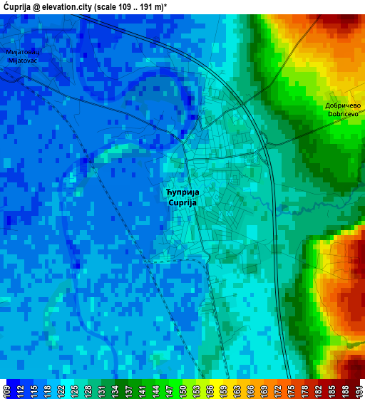
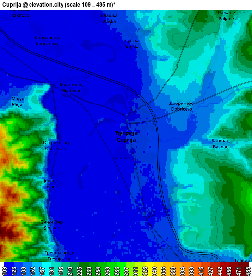
Below is the Elevation map of Ćuprija, which displays elevation range with different colors. Scale of the first map is from 109 to 191 m (358 to 627 ft) with average elevation of 127.3 meters (=418 ft) [note 1]
These maps also provides idea of topography and contour of this city, they are displayed at different zoom levels. More info about maps, scale and edge coordinates you can find below images.
| \ | Map #1 | Map #2 | Topo.Map |
| Scale [m] | 109..191 m | 109..485 m | × |
| Scale [ft] | 358..627 ft | 358..1591 ft | × |
| Average | 127.3 m = 418 ft | 162.5 m = 533 ft | × |
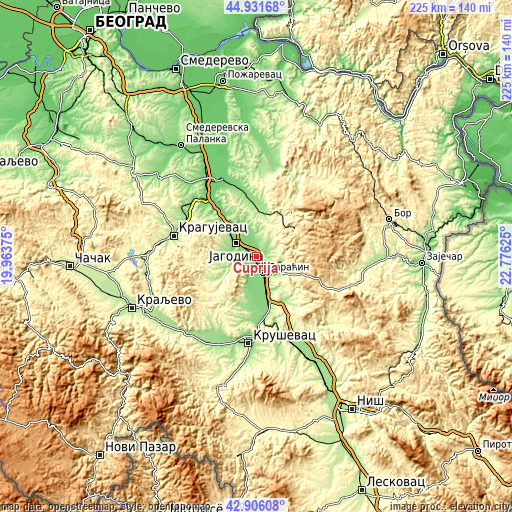
| Width | 7.04 km = 4.4 mi | 14.08 km = 8.7 mi | 225.2 km = 139.9 mi |
| Height | 7.04 km = 4.4 mi | 14.08 km = 8.7 mi | 225.2 km = 139.9 mi |
| ↑Max Latitude | 43.959142° | 43.990767° | 44.93168° |
| Latitude at center | 43.9275° | 43.9275° | 43.9275° |
| ↓Min Latitude | 43.895841° | 43.864166° | 42.90608° |
| ← Min Longitude | 21.326055° | 21.282109° | 19.96375° |
| Longitude center | 21.37° | 21.37° | 21.37° |
| →Max Longitude | 21.413945° | 21.457891° | 22.77625° |
Nearby cities:
Cities around Ćuprija sort by population:
• Kragujevac elevation 182 m
37.6 km,  285°
285°
• Kruševac 162 m
38.7 km,  184°
184°
• Jagodina 120 m
10.3 km,  302°
302°
• Lapovo 110 m
35.9 km,  322°
322°
• Paraćin 130 m
8 km,  157°
157°
• Ćićevac 144 m
23.9 km,  166°
166°
• Svilajnac 104 m
36.8 km,  337°
337°
• Batočina 109 m
34.1 km, 317°
• Ražanj 262 m
31.8 km,  153°
153°
• Rekovac 241 m
23.3 km,  252°
252°
• Varvarin 142 m
22.6 km, 181°
• Despotovac 199 m
19.4 km,  18°
18°
Multilingual:
 En español:
Ćuprija elevación 124 m.
 En France:
Ćuprija élévation 124 m.


Sources and notes:
- [note 1] Map square and city borders are not equal. Map elevation data is calculated only from area inside that square.
- [src 1] Elevation data from geonames database provided with same terms of usage.
- [src 2] The elevation map of Ćuprija is generated using elevation data from NASA's 3 arcsec (90m) resolution SRTM data.
- [src 3] Base (background) map © OpenStreetMap contributors tiles are generated by Geofabrik and OpenTopoMap.
Copyright & License:
This Ćuprija Elevation Map is licensed under CC BY-SA. You may reuse any part from this page, if you give a proper credit by linking to this URL:
 More info on terms of use page.