Smederevo elevation
Smederevo (Central Serbia, Podunavlje District), Serbia elevation is 79 meters and Smederevo elevation in feet is 259 ft above sea level [src 1]. Smederevo is a seat of a second-order administrative division (feature code) with elevation that is 88 meters (289 ft) smaller than average city elevation in Serbia.
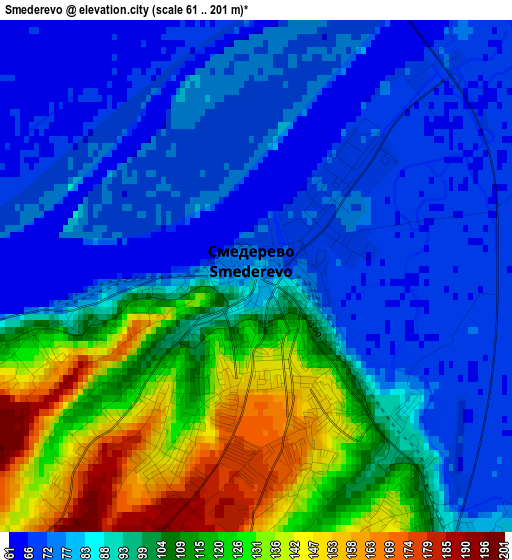
Below is the Elevation map of Smederevo, which displays elevation range with different colors. Scale of the first map is from 61 to 201 m (200 to 659 ft) with average elevation of 94.3 meters (=309 ft) [note 1]
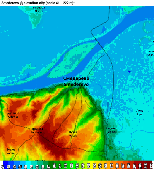
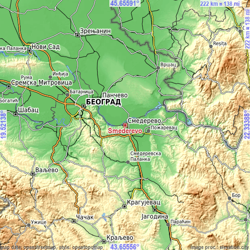
These maps also provides idea of topography and contour of this city, they are displayed at different zoom levels. More info about maps, scale and edge coordinates you can find below images.
| \ | Map #1 | Map #2 | Topo.Map |
| Scale [m] | 61..201 m | 41..222 m | × |
| Scale [ft] | 200..659 ft | 135..728 ft | × |
| Average | 94.3 m = 309 ft | 97.1 m = 319 ft | × |
| Width | 6.95 km = 4.3 mi | 13.9 km = 8.6 mi | 222.4 km = 138.2 mi |
| Height | 6.95 km = 4.3 mi | 13.9 km = 8.6 mi | 222.4 km = 138.2 mi |
| ↑Max Latitude | 44.695607° | 44.726837° | 45.65591° |
| Latitude at center | 44.66436° | 44.66436° | 44.66436° |
| ↓Min Latitude | 44.633096° | 44.601815° | 43.65556° |
| ← Min Longitude | 20.883685° | 20.839739° | 19.52138° |
| Longitude center | 20.92763° | 20.92763° | 20.92763° |
| →Max Longitude | 20.971575° | 21.015521° | 22.33388° |
Nearby cities:
Cities around Smederevo sort by population:
• Pančevo elevation 80 m
32.3 km,  315°
315°
• Požarevac 80 m
21.1 km,  103°
103°
• Smederevska Palanka 122 m
33.3 km,  175°
175°
• Kovin 78 m
10 km,  22°
22°
• Rušanj 201 m
37.8 km,  273°
273°
• Lugavčina 82 m
19.4 km,  144°
144°
• Palilula 120 m
36.4 km,  296°
296°
• Zvezdara 221 m
33.6 km,  291°
291°
• Sopot 188 m
32.3 km,  240°
240°
• Mladenovac 169 m
30.9 km,  215°
215°
• Malo Crniće 85 m
30.8 km,  113°
113°
• Grocka 85 m
16.7 km, 272°
Multilingual:
 En español:
Smederevo elevación 79 m.
 En France:
Smederevo élévation 79 m.
 Auf Deutsch:
Smederevo höhe über dem Meeresspiegel ist 79 m.

Sources and notes:
- [note 1] Map square and city borders are not equal. Map elevation data is calculated only from area inside that square.
- [src 1] Elevation data from geonames database provided with same terms of usage.
- [src 2] The elevation map of Smederevo is generated using elevation data from NASA's 3 arcsec (90m) resolution SRTM data.
- [src 3] Base (background) map © OpenStreetMap contributors tiles are generated by Geofabrik and OpenTopoMap.
Copyright & License:
This Smederevo Elevation Map is licensed under CC BY-SA. You may reuse any part from this page, if you give a proper credit by linking to this URL:
 More info on terms of use page.