Aţel elevation
Aţel (Sibiu, Comuna Aţel), Romania elevation is 348 meters and Aţel elevation in feet is 1142 ft above sea level [src 1]. Aţel is a seat of a second-order administrative division (feature code) with elevation that is 96 meters (315 ft) bigger than average city elevation in Romania.
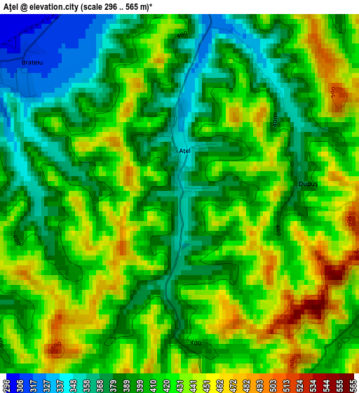
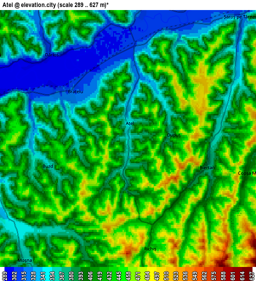
Below is the Elevation map of Aţel, which displays elevation range with different colors. Scale of the first map is from 296 to 565 m (971 to 1854 ft) with average elevation of 409.7 meters (=1344 ft) [note 1]
These maps also provides idea of topography and contour of this city, they are displayed at different zoom levels. More info about maps, scale and edge coordinates you can find below images.
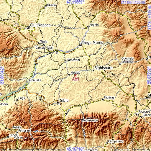
| \ | Map #1 | Map #2 | Topo.Map |
| Scale [m] | 296..565 m | 289..627 m | × |
| Scale [ft] | 971..1854 ft | 948..2057 ft | × |
| Average | 409.7 m = 1344 ft | 406.6 m = 1334 ft | × |
| Width | 6.77 km = 4.2 mi | 13.54 km = 8.4 mi | 216.6 km = 134.6 mi |
| Height | 6.77 km = 4.2 mi | 13.54 km = 8.4 mi | 216.6 km = 134.6 mi |
| ↑Max Latitude | 46.180436° | 46.210855° | 47.11559° |
| Latitude at center | 46.15° | 46.15° | 46.15° |
| ↓Min Latitude | 46.119547° | 46.089078° | 45.16716° |
| ← Min Longitude | 24.422725° | 24.378779° | 23.06042° |
| Longitude center | 24.46667° | 24.46667° | 24.46667° |
| →Max Longitude | 24.510615° | 24.554561° | 25.87292° |
Nearby cities:
Cities around Aţel sort by population:
• Mediaş elevation 301 m
9.2 km,  281°
281°
• Dumbrăveni 349 m
12 km,  39°
39°
• Dârlos 294 m
6.3 km,  305°
305°
• Moşna 424 m
9 km,  214°
214°
• Brateiu 339 m
4.3 km,  295°
295°
• Biertan 380 m
4.3 km,  115°
115°
• Blăjel 305 m
13.7 km, 302°
• Șaroș pe Târnave 407 m
8.5 km,  49°
49°
• Târnava 290 m
13.7 km,  265°
265°
• Ighișu Nou 342 m
10 km,  244°
244°
• Mălâncrav 433 m
14.7 km,  107°
107°
• Alma 322 m
7.1 km,  8°
8°
Multilingual:
 En español:
Aţel elevación 348 m.
 En France:
Aţel élévation 348 m.


Sources and notes:
- [note 1] Map square and city borders are not equal. Map elevation data is calculated only from area inside that square.
- [src 1] Elevation data from geonames database provided with same terms of usage.
- [src 2] The elevation map of Aţel is generated using elevation data from NASA's 3 arcsec (90m) resolution SRTM data.
- [src 3] Base (background) map © OpenStreetMap contributors tiles are generated by Geofabrik and OpenTopoMap.
Copyright & License:
This Aţel Elevation Map is licensed under CC BY-SA. You may reuse any part from this page, if you give a proper credit by linking to this URL:
 More info on terms of use page.