Berceni elevation
Berceni (Ilfov, Comuna Berceni), Romania elevation is 65 meters and Berceni elevation in feet is 213 ft above sea level [src 1]. Berceni is a seat of a second-order administrative division (feature code) with elevation that is 187 meters (614 ft) smaller than average city elevation in Romania.
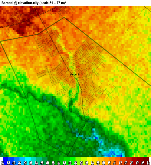
Below is the Elevation map of Berceni, which displays elevation range with different colors. Scale of the first map is from 51 to 77 m (167 to 253 ft) with average elevation of 65.8 meters (=216 ft) [note 1]
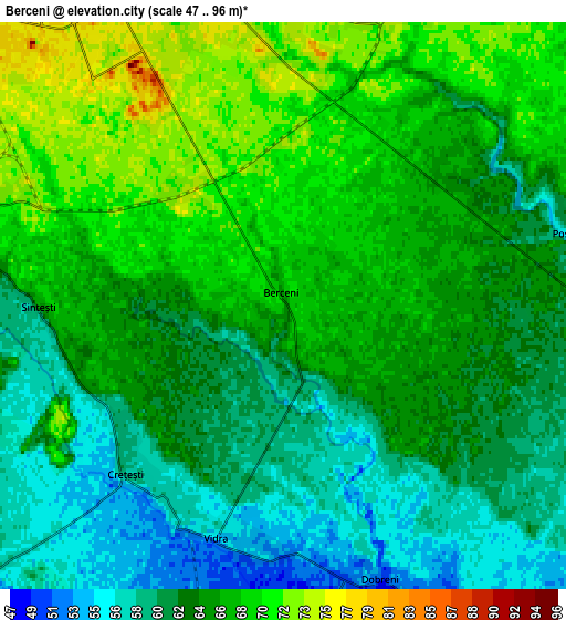
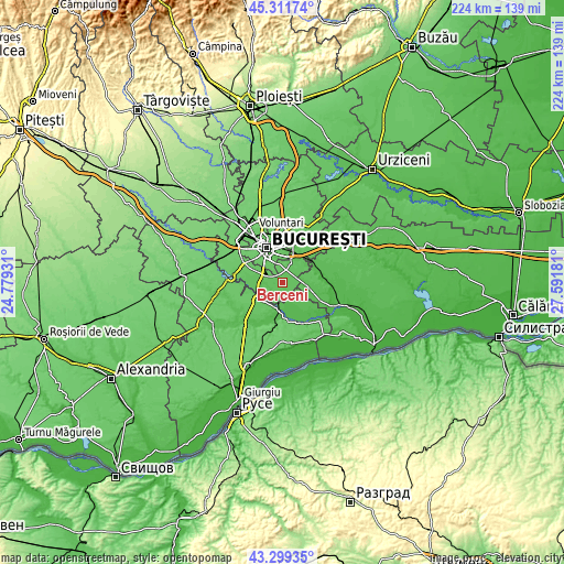
These maps also provides idea of topography and contour of this city, they are displayed at different zoom levels. More info about maps, scale and edge coordinates you can find below images.
| \ | Map #1 | Map #2 | Topo.Map |
| Scale [m] | 51..77 m | 47..96 m | × |
| Scale [ft] | 167..253 ft | 154..315 ft | × |
| Average | 65.8 m = 216 ft | 64.4 m = 211 ft | × |
| Width | 6.99 km = 4.3 mi | 13.98 km = 8.7 mi | 223.8 km = 139.1 mi |
| Height | 6.99 km = 4.3 mi | 13.98 km = 8.7 mi | 223.7 km = 139 mi |
| ↑Max Latitude | 44.345605° | 44.377024° | 45.31174° |
| Latitude at center | 44.31417° | 44.31417° | 44.31417° |
| ↓Min Latitude | 44.282718° | 44.251249° | 43.29935° |
| ← Min Longitude | 26.141615° | 26.097669° | 24.77931° |
| Longitude center | 26.18556° | 26.18556° | 26.18556° |
| →Max Longitude | 26.229505° | 26.273451° | 27.59181° |
Nearby cities:
Cities around Berceni sort by population:
• Sector 4 elevation 79 m
8.6 km,  323°
323°
• Popeşti-Leordeni 76 m
7.8 km,  348°
348°
• Jilava 73 m
8.8 km,  283°
283°
• Vidra 53 m
6.1 km,  191°
191°
• Glina 67 m
9.2 km,  33°
33°
• Vărăşti 51 m
9.9 km,  149°
149°
• Copăceni 59 m
9.3 km,  232°
232°
• Crețești 60 m
5.3 km, 228°
• Cățelu 64 m
10.2 km,  15°
15°
• Dobreni 53 m
7 km,  161°
161°
• Sintești 65 m
5.3 km,  253°
253°
• Câmpurelu 49 m
8.9 km,  179°
179°
Multilingual:
 En español:
Berceni elevación 65 m.
 En France:
Berceni élévation 65 m.


Sources and notes:
- [note 1] Map square and city borders are not equal. Map elevation data is calculated only from area inside that square.
- [src 1] Elevation data from geonames database provided with same terms of usage.
- [src 2] The elevation map of Berceni is generated using elevation data from NASA's 3 arcsec (90m) resolution SRTM data.
- [src 3] Base (background) map © OpenStreetMap contributors tiles are generated by Geofabrik and OpenTopoMap.
Copyright & License:
This Berceni Elevation Map is licensed under CC BY-SA. You may reuse any part from this page, if you give a proper credit by linking to this URL:
 More info on terms of use page.