Bocşa elevation
Bocşa (Caraş-Severin, Oraş Bocşa), Romania elevation is 159 meters and Bocşa elevation in feet is 522 ft above sea level [src 1]. Bocşa is a seat of a second-order administrative division (feature code) with elevation that is 93 meters (305 ft) smaller than average city elevation in Romania.
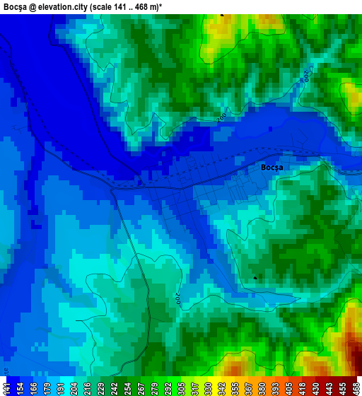
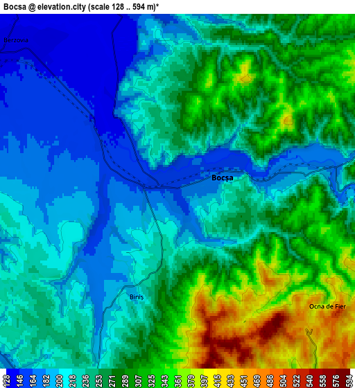
Below is the Elevation map of Bocşa, which displays elevation range with different colors. Scale of the first map is from 141 to 468 m (463 to 1535 ft) with average elevation of 207.1 meters (=679 ft) [note 1]
These maps also provides idea of topography and contour of this city, they are displayed at different zoom levels. More info about maps, scale and edge coordinates you can find below images.
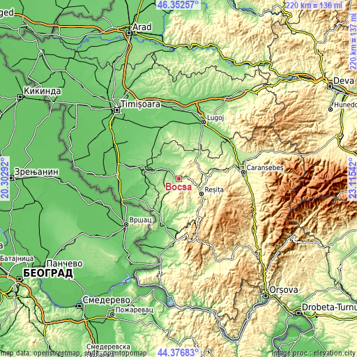
| \ | Map #1 | Map #2 | Topo.Map |
| Scale [m] | 141..468 m | 128..594 m | × |
| Scale [ft] | 463..1535 ft | 420..1949 ft | × |
| Average | 207.1 m = 679 ft | 249.9 m = 820 ft | × |
| Width | 6.86 km = 4.3 mi | 13.73 km = 8.5 mi | 219.7 km = 136.5 mi |
| Height | 6.86 km = 4.3 mi | 13.73 km = 8.5 mi | 219.7 km = 136.5 mi |
| ↑Max Latitude | 45.404192° | 45.435038° | 46.35257° |
| Latitude at center | 45.37333° | 45.37333° | 45.37333° |
| ↓Min Latitude | 45.342451° | 45.311555° | 44.37683° |
| ← Min Longitude | 21.665225° | 21.621279° | 20.30292° |
| Longitude center | 21.70917° | 21.70917° | 21.70917° |
| →Max Longitude | 21.753115° | 21.797061° | 23.11542° |
Nearby cities:
Cities around Bocşa sort by population:
• Reşiţa elevation 301 m
16.2 km,  119°
119°
• Berzovia 137 m
8.6 km,  312°
312°
• Lupac 278 m
13.2 km,  142°
142°
• Măureni 143 m
16.5 km,  281°
281°
• Fârliug 183 m
16.8 km,  40°
40°
• Dognecea 281 m
11.6 km,  161°
161°
• Doclin 244 m
9.5 km,  206°
206°
• Ramna 153 m
7.4 km,  347°
347°
• Câlnic 208 m
12.2 km,  108°
108°
• Ezeriş 221 m
14.4 km,  73°
73°
• Gherteniș 130 m
12 km,  303°
303°
• Fizeș 150 m
9 km,  263°
263°
Multilingual:
 En español:
Bocşa elevación 159 m.
 En France:
Bocşa élévation 159 m.


Sources and notes:
- [note 1] Map square and city borders are not equal. Map elevation data is calculated only from area inside that square.
- [src 1] Elevation data from geonames database provided with same terms of usage.
- [src 2] The elevation map of Bocşa is generated using elevation data from NASA's 3 arcsec (90m) resolution SRTM data.
- [src 3] Base (background) map © OpenStreetMap contributors tiles are generated by Geofabrik and OpenTopoMap.
Copyright & License:
This Bocşa Elevation Map is licensed under CC BY-SA. You may reuse any part from this page, if you give a proper credit by linking to this URL:
 More info on terms of use page.