Bogaţi elevation
Bogaţi (Arges, Comuna Bogaţi), Romania elevation is 287 meters and Bogaţi elevation in feet is 942 ft above sea level [src 1]. Bogaţi is a seat of a second-order administrative division (feature code) with elevation that is 35 meters (115 ft) bigger than average city elevation in Romania.
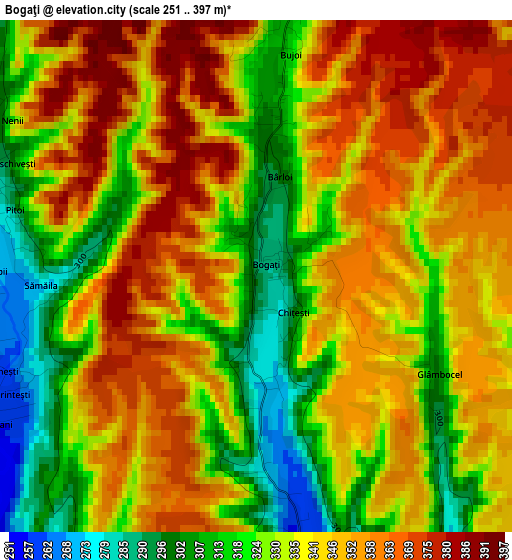
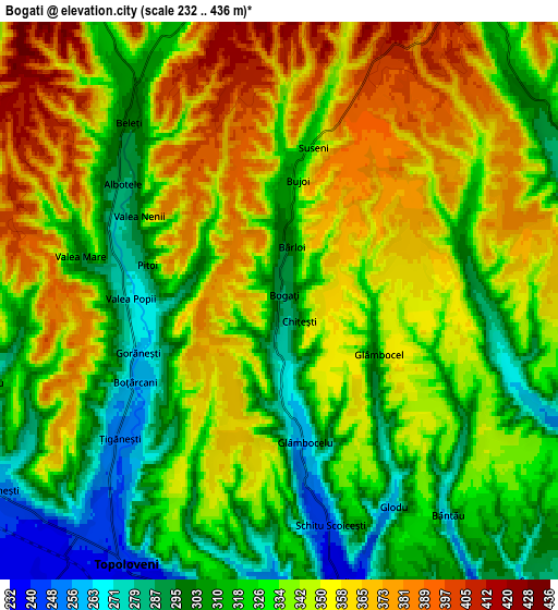
Below is the Elevation map of Bogaţi, which displays elevation range with different colors. Scale of the first map is from 251 to 397 m (823 to 1302 ft) with average elevation of 338.7 meters (=1111 ft) [note 1]
These maps also provides idea of topography and contour of this city, they are displayed at different zoom levels. More info about maps, scale and edge coordinates you can find below images.
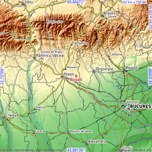
| \ | Map #1 | Map #2 | Topo.Map |
| Scale [m] | 251..397 m | 232..436 m | × |
| Scale [ft] | 823..1302 ft | 761..1430 ft | × |
| Average | 338.7 m = 1111 ft | 335.2 m = 1100 ft | × |
| Width | 6.93 km = 4.3 mi | 13.85 km = 8.6 mi | 221.6 km = 137.7 mi |
| Height | 6.93 km = 4.3 mi | 13.85 km = 8.6 mi | 221.6 km = 137.7 mi |
| ↑Max Latitude | 44.897808° | 44.928929° | 45.85472° |
| Latitude at center | 44.86667° | 44.86667° | 44.86667° |
| ↓Min Latitude | 44.835515° | 44.804344° | 43.86136° |
| ← Min Longitude | 25.089385° | 25.045439° | 23.72708° |
| Longitude center | 25.13333° | 25.13333° | 25.13333° |
| →Max Longitude | 25.177275° | 25.221221° | 26.53958° |
Nearby cities:
Cities around Bogaţi sort by population:
• Topoloveni elevation 243 m
6.8 km,  215°
215°
• Călineşti 240 m
8.6 km,  229°
229°
• Leordeni 224 m
9.4 km,  188°
188°
• Ludeşti 290 m
7.9 km,  90°
90°
• Priboieni 279 m
4.4 km,  295°
295°
• Hulubeşti 244 m
8.7 km,  115°
115°
• Beleţi 294 m
5.4 km,  313°
313°
• Scheiu de Jos 334 m
9.2 km,  34°
34°
• Vrănești 273 m
10.2 km,  256°
256°
• Suseni 328 m
3.9 km,  12°
12°
• Gorganu 267 m
8 km,  250°
250°
• Ciulnița 225 m
8.9 km,  169°
169°
Multilingual:
 En español:
Bogaţi elevación 287 m.
 En France:
Bogaţi élévation 287 m.


Sources and notes:
- [note 1] Map square and city borders are not equal. Map elevation data is calculated only from area inside that square.
- [src 1] Elevation data from geonames database provided with same terms of usage.
- [src 2] The elevation map of Bogaţi is generated using elevation data from NASA's 3 arcsec (90m) resolution SRTM data.
- [src 3] Base (background) map © OpenStreetMap contributors tiles are generated by Geofabrik and OpenTopoMap.
Copyright & License:
This Bogaţi Elevation Map is licensed under CC BY-SA. You may reuse any part from this page, if you give a proper credit by linking to this URL:
 More info on terms of use page.