Brăneşti elevation
Brăneşti (Gorj, Comuna Brăneşti), Romania elevation is 171 meters and Brăneşti elevation in feet is 561 ft above sea level [src 1]. Brăneşti is a seat of a second-order administrative division (feature code) with elevation that is 81 meters (266 ft) smaller than average city elevation in Romania.
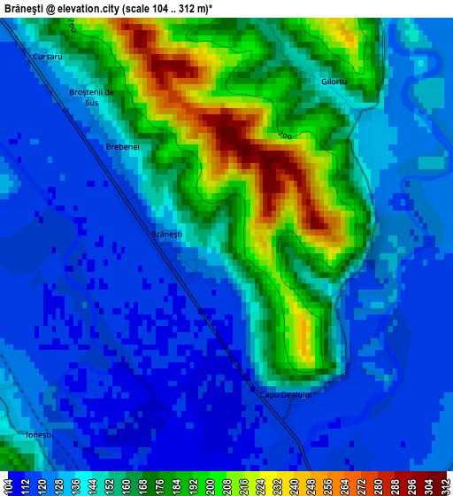
Below is the Elevation map of Brăneşti, which displays elevation range with different colors. Scale of the first map is from 104 to 312 m (341 to 1024 ft) with average elevation of 147.8 meters (=485 ft) [note 1]
These maps also provides idea of topography and contour of this city, they are displayed at different zoom levels. More info about maps, scale and edge coordinates you can find below images.
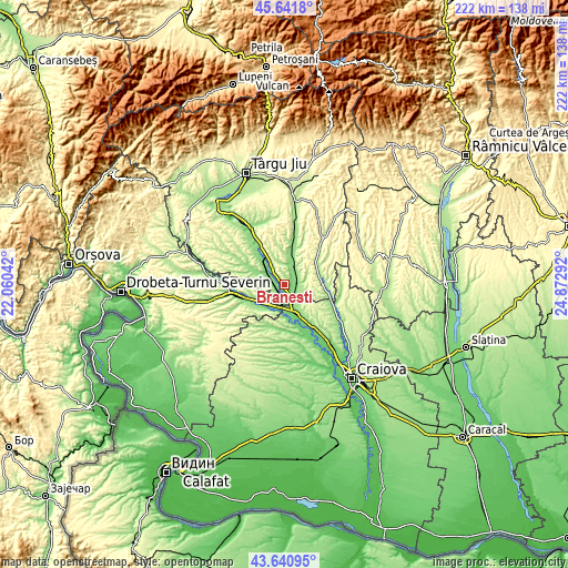
| \ | Map #1 | Topo.Map |
| Scale [m] | 104..312 m | × |
| Scale [ft] | 341..1024 ft | × |
| Average | 147.8 m = 485 ft | × |
| Width | 6.95 km = 4.3 mi | 222.5 km = 138.3 mi |
| Height | 6.95 km = 4.3 mi | 222.5 km = 138.3 mi |
| ↑Max Latitude | 44.681255° | 45.6418° |
| Latitude at center | 44.65° | 44.65° |
| ↓Min Latitude | 44.618728° | 43.64095° |
| ← Min Longitude | 23.422725° | 22.06042° |
| Longitude center | 23.46667° | 23.46667° |
| →Max Longitude | 23.510615° | 24.87292° |
Nearby cities:
Cities around Brăneşti sort by population:
• Filiaşi elevation 106 m
11.8 km,  160°
160°
• Turceni 127 m
8.7 km,  295°
295°
• Turburea 150 m
8.4 km,  28°
28°
• Aninoasa 155 m
11.2 km,  6°
6°
• Butoieşti 114 m
10.8 km,  226°
226°
• Florești 142 m
6 km,  125°
125°
• Ioneşti 124 m
4.5 km,  215°
215°
• Fratoștița 174 m
10.8 km, 130°
• Grozeşti 243 m
11.9 km,  270°
270°
• Poiana 146 m
5.1 km,  87°
87°
• Costești 190 m
9.3 km,  349°
349°
• Ţânţăreni 110 m
5.7 km,  166°
166°
Multilingual:
 En español:
Brăneşti elevación 171 m.
 En France:
Brăneşti élévation 171 m.
 Auf Deutsch:
Brăneşti höhe über dem Meeresspiegel ist 171 m.

Sources and notes:
- [note 1] Map square and city borders are not equal. Map elevation data is calculated only from area inside that square.
- [src 1] Elevation data from geonames database provided with same terms of usage.
- [src 2] The elevation map of Brăneşti is generated using elevation data from NASA's 3 arcsec (90m) resolution SRTM data.
- [src 3] Base (background) map © OpenStreetMap contributors tiles are generated by Geofabrik and OpenTopoMap.
Copyright & License:
This Brăneşti Elevation Map is licensed under CC BY-SA. You may reuse any part from this page, if you give a proper credit by linking to this URL:
 More info on terms of use page.