Târgu Bujor elevation
Târgu Bujor (Galaţi, Oraș Târgu Bujor), Romania elevation is 137 meters and Târgu Bujor elevation in feet is 449 ft above sea level [src 1]. Târgu Bujor is a seat of a second-order administrative division (feature code) with elevation that is 115 meters (377 ft) smaller than average city elevation in Romania.
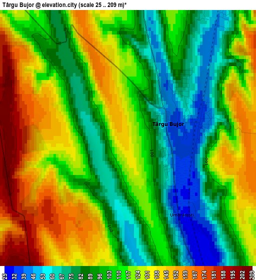
Below is the Elevation map of Târgu Bujor, which displays elevation range with different colors. Scale of the first map is from 25 to 209 m (82 to 686 ft) with average elevation of 111.4 meters (=365 ft) [note 1]
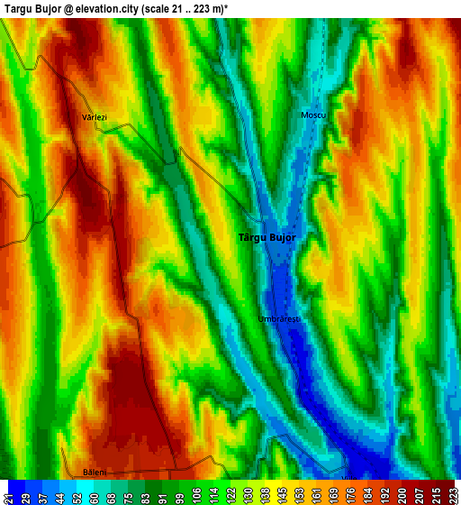
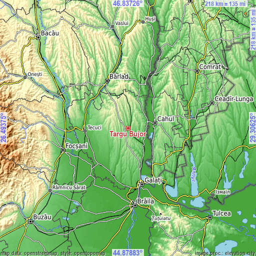
These maps also provides idea of topography and contour of this city, they are displayed at different zoom levels. More info about maps, scale and edge coordinates you can find below images.
| \ | Map #1 | Map #2 | Topo.Map |
| Scale [m] | 25..209 m | 21..223 m | × |
| Scale [ft] | 82..686 ft | 69..732 ft | × |
| Average | 111.4 m = 365 ft | 125.1 m = 410 ft | × |
| Width | 6.8 km = 4.2 mi | 13.61 km = 8.5 mi | 217.8 km = 135.3 mi |
| Height | 6.8 km = 4.2 mi | 13.61 km = 8.5 mi | 217.7 km = 135.3 mi |
| ↑Max Latitude | 45.897262° | 45.927837° | 46.83726° |
| Latitude at center | 45.86667° | 45.86667° | 45.86667° |
| ↓Min Latitude | 45.836061° | 45.805435° | 44.87883° |
| ← Min Longitude | 27.856055° | 27.812109° | 26.49375° |
| Longitude center | 27.9° | 27.9° | 27.9° |
| →Max Longitude | 27.943945° | 27.987891° | 29.30625° |
Nearby cities:
Cities around Târgu Bujor sort by population:
• Măstăcani elevation 35 m
13.9 km,  131°
131°
• Băleni 121 m
7.6 km,  222°
222°
• Corni 212 m
10.5 km,  259°
259°
• Vârlezi 130 m
5.4 km,  313°
313°
• Băneasa 67 m
7.8 km,  19°
19°
• Jorăşti 166 m
13.2 km,  348°
348°
• Viile 24 m
7.6 km,  151°
151°
• Smulţi 218 m
13.8 km,  302°
302°
• Moscu 50 m
4.7 km,  31°
31°
• Umbrărești 33 m
2.5 km,  144°
144°
• Crăiești 205 m
10.9 km,  321°
321°
• Fârţăneşti 54 m
8.5 km, 130°
Multilingual:
 En español:
Târgu Bujor elevación 137 m.
 En France:
Târgu Bujor élévation 137 m.
 Auf Deutsch:
Târgu Bujor höhe über dem Meeresspiegel ist 137 m.

Sources and notes:
- [note 1] Map square and city borders are not equal. Map elevation data is calculated only from area inside that square.
- [src 1] Elevation data from geonames database provided with same terms of usage.
- [src 2] The elevation map of Târgu Bujor is generated using elevation data from NASA's 3 arcsec (90m) resolution SRTM data.
- [src 3] Base (background) map © OpenStreetMap contributors tiles are generated by Geofabrik and OpenTopoMap.
Copyright & License:
This Târgu Bujor Elevation Map is licensed under CC BY-SA. You may reuse any part from this page, if you give a proper credit by linking to this URL:
 More info on terms of use page.