Călugăreni elevation
Călugăreni (Giurgiu, Comuna Călugăreni), Romania elevation is 49 meters and Călugăreni elevation in feet is 161 ft above sea level [src 1]. Călugăreni is a seat of a second-order administrative division (feature code) with elevation that is 203 meters (666 ft) smaller than average city elevation in Romania.
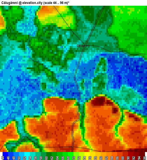
Below is the Elevation map of Călugăreni, which displays elevation range with different colors. Scale of the first map is from 44 to 96 m (144 to 315 ft) with average elevation of 63.9 meters (=210 ft) [note 1]
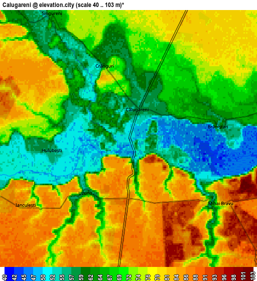
These maps also provides idea of topography and contour of this city, they are displayed at different zoom levels. More info about maps, scale and edge coordinates you can find below images.
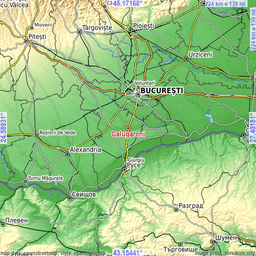
| \ | Map #1 | Map #2 | Topo.Map |
| Scale [m] | 44..96 m | 40..103 m | × |
| Scale [ft] | 144..315 ft | 131..338 ft | × |
| Average | 63.9 m = 210 ft | 71.7 m = 235 ft | × |
| Width | 7.01 km = 4.4 mi | 14.02 km = 8.7 mi | 224.3 km = 139.4 mi |
| Height | 7.01 km = 4.4 mi | 14.02 km = 8.7 mi | 224.3 km = 139.4 mi |
| ↑Max Latitude | 44.203182° | 44.234676° | 45.17168° |
| Latitude at center | 44.17167° | 44.17167° | 44.17167° |
| ↓Min Latitude | 44.140142° | 44.108596° | 43.15441° |
| ← Min Longitude | 25.951615° | 25.907669° | 24.58931° |
| Longitude center | 25.99556° | 25.99556° | 25.99556° |
| →Max Longitude | 26.039505° | 26.083451° | 27.40181° |
Nearby cities:
Cities around Călugăreni sort by population:
• Comana elevation 52 m
11.9 km,  90°
90°
• Singureni 65 m
8 km,  328°
328°
• Adunații-Copăceni 77 m
10.1 km,  25°
25°
• Copăceni 59 m
12.8 km,  37°
37°
• Mihai Bravu 87 m
6.4 km,  122°
122°
• Stoeneşti 58 m
8.6 km,  249°
249°
• Iepureşti 67 m
13.2 km,  316°
316°
• Schitu 90 m
13.1 km, 254°
• Vlad Țepeș 83 m
11.8 km,  111°
111°
• Hulubești 57 m
4.3 km,  263°
263°
• Uzunu 58 m
3.5 km,  219°
219°
• Brăniștari 57 m
5.1 km,  84°
84°
Multilingual:
 En español:
Călugăreni elevación 49 m.
 En France:
Călugăreni élévation 49 m.
 Auf Deutsch:
Călugăreni höhe über dem Meeresspiegel ist 49 m.

Sources and notes:
- [note 1] Map square and city borders are not equal. Map elevation data is calculated only from area inside that square.
- [src 1] Elevation data from geonames database provided with same terms of usage.
- [src 2] The elevation map of Călugăreni is generated using elevation data from NASA's 3 arcsec (90m) resolution SRTM data.
- [src 3] Base (background) map © OpenStreetMap contributors tiles are generated by Geofabrik and OpenTopoMap.
Copyright & License:
This Călugăreni Elevation Map is licensed under CC BY-SA. You may reuse any part from this page, if you give a proper credit by linking to this URL:
 More info on terms of use page.