Cernat elevation
Cernat (Covasna, Comună Cernat), Romania elevation is 563 meters and Cernat elevation in feet is 1847 ft above sea level [src 1]. Cernat is a seat of a second-order administrative division (feature code) with elevation that is 311 meters (1020 ft) bigger than average city elevation in Romania.
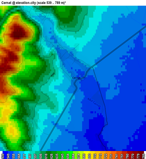
Below is the Elevation map of Cernat, which displays elevation range with different colors. Scale of the first map is from 539 to 789 m (1768 to 2589 ft) with average elevation of 593.9 meters (=1948 ft) [note 1]
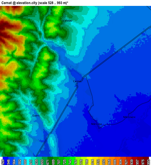
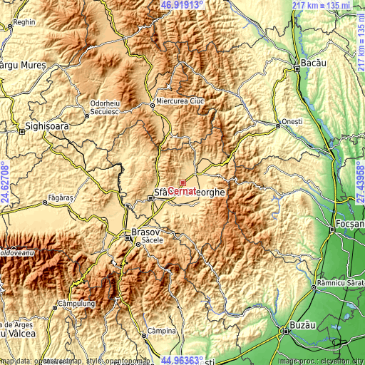
These maps also provides idea of topography and contour of this city, they are displayed at different zoom levels. More info about maps, scale and edge coordinates you can find below images.
| \ | Map #1 | Map #2 | Topo.Map |
| Scale [m] | 539..789 m | 528..993 m | × |
| Scale [ft] | 1768..2589 ft | 1732..3258 ft | × |
| Average | 593.9 m = 1948 ft | 616 m = 2021 ft | × |
| Width | 6.79 km = 4.2 mi | 13.59 km = 8.4 mi | 217.4 km = 135.1 mi |
| Height | 6.79 km = 4.2 mi | 13.59 km = 8.4 mi | 217.4 km = 135.1 mi |
| ↑Max Latitude | 45.980546° | 46.011075° | 46.91913° |
| Latitude at center | 45.95° | 45.95° | 45.95° |
| ↓Min Latitude | 45.919437° | 45.888857° | 44.96363° |
| ← Min Longitude | 25.989385° | 25.945439° | 24.62708° |
| Longitude center | 26.03333° | 26.03333° | 26.03333° |
| →Max Longitude | 26.077275° | 26.121221° | 27.43958° |
Nearby cities:
Cities around Cernat sort by population:
• Târgu Secuiesc elevation 571 m
9.5 km,  54°
54°
• Zăbala 564 m
12.9 km,  115°
115°
• Sânzieni 654 m
13.5 km,  34°
34°
• Turia 621 m
9.4 km,  7°
7°
• Catalina 551 m
9.2 km,  78°
78°
• Boroşneu Mare 526 m
15 km,  189°
189°
• Ghidfalău 555 m
15.2 km,  248°
248°
• Bodoc 539 m
14.2 km,  270°
270°
• Moacşa 533 m
10.6 km,  209°
209°
• Reci 531 m
13.5 km, 214°
• Brateş 528 m
13.2 km,  168°
168°
• Dalnic 577 m
4.7 km,  229°
229°
Multilingual:
 En español:
Cernat elevación 563 m.
 En France:
Cernat élévation 563 m.


Sources and notes:
- [note 1] Map square and city borders are not equal. Map elevation data is calculated only from area inside that square.
- [src 1] Elevation data from geonames database provided with same terms of usage.
- [src 2] The elevation map of Cernat is generated using elevation data from NASA's 3 arcsec (90m) resolution SRTM data.
- [src 3] Base (background) map © OpenStreetMap contributors tiles are generated by Geofabrik and OpenTopoMap.
Copyright & License:
This Cernat Elevation Map is licensed under CC BY-SA. You may reuse any part from this page, if you give a proper credit by linking to this URL:
 More info on terms of use page.