Ciomăgeşti elevation
Ciomăgeşti (Arges, Comuna Ciomăgeşti), Romania elevation is 309 meters and Ciomăgeşti elevation in feet is 1014 ft above sea level [src 1]. Ciomăgeşti is a seat of a second-order administrative division (feature code) with elevation that is 57 meters (187 ft) bigger than average city elevation in Romania.
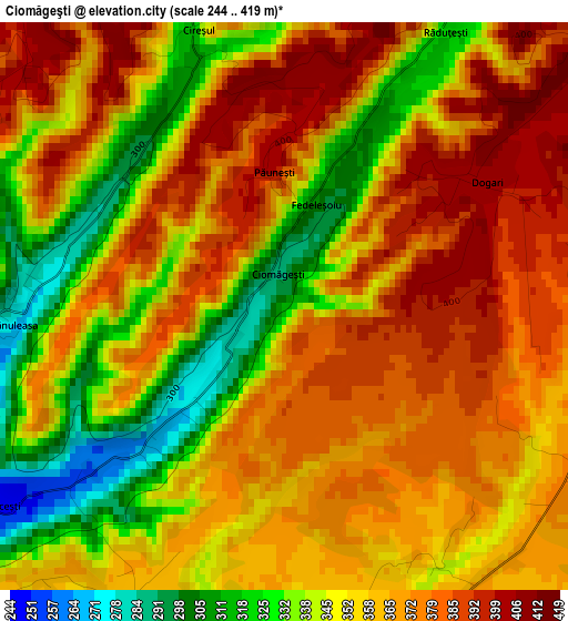
Below is the Elevation map of Ciomăgeşti, which displays elevation range with different colors. Scale of the first map is from 244 to 419 m (801 to 1375 ft) with average elevation of 359.1 meters (=1178 ft) [note 1]
These maps also provides idea of topography and contour of this city, they are displayed at different zoom levels. More info about maps, scale and edge coordinates you can find below images.
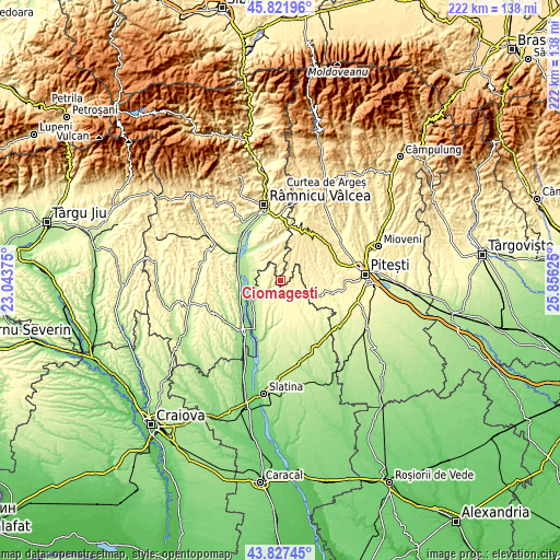
| \ | Map #1 | Topo.Map |
| Scale [m] | 244..419 m | × |
| Scale [ft] | 801..1375 ft | × |
| Average | 359.1 m = 1178 ft | × |
| Width | 6.93 km = 4.3 mi | 221.8 km = 137.8 mi |
| Height | 6.93 km = 4.3 mi | 221.8 km = 137.8 mi |
| ↑Max Latitude | 44.864486° | 45.82196° |
| Latitude at center | 44.83333° | 44.83333° |
| ↓Min Latitude | 44.802157° | 43.82745° |
| ← Min Longitude | 24.406055° | 23.04375° |
| Longitude center | 24.45° | 24.45° |
| →Max Longitude | 24.493945° | 25.85625° |
Nearby cities:
Cities around Ciomăgeşti sort by population:
• Stoileşti elevation 431 m
9.1 km,  324°
324°
• Vitomireşti 407 m
5.4 km,  313°
313°
• Uda 446 m
13.1 km,  44°
44°
• Dealu Dănicei 434 m
7.5 km,  349°
349°
• Drăgoeşti 224 m
12 km,  261°
261°
• Dobroteasa 332 m
7.7 km,  223°
223°
• Leleasca 347 m
5.7 km,  193°
193°
• Făgeţelu 354 m
8.6 km,  130°
130°
• Topana 338 m
5.6 km,  109°
109°
• Dejești 286 m
7.4 km,  267°
267°
• Olanu 200 m
12.4 km,  287°
287°
• Sâmbureşti 354 m
4.5 km, 215°
Multilingual:
 En español:
Ciomăgeşti elevación 309 m.
 En France:
Ciomăgeşti élévation 309 m.
 Auf Deutsch:
Ciomăgeşti höhe über dem Meeresspiegel ist 309 m.

Sources and notes:
- [note 1] Map square and city borders are not equal. Map elevation data is calculated only from area inside that square.
- [src 1] Elevation data from geonames database provided with same terms of usage.
- [src 2] The elevation map of Ciomăgeşti is generated using elevation data from NASA's 3 arcsec (90m) resolution SRTM data.
- [src 3] Base (background) map © OpenStreetMap contributors tiles are generated by Geofabrik and OpenTopoMap.
Copyright & License:
This Ciomăgeşti Elevation Map is licensed under CC BY-SA. You may reuse any part from this page, if you give a proper credit by linking to this URL:
 More info on terms of use page.