Cârţişoara elevation
Cârţişoara (Sibiu, Comuna Cârţişoara), Romania elevation is 512 meters and Cârţişoara elevation in feet is 1680 ft above sea level [src 1]. Cârţişoara is a seat of a second-order administrative division (feature code) with elevation that is 260 meters (853 ft) bigger than average city elevation in Romania.
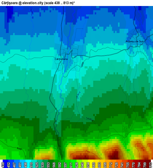
Below is the Elevation map of Cârţişoara, which displays elevation range with different colors. Scale of the first map is from 438 to 813 m (1437 to 2667 ft) with average elevation of 534.4 meters (=1753 ft) [note 1]
These maps also provides idea of topography and contour of this city, they are displayed at different zoom levels. More info about maps, scale and edge coordinates you can find below images.
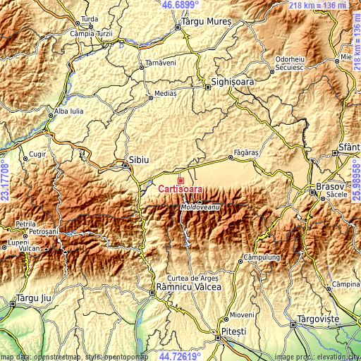
| \ | Map #1 | Topo.Map |
| Scale [m] | 438..813 m | × |
| Scale [ft] | 1437..2667 ft | × |
| Average | 534.4 m = 1753 ft | × |
| Width | 6.82 km = 4.2 mi | 218.3 km = 135.6 mi |
| Height | 6.82 km = 4.2 mi | 218.3 km = 135.6 mi |
| ↑Max Latitude | 45.747345° | 46.6899° |
| Latitude at center | 45.71667° | 45.71667° |
| ↓Min Latitude | 45.685979° | 44.72619° |
| ← Min Longitude | 24.539385° | 23.17708° |
| Longitude center | 24.58333° | 24.58333° |
| →Max Longitude | 24.627275° | 25.98958° |
Nearby cities:
Cities around Cârţişoara sort by population:
• Avrig elevation 385 m
15.5 km,  270°
270°
• Victoria 551 m
9.4 km,  81°
81°
• Mârșa 382 m
16.6 km,  263°
263°
• Porumbacu de Jos 407 m
11 km,  289°
289°
• Arpaşu de Jos 405 m
7.9 km,  19°
19°
• Ucea de Sus 492 m
8.6 km,  64°
64°
• Arpașu de Sus 487 m
3.4 km,  54°
54°
• Drăguș 488 m
16 km,  71°
71°
• Cârţa 406 m
7.5 km,  350°
350°
• Ucea de Jos 428 m
10.1 km,  42°
42°
• Marpod 456 m
17.9 km,  338°
338°
• Viștea de Jos 421 m
14 km, 51°
Multilingual:
 En español:
Cârţişoara elevación 512 m.
 En France:
Cârţişoara élévation 512 m.
 Auf Deutsch:
Cârţişoara höhe über dem Meeresspiegel ist 512 m.

Sources and notes:
- [note 1] Map square and city borders are not equal. Map elevation data is calculated only from area inside that square.
- [src 1] Elevation data from geonames database provided with same terms of usage.
- [src 2] The elevation map of Cârţişoara is generated using elevation data from NASA's 3 arcsec (90m) resolution SRTM data.
- [src 3] Base (background) map © OpenStreetMap contributors tiles are generated by Geofabrik and OpenTopoMap.
Copyright & License:
This Cârţişoara Elevation Map is licensed under CC BY-SA. You may reuse any part from this page, if you give a proper credit by linking to this URL:
 More info on terms of use page.