Ciuani elevation
Ciuani (Teleorman, Comuna Mereni), Romania elevation is 76 meters and Ciuani elevation in feet is 249 ft above sea level [src 1]. Ciuani is a populated place (feature code) with elevation that is 176 meters (577 ft) smaller than average city elevation in Romania.
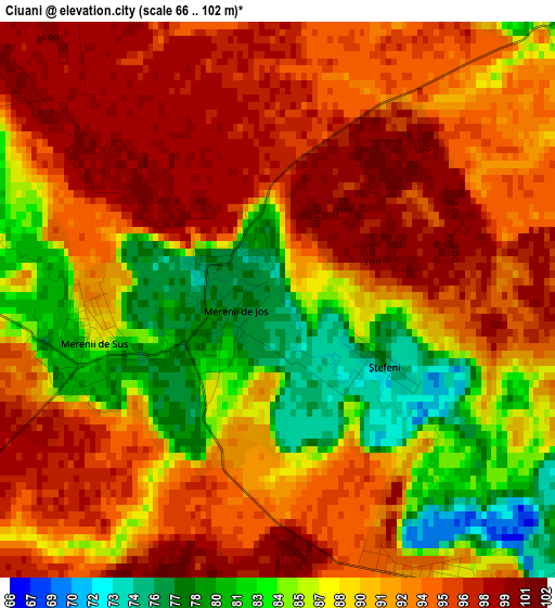
Below is the Elevation map of Ciuani, which displays elevation range with different colors. Scale of the first map is from 66 to 102 m (217 to 335 ft) with average elevation of 90.6 meters (=297 ft) [note 1]
These maps also provides idea of topography and contour of this city, they are displayed at different zoom levels. More info about maps, scale and edge coordinates you can find below images.
| \ | Map #1 | Topo.Map |
| Scale [m] | 66..102 m | × |
| Scale [ft] | 217..335 ft | × |
| Average | 90.6 m = 297 ft | × |
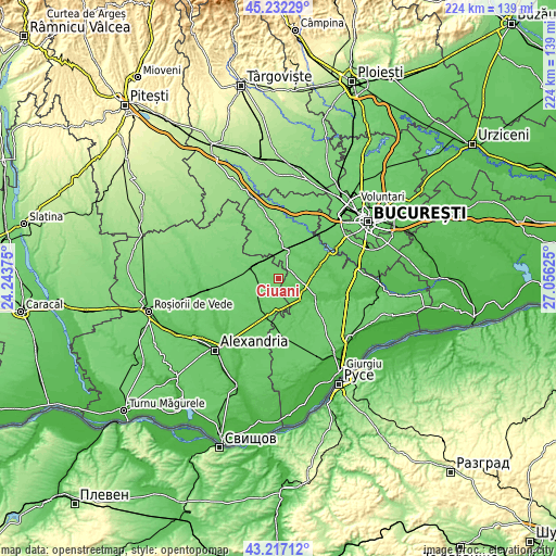
| Width | 7 km = 4.3 mi | 224.1 km = 139.2 mi |
| Height | 7 km = 4.3 mi | 224.1 km = 139.2 mi |
| ↑Max Latitude | 44.264809° | 45.23229° |
| Latitude at center | 44.23333° | 44.23333° |
| ↓Min Latitude | 44.201835° | 43.21712° |
| ← Min Longitude | 25.606055° | 24.24375° |
| Longitude center | 25.65° | 25.65° |
| →Max Longitude | 25.693945° | 27.05625° |
Nearby cities:
Cities around Ciuani sort by population:
• Videle elevation 104 m
11.2 km,  296°
296°
• Clejani 83 m
10.4 km,  22°
22°
• Ghimpați 79 m
11.4 km,  111°
111°
• Valea Cireșului 89 m
10 km,  222°
222°
• Merenii de Jos 76 m
0.5 km,  255°
255°
• Moșteni 99 m
11.9 km,  250°
250°
• Crevenicu 82 m
5 km,  279°
279°
• Merenii de Sus 86 m
2.4 km, 256°
• Letca Veche 94 m
4.8 km,  142°
142°
• Milcovățu 82 m
5.3 km,  47°
47°
• Copaciu 75 m
11.1 km,  121°
121°
• Letca Nouă 88 m
7.4 km,  88°
88°
Multilingual:
 En español:
Ciuani elevación 76 m.
 En France:
Ciuani élévation 76 m.


Sources and notes:
- [note 1] Map square and city borders are not equal. Map elevation data is calculated only from area inside that square.
- [src 1] Elevation data from geonames database provided with same terms of usage.
- [src 2] The elevation map of Ciuani is generated using elevation data from NASA's 3 arcsec (90m) resolution SRTM data.
- [src 3] Base (background) map © OpenStreetMap contributors tiles are generated by Geofabrik and OpenTopoMap.
Copyright & License:
This Ciuani Elevation Map is licensed under CC BY-SA. You may reuse any part from this page, if you give a proper credit by linking to this URL:
 More info on terms of use page.