Codlea elevation
Codlea (Braşov, Municipiul Codlea), Romania elevation is 550 meters and Codlea elevation in feet is 1804 ft above sea level [src 1]. Codlea is a populated place (feature code) with elevation that is 298 meters (978 ft) bigger than average city elevation in Romania.
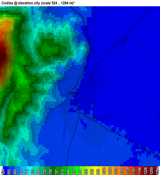
Below is the Elevation map of Codlea, which displays elevation range with different colors. Scale of the first map is from 524 to 1284 m (1719 to 4213 ft) with average elevation of 618.8 meters (=2030 ft) [note 1]
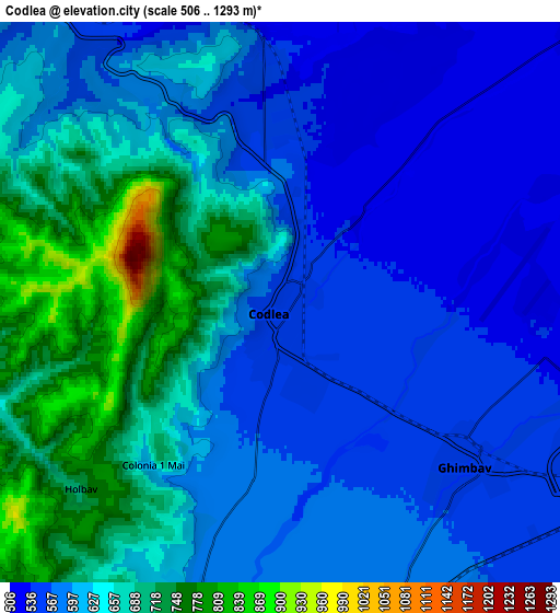
These maps also provides idea of topography and contour of this city, they are displayed at different zoom levels. More info about maps, scale and edge coordinates you can find below images.
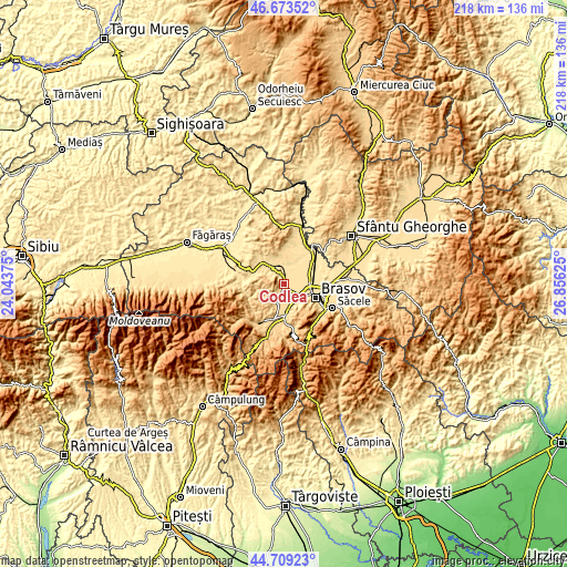
| \ | Map #1 | Map #2 | Topo.Map |
| Scale [m] | 524..1284 m | 506..1293 m | × |
| Scale [ft] | 1719..4213 ft | 1660..4242 ft | × |
| Average | 618.8 m = 2030 ft | 618.1 m = 2028 ft | × |
| Width | 6.83 km = 4.2 mi | 13.65 km = 8.5 mi | 218.4 km = 135.7 mi |
| Height | 6.83 km = 4.2 mi | 13.65 km = 8.5 mi | 218.4 km = 135.7 mi |
| ↑Max Latitude | 45.730684° | 45.76135° | 46.67352° |
| Latitude at center | 45.7° | 45.7° | 45.7° |
| ↓Min Latitude | 45.669299° | 45.638582° | 44.70923° |
| ← Min Longitude | 25.406055° | 25.362109° | 24.04375° |
| Longitude center | 25.45° | 25.45° | 25.45° |
| →Max Longitude | 25.493945° | 25.537891° | 26.85625° |
Nearby cities:
Cities around Codlea sort by population:
• Braşov elevation 573 m
13.4 km,  115°
115°
• Râşnov 641 m
13 km,  180°
180°
• Hălchiu 505 m
10.7 km,  46°
46°
• Vulcan 600 m
7.9 km,  199°
199°
• Ghimbav 557 m
5.4 km,  133°
133°
• Dumbrăviţa 524 m
7.5 km,  350°
350°
• Cristian 603 m
9.4 km,  172°
172°
• Sânpetru 528 m
14.6 km,  85°
85°
• Colonia Bod 502 m
13.2 km,  61°
61°
• Holbav 717 m
6.6 km,  226°
226°
• Șinca Nouă 539 m
16 km,  267°
267°
• Crizbav 570 m
12.9 km,  5°
5°
Multilingual:
 En español:
Codlea elevación 550 m.
 En France:
Codlea élévation 550 m.


Sources and notes:
- [note 1] Map square and city borders are not equal. Map elevation data is calculated only from area inside that square.
- [src 1] Elevation data from geonames database provided with same terms of usage.
- [src 2] The elevation map of Codlea is generated using elevation data from NASA's 3 arcsec (90m) resolution SRTM data.
- [src 3] Base (background) map © OpenStreetMap contributors tiles are generated by Geofabrik and OpenTopoMap.
Copyright & License:
This Codlea Elevation Map is licensed under CC BY-SA. You may reuse any part from this page, if you give a proper credit by linking to this URL:
 More info on terms of use page.