Cujmir elevation
Cujmir (Mehedinţi, Comuna Cujmir), Romania elevation is 68 meters and Cujmir elevation in feet is 223 ft above sea level [src 1]. Cujmir is a seat of a second-order administrative division (feature code) with elevation that is 184 meters (604 ft) smaller than average city elevation in Romania.
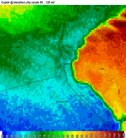
Below is the Elevation map of Cujmir, which displays elevation range with different colors. Scale of the first map is from 50 to 120 m (164 to 394 ft) with average elevation of 75 meters (=246 ft) [note 1]
These maps also provides idea of topography and contour of this city, they are displayed at different zoom levels. More info about maps, scale and edge coordinates you can find below images.
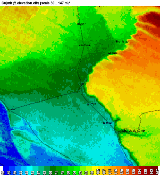
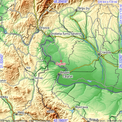
| \ | Map #1 | Map #2 | Topo.Map |
| Scale [m] | 50..120 m | 30..147 m | × |
| Scale [ft] | 164..394 ft | 98..482 ft | × |
| Average | 75 m = 246 ft | 79.2 m = 260 ft | × |
| Width | 7.01 km = 4.4 mi | 14.01 km = 8.7 mi | 224.2 km = 139.3 mi |
| Height | 7.01 km = 4.4 mi | 14.01 km = 8.7 mi | 224.2 km = 139.3 mi |
| ↑Max Latitude | 44.238163° | 44.269639° | 45.20608° |
| Latitude at center | 44.20667° | 44.20667° | 44.20667° |
| ↓Min Latitude | 44.17516° | 44.143634° | 43.19001° |
| ← Min Longitude | 22.882725° | 22.838779° | 21.52042° |
| Longitude center | 22.92667° | 22.92667° | 22.92667° |
| →Max Longitude | 22.970615° | 23.014561° | 24.33292° |
Nearby cities:
Cities around Cujmir sort by population:
• Gârla-Mare elevation 83 m
12.1 km,  271°
271°
• Vânători 82 m
4 km,  2°
2°
• Salcia 43 m
7.3 km,  179°
179°
• Punghina 91 m
8.4 km, 4°
• Dârvari 109 m
9.9 km,  94°
94°
• Vrata 60 m
6.4 km,  255°
255°
• Braniștea 82 m
5.4 km,  43°
43°
• Gemeni 97 m
13 km,  106°
106°
• Izimșa 55 m
4 km,  143°
143°
• Roșiori 87 m
5.5 km, 1°
• Recea 105 m
12.6 km,  356°
356°
• Obârșia de Câmp 93 m
5.7 km,  132°
132°
Multilingual:
 En español:
Cujmir elevación 68 m.
 En France:
Cujmir élévation 68 m.


Sources and notes:
- [note 1] Map square and city borders are not equal. Map elevation data is calculated only from area inside that square.
- [src 1] Elevation data from geonames database provided with same terms of usage.
- [src 2] The elevation map of Cujmir is generated using elevation data from NASA's 3 arcsec (90m) resolution SRTM data.
- [src 3] Base (background) map © OpenStreetMap contributors tiles are generated by Geofabrik and OpenTopoMap.
Copyright & License:
This Cujmir Elevation Map is licensed under CC BY-SA. You may reuse any part from this page, if you give a proper credit by linking to this URL:
 More info on terms of use page.