Gârla-Mare elevation
Gârla-Mare (Mehedinţi, Comuna Gârla Mare), Romania elevation is 83 meters and Gârla-Mare elevation in feet is 272 ft above sea level [src 1]. Gârla-Mare is a populated place (feature code) with elevation that is 169 meters (554 ft) smaller than average city elevation in Romania.
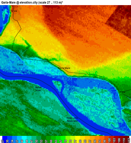
Below is the Elevation map of Gârla-Mare, which displays elevation range with different colors. Scale of the first map is from 30 to 99 m (98 to 325 ft) with average elevation of 60.4 meters (=198 ft) [note 1]
These maps also provides idea of topography and contour of this city, they are displayed at different zoom levels. More info about maps, scale and edge coordinates you can find below images.

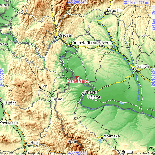
| \ | Map #1 | Map #2 | Topo.Map |
| Scale [m] | 30..99 m | 27..113 m | × |
| Scale [ft] | 98..325 ft | 89..371 ft | × |
| Average | 60.4 m = 198 ft | 64.8 m = 213 ft | × |
| Width | 7 km = 4.3 mi | 14.01 km = 8.7 mi | 224.2 km = 139.3 mi |
| Height | 7 km = 4.3 mi | 14.01 km = 8.7 mi | 224.1 km = 139.2 mi |
| ↑Max Latitude | 44.240662° | 44.272136° | 45.20854° |
| Latitude at center | 44.20917° | 44.20917° | 44.20917° |
| ↓Min Latitude | 44.177662° | 44.146136° | 43.19255° |
| ← Min Longitude | 22.731055° | 22.687109° | 21.36875° |
| Longitude center | 22.775° | 22.775° | 22.775° |
| →Max Longitude | 22.818945° | 22.862891° | 24.18125° |
Nearby cities:
Cities around Gârla-Mare sort by population:
• Vânători elevation 82 m
12.8 km,  73°
73°
• Pătulele 75 m
15.1 km,  359°
359°
• Cujmir 68 m
12.1 km,  91°
91°
• Salcia 43 m
14.4 km,  121°
121°
• Punghina 91 m
15.1 km,  57°
57°
• Gruia 98 m
8.6 km,  319°
319°
• Vrata 60 m
6.2 km,  107°
107°
• Pristol 42 m
5.5 km,  288°
288°
• Braniștea 82 m
16.2 km,  77°
77°
• Izimșa 55 m
14.9 km,  103°
103°
• Izvoarele 72 m
14.3 km, 321°
• Roșiori 87 m
13.3 km, 66°
Multilingual:
 En español:
Gârla-Mare elevación 83 m.
 En France:
Gârla-Mare élévation 83 m.
 Auf Deutsch:
Gârla-Mare höhe über dem Meeresspiegel ist 83 m.

Sources and notes:
- [note 1] Map square and city borders are not equal. Map elevation data is calculated only from area inside that square.
- [src 1] Elevation data from geonames database provided with same terms of usage.
- [src 2] The elevation map of Gârla-Mare is generated using elevation data from NASA's 3 arcsec (90m) resolution SRTM data.
- [src 3] Base (background) map © OpenStreetMap contributors tiles are generated by Geofabrik and OpenTopoMap.
Copyright & License:
This Gârla-Mare Elevation Map is licensed under CC BY-SA. You may reuse any part from this page, if you give a proper credit by linking to this URL:
 More info on terms of use page.