Deleni elevation
Deleni (Iaşi, Comuna Deleni), Romania elevation is 258 meters and Deleni elevation in feet is 846 ft above sea level [src 1]. Deleni is a seat of a second-order administrative division (feature code) with elevation that is 6 meters (20 ft) bigger than average city elevation in Romania.
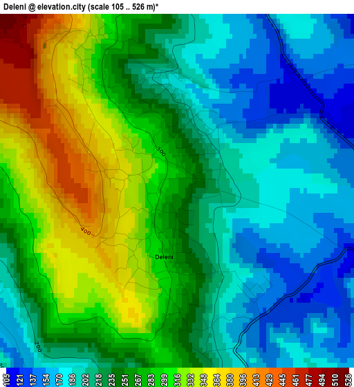
Below is the Elevation map of Deleni, which displays elevation range with different colors. Scale of the first map is from 105 to 526 m (344 to 1726 ft) with average elevation of 247.1 meters (=811 ft) [note 1]
These maps also provides idea of topography and contour of this city, they are displayed at different zoom levels. More info about maps, scale and edge coordinates you can find below images.
| \ | Map #1 | Map #2 | Topo.Map |
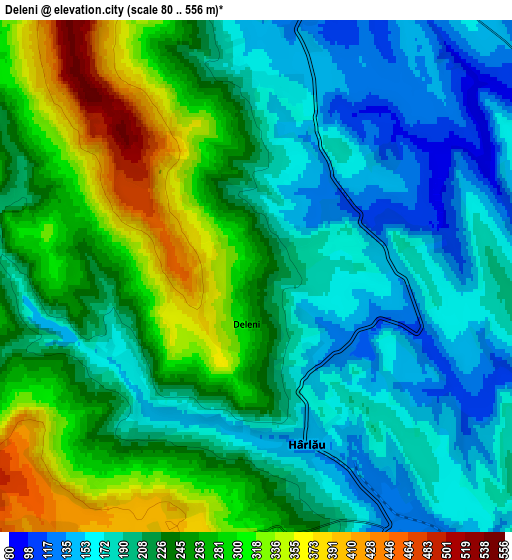
| Scale [m] | 105..526 m | 80..556 m | × |
| Scale [ft] | 344..1726 ft | 262..1824 ft | × |
| Average | 247.1 m = 811 ft | 230.4 m = 756 ft | × |
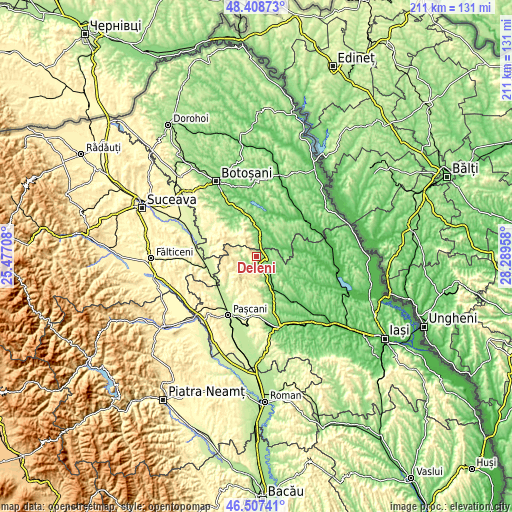
| Width | 6.61 km = 4.1 mi | 13.21 km = 8.2 mi | 211.4 km = 131.4 mi |
| Height | 6.61 km = 4.1 mi | 13.21 km = 8.2 mi | 211.4 km = 131.4 mi |
| ↑Max Latitude | 47.496369° | 47.526052° | 48.40873° |
| Latitude at center | 47.46667° | 47.46667° | 47.46667° |
| ↓Min Latitude | 47.436954° | 47.407221° | 46.50741° |
| ← Min Longitude | 26.839385° | 26.795439° | 25.47708° |
| Longitude center | 26.88333° | 26.88333° | 26.88333° |
| →Max Longitude | 26.927275° | 26.971221° | 28.28958° |
Nearby cities:
Cities around Deleni sort by population:
• Hârlău elevation 153 m
3.9 km,  161°
161°
• Frumuşica 139 m
7.5 km,  9°
9°
• Pârcovaci 155 m
4.2 km,  215°
215°
• Maxut 202 m
3 km,  167°
167°
• Vlădeni-Deal 173 m
6.3 km,  352°
352°
• Sticlăria 393 m
8 km,  205°
205°
• Bădeni 125 m
8.4 km,  143°
143°
• Poiana 323 m
3.3 km,  333°
333°
• Fetești 206 m
6.7 km, 163°
• Slobozia 189 m
1.3 km,  21°
21°
• Zagavia 188 m
5.4 km, 168°
• Rădeni 157 m
5.1 km, 7°
Multilingual:
 En español:
Deleni elevación 258 m.
 En France:
Deleni élévation 258 m.


Sources and notes:
- [note 1] Map square and city borders are not equal. Map elevation data is calculated only from area inside that square.
- [src 1] Elevation data from geonames database provided with same terms of usage.
- [src 2] The elevation map of Deleni is generated using elevation data from NASA's 3 arcsec (90m) resolution SRTM data.
- [src 3] Base (background) map © OpenStreetMap contributors tiles are generated by Geofabrik and OpenTopoMap.
Copyright & License:
This Deleni Elevation Map is licensed under CC BY-SA. You may reuse any part from this page, if you give a proper credit by linking to this URL:
 More info on terms of use page.