Dioșod elevation
Dioșod (Sălaj, Comuna Hereclean), Romania elevation is 267 meters and Dioșod elevation in feet is 876 ft above sea level [src 1]. Dioșod is a populated place (feature code) with elevation that is 15 meters (49 ft) bigger than average city elevation in Romania.
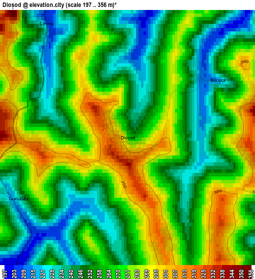
Below is the Elevation map of Dioșod, which displays elevation range with different colors. Scale of the first map is from 197 to 356 m (646 to 1168 ft) with average elevation of 263.7 meters (=865 ft) [note 1]
These maps also provides idea of topography and contour of this city, they are displayed at different zoom levels. More info about maps, scale and edge coordinates you can find below images.
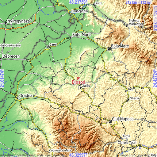
| \ | Map #1 | Topo.Map |
| Scale [m] | 197..356 m | × |
| Scale [ft] | 646..1168 ft | × |
| Average | 263.7 m = 865 ft | × |
| Width | 6.63 km = 4.1 mi | 212.1 km = 131.8 mi |
| Height | 6.63 km = 4.1 mi | 212.1 km = 131.8 mi |
| ↑Max Latitude | 47.322178° | 48.23759° |
| Latitude at center | 47.29238° | 47.29238° |
| ↓Min Latitude | 47.262565° | 46.32997° |
| ← Min Longitude | 22.977045° | 21.61474° |
| Longitude center | 23.02099° | 23.02099° |
| →Max Longitude | 23.064935° | 24.42724° |
Nearby cities:
Cities around Dioșod sort by population:
• Zalău elevation 261 m
10.5 km,  167°
167°
• Hereclean 270 m
4.7 km,  183°
183°
• Bocşa 204 m
8.1 km,  271°
271°
• Hodod 243 m
12 km,  4°
4°
• Sălăţig 182 m
11.8 km,  45°
45°
• Pericei 221 m
12.3 km,  237°
237°
• Crişeni 252 m
6.9 km,  161°
161°
• Mirşid 323 m
10.7 km,  127°
127°
• Dobrin 289 m
8.5 km,  96°
96°
• Şamşud 229 m
8.3 km,  320°
320°
• Coşeiu 290 m
3.9 km,  313°
313°
• Vârşolţ 224 m
12.2 km,  212°
212°
Multilingual:
 En español:
Dioșod elevación 267 m.
 En France:
Dioșod élévation 267 m.


Sources and notes:
- [note 1] Map square and city borders are not equal. Map elevation data is calculated only from area inside that square.
- [src 1] Elevation data from geonames database provided with same terms of usage.
- [src 2] The elevation map of Dioșod is generated using elevation data from NASA's 3 arcsec (90m) resolution SRTM data.
- [src 3] Base (background) map © OpenStreetMap contributors tiles are generated by Geofabrik and OpenTopoMap.
Copyright & License:
This Dioșod Elevation Map is licensed under CC BY-SA. You may reuse any part from this page, if you give a proper credit by linking to this URL:
 More info on terms of use page.