Zalău elevation
Zalău (Sălaj, Municipiul Zalãu), Romania elevation is 261 meters and Zalău elevation in feet is 856 ft above sea level [src 1]. Zalău is a seat of a first-order administrative division (feature code) with elevation that is 9 meters (30 ft) bigger than average city elevation in Romania.
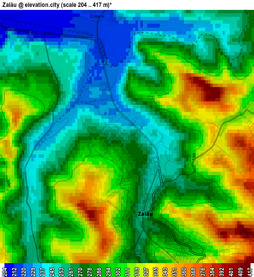
Below is the Elevation map of Zalău, which displays elevation range with different colors. Scale of the first map is from 204 to 417 m (669 to 1368 ft) with average elevation of 284.4 meters (=933 ft) [note 1]
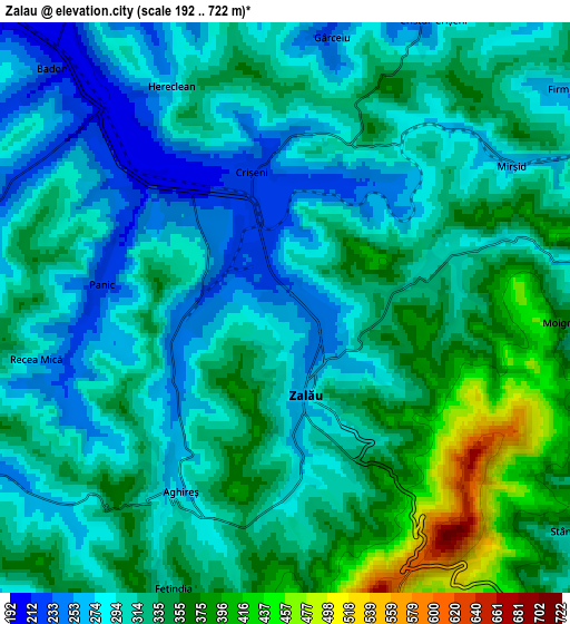
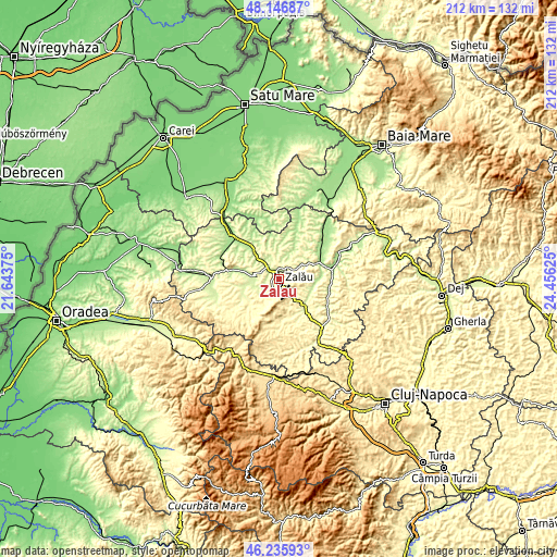
These maps also provides idea of topography and contour of this city, they are displayed at different zoom levels. More info about maps, scale and edge coordinates you can find below images.
| \ | Map #1 | Map #2 | Topo.Map |
| Scale [m] | 204..417 m | 192..722 m | × |
| Scale [ft] | 669..1368 ft | 630..2369 ft | × |
| Average | 284.4 m = 933 ft | 317.2 m = 1041 ft | × |
| Width | 6.64 km = 4.1 mi | 13.28 km = 8.3 mi | 212.5 km = 132 mi |
| Height | 6.64 km = 4.1 mi | 13.28 km = 8.3 mi | 212.5 km = 132 mi |
| ↑Max Latitude | 47.22985° | 47.259683° | 48.14687° |
| Latitude at center | 47.2° | 47.2° | 47.2° |
| ↓Min Latitude | 47.170133° | 47.14025° | 46.23593° |
| ← Min Longitude | 23.006055° | 22.962109° | 21.64375° |
| Longitude center | 23.05° | 23.05° | 23.05° |
| →Max Longitude | 23.093945° | 23.137891° | 24.45625° |
Nearby cities:
Cities around Zalău sort by population:
• Crasna elevation 302 m
11.9 km,  251°
251°
• Hereclean 270 m
6.1 km,  335°
335°
• Meseşenii de Jos 292 m
7.5 km,  222°
222°
• Pericei 221 m
13.1 km,  286°
286°
• Crişeni 252 m
3.7 km,  0°
0°
• Mirşid 323 m
7.3 km,  59°
59°
• Dobrin 289 m
11.2 km,  34°
34°
• Coşeiu 290 m
13.9 km, 338°
• Aghireș 273 m
4.9 km,  209°
209°
• Dioșod 267 m
10.5 km,  347°
347°
• Treznea 339 m
12.2 km,  155°
155°
• Vârşolţ 224 m
8.8 km,  270°
270°
Multilingual:
 En español:
Zalău elevación 261 m.
 En France:
Zalău élévation 261 m.


Sources and notes:
- [note 1] Map square and city borders are not equal. Map elevation data is calculated only from area inside that square.
- [src 1] Elevation data from geonames database provided with same terms of usage.
- [src 2] The elevation map of Zalău is generated using elevation data from NASA's 3 arcsec (90m) resolution SRTM data.
- [src 3] Base (background) map © OpenStreetMap contributors tiles are generated by Geofabrik and OpenTopoMap.
Copyright & License:
This Zalău Elevation Map is licensed under CC BY-SA. You may reuse any part from this page, if you give a proper credit by linking to this URL:
 More info on terms of use page.