Dobreni elevation
Dobreni (Neamţ, Comuna Dobreni), Romania elevation is 487 meters and Dobreni elevation in feet is 1598 ft above sea level [src 1]. Dobreni is a seat of a second-order administrative division (feature code) with elevation that is 235 meters (771 ft) bigger than average city elevation in Romania.
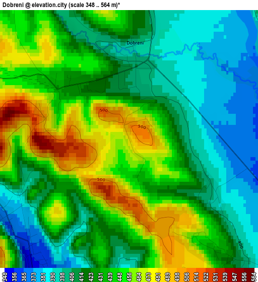
Below is the Elevation map of Dobreni, which displays elevation range with different colors. Scale of the first map is from 348 to 564 m (1142 to 1850 ft) with average elevation of 429.9 meters (=1410 ft) [note 1]
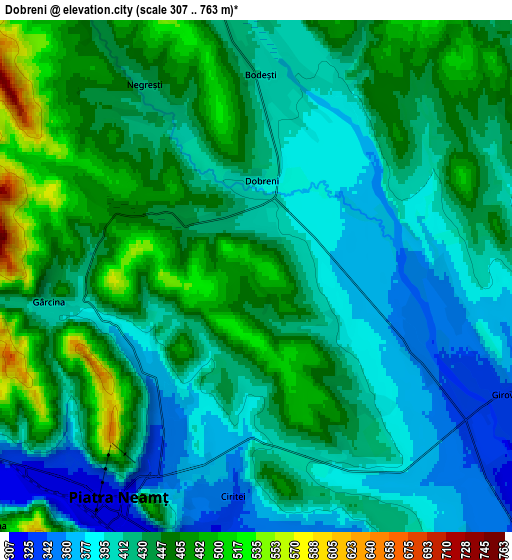
These maps also provides idea of topography and contour of this city, they are displayed at different zoom levels. More info about maps, scale and edge coordinates you can find below images.
| \ | Map #1 | Map #2 | Topo.Map |
| Scale [m] | 348..564 m | 307..763 m | × |
| Scale [ft] | 1142..1850 ft | 1007..2503 ft | × |
| Average | 429.9 m = 1410 ft | 429.1 m = 1408 ft | × |
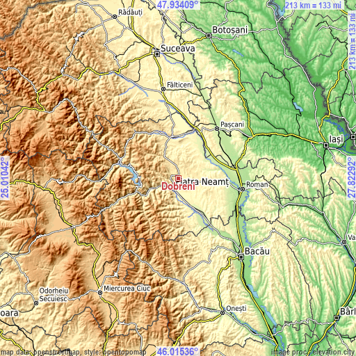
| Width | 6.67 km = 4.1 mi | 13.33 km = 8.3 mi | 213.3 km = 132.5 mi |
| Height | 6.67 km = 4.1 mi | 13.33 km = 8.3 mi | 213.3 km = 132.5 mi |
| ↑Max Latitude | 47.013302° | 47.043256° | 47.93409° |
| Latitude at center | 46.98333° | 46.98333° | 46.98333° |
| ↓Min Latitude | 46.953342° | 46.923336° | 46.01536° |
| ← Min Longitude | 26.372725° | 26.328779° | 25.01042° |
| Longitude center | 26.41667° | 26.41667° | 26.41667° |
| →Max Longitude | 26.460615° | 26.504561° | 27.82292° |
Nearby cities:
Cities around Dobreni sort by population:
• Piatra Neamţ elevation 508 m
9.7 km,  220°
220°
• Girov 347 m
8.4 km,  116°
116°
• Bodeşti 409 m
5.6 km,  0°
0°
• Ştefan cel Mare 371 m
7.1 km,  88°
88°
• Dragomireşti 433 m
9.6 km,  67°
67°
• Gârcina 413 m
5.4 km,  262°
262°
• Bodeștii de Jos 397 m
5.4 km,  23°
23°
• Bistrița 391 m
9.9 km,  247°
247°
• Negrești 431 m
5.8 km,  331°
331°
• Cuejdiu 480 m
9.3 km,  274°
274°
• Văleni 306 m
9.2 km,  193°
193°
• Izvoare 327 m
9.1 km,  153°
153°
Multilingual:
 En español:
Dobreni elevación 487 m.
 En France:
Dobreni élévation 487 m.


Sources and notes:
- [note 1] Map square and city borders are not equal. Map elevation data is calculated only from area inside that square.
- [src 1] Elevation data from geonames database provided with same terms of usage.
- [src 2] The elevation map of Dobreni is generated using elevation data from NASA's 3 arcsec (90m) resolution SRTM data.
- [src 3] Base (background) map © OpenStreetMap contributors tiles are generated by Geofabrik and OpenTopoMap.
Copyright & License:
This Dobreni Elevation Map is licensed under CC BY-SA. You may reuse any part from this page, if you give a proper credit by linking to this URL:
 More info on terms of use page.