Ghergheşti elevation
Ghergheşti (Vaslui, Comuna Ghergheşti), Romania elevation is 246 meters and Ghergheşti elevation in feet is 807 ft above sea level [src 1]. Ghergheşti is a seat of a second-order administrative division (feature code) with elevation that is 6 meters (20 ft) smaller than average city elevation in Romania.
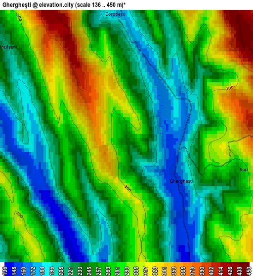
Below is the Elevation map of Ghergheşti, which displays elevation range with different colors. Scale of the first map is from 136 to 450 m (446 to 1476 ft) with average elevation of 259.1 meters (=850 ft) [note 1]
These maps also provides idea of topography and contour of this city, they are displayed at different zoom levels. More info about maps, scale and edge coordinates you can find below images.
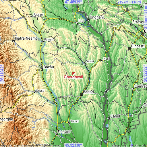
| \ | Map #1 | Topo.Map |
| Scale [m] | 136..450 m | × |
| Scale [ft] | 446..1476 ft | × |
| Average | 259.1 m = 850 ft | × |
| Width | 6.73 km = 4.2 mi | 215.3 km = 133.8 mi |
| Height | 6.73 km = 4.2 mi | 215.3 km = 133.8 mi |
| ↑Max Latitude | 46.530242° | 47.45939° |
| Latitude at center | 46.5° | 46.5° |
| ↓Min Latitude | 46.469742° | 45.52338° |
| ← Min Longitude | 27.472725° | 26.11042° |
| Longitude center | 27.51667° | 27.51667° |
| →Max Longitude | 27.560615° | 28.92292° |
Nearby cities:
Cities around Ghergheşti sort by population:
• Puieşti elevation 116 m
9.4 km,  187°
187°
• Răchitoasa 337 m
13.7 km,  237°
237°
• Lipovăţ 194 m
15.9 km,  62°
62°
• Iana 105 m
13.2 km,  168°
168°
• Voineşti 214 m
10.7 km,  314°
314°
• Poieneşti 201 m
13 km,  5°
5°
• Alexandru Vlăhuţă 263 m
12.9 km,  136°
136°
• Bogdăniţa 188 m
13.9 km,  113°
113°
• Ivănești 177 m
15.6 km,  344°
344°
• Hălărești 194 m
12.1 km, 165°
• Ibănești 141 m
14.4 km, 144°
• Bogdana 204 m
9.4 km,  71°
71°
Multilingual:
 En español:
Ghergheşti elevación 246 m.
 En France:
Ghergheşti élévation 246 m.
 Auf Deutsch:
Ghergheşti höhe über dem Meeresspiegel ist 246 m.

Sources and notes:
- [note 1] Map square and city borders are not equal. Map elevation data is calculated only from area inside that square.
- [src 1] Elevation data from geonames database provided with same terms of usage.
- [src 2] The elevation map of Ghergheşti is generated using elevation data from NASA's 3 arcsec (90m) resolution SRTM data.
- [src 3] Base (background) map © OpenStreetMap contributors tiles are generated by Geofabrik and OpenTopoMap.
Copyright & License:
This Ghergheşti Elevation Map is licensed under CC BY-SA. You may reuse any part from this page, if you give a proper credit by linking to this URL:
 More info on terms of use page.