Iclănzel elevation
Iclănzel (Mureş, Comuna Iclănzel), Romania elevation is 310 meters and Iclănzel elevation in feet is 1017 ft above sea level [src 1]. Iclănzel is a seat of a second-order administrative division (feature code) with elevation that is 58 meters (190 ft) bigger than average city elevation in Romania.
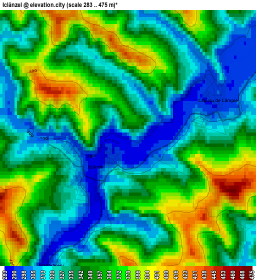
Below is the Elevation map of Iclănzel, which displays elevation range with different colors. Scale of the first map is from 283 to 475 m (928 to 1558 ft) with average elevation of 347 meters (=1138 ft) [note 1]
These maps also provides idea of topography and contour of this city, they are displayed at different zoom levels. More info about maps, scale and edge coordinates you can find below images.
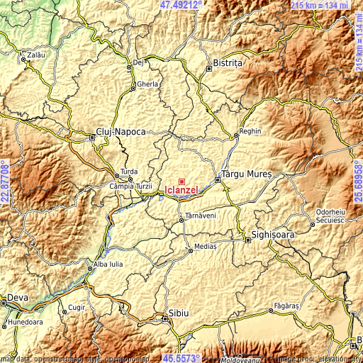
| \ | Map #1 | Topo.Map |
| Scale [m] | 283..475 m | × |
| Scale [ft] | 928..1558 ft | × |
| Average | 347 m = 1138 ft | × |
| Width | 6.72 km = 4.2 mi | 215.1 km = 133.7 mi |
| Height | 6.72 km = 4.2 mi | 215.1 km = 133.7 mi |
| ↑Max Latitude | 46.563553° | 47.49212° |
| Latitude at center | 46.53333° | 46.53333° |
| ↓Min Latitude | 46.50309° | 45.5573° |
| ← Min Longitude | 24.239385° | 22.87708° |
| Longitude center | 24.28333° | 24.28333° |
| →Max Longitude | 24.327275° | 25.68958° |
Nearby cities:
Cities around Iclănzel sort by population:
• Iernut elevation 275 m
9.6 km,  195°
195°
• Band 358 m
9.5 km,  53°
53°
• Sânpaul 284 m
10.6 km,  151°
151°
• Bârza 299 m
11.6 km,  279°
279°
• Ogra 292 m
11.4 km,  167°
167°
• Cuci 274 m
12.6 km,  234°
234°
• Şăulia 370 m
12.2 km,  335°
335°
• Grebenişu de Câmpie 393 m
7.5 km,  9°
9°
• Sânger 301 m
11.5 km, 283°
• Valea Izvoarelor 310 m
12.7 km, 146°
• Cipău 281 m
9.4 km,  182°
182°
• Papiu Ilarian 378 m
6.6 km,  286°
286°
Multilingual:
 En español:
Iclănzel elevación 310 m.
 En France:
Iclănzel élévation 310 m.
 Auf Deutsch:
Iclănzel höhe über dem Meeresspiegel ist 310 m.

Sources and notes:
- [note 1] Map square and city borders are not equal. Map elevation data is calculated only from area inside that square.
- [src 1] Elevation data from geonames database provided with same terms of usage.
- [src 2] The elevation map of Iclănzel is generated using elevation data from NASA's 3 arcsec (90m) resolution SRTM data.
- [src 3] Base (background) map © OpenStreetMap contributors tiles are generated by Geofabrik and OpenTopoMap.
Copyright & License:
This Iclănzel Elevation Map is licensed under CC BY-SA. You may reuse any part from this page, if you give a proper credit by linking to this URL:
 More info on terms of use page.