Mărgineni elevation
Mărgineni (Neamţ, Comuna Mărgineni), Romania elevation is 431 meters and Mărgineni elevation in feet is 1414 ft above sea level [src 1]. Mărgineni is a seat of a second-order administrative division (feature code) with elevation that is 179 meters (587 ft) bigger than average city elevation in Romania.
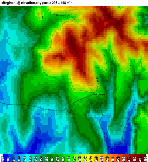
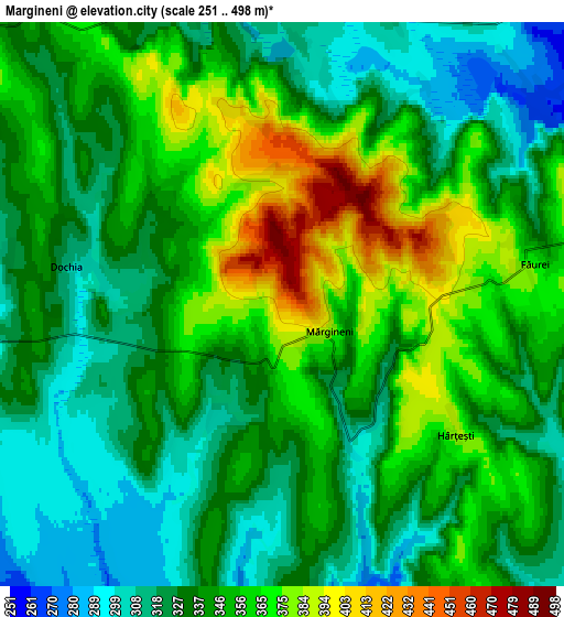
Below is the Elevation map of Mărgineni, which displays elevation range with different colors. Scale of the first map is from 295 to 498 m (968 to 1634 ft) with average elevation of 377.2 meters (=1238 ft) [note 1]
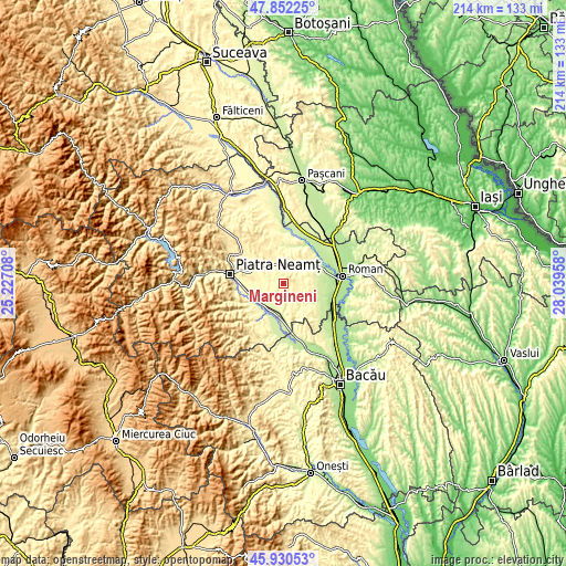
These maps also provides idea of topography and contour of this city, they are displayed at different zoom levels. More info about maps, scale and edge coordinates you can find below images.
| \ | Map #1 | Map #2 | Topo.Map |
| Scale [m] | 295..498 m | 251..498 m | × |
| Scale [ft] | 968..1634 ft | 823..1634 ft | × |
| Average | 377.2 m = 1238 ft | 342.3 m = 1123 ft | × |
| Width | 6.68 km = 4.2 mi | 13.35 km = 8.3 mi | 213.7 km = 132.8 mi |
| Height | 6.68 km = 4.2 mi | 13.35 km = 8.3 mi | 213.7 km = 132.8 mi |
| ↑Max Latitude | 46.930018° | 46.96002° | 47.85225° |
| Latitude at center | 46.9° | 46.9° | 46.9° |
| ↓Min Latitude | 46.869965° | 46.839913° | 45.93053° |
| ← Min Longitude | 26.589385° | 26.545439° | 25.22708° |
| Longitude center | 26.63333° | 26.63333° | 26.63333° |
| →Max Longitude | 26.677275° | 26.721221° | 28.03958° |
Nearby cities:
Cities around Mărgineni sort by population:
• Roznov elevation 269 m
11.6 km,  230°
230°
• Girov 347 m
10.5 km,  302°
302°
• Zăneşti 261 m
11.2 km,  214°
214°
• Podoleni 247 m
11.2 km,  186°
186°
• Slobozia 277 m
9.5 km, 233°
• Făurei 426 m
4.2 km,  63°
63°
• Dochia 306 m
5.1 km,  279°
279°
• Ruginoasa 317 m
11.1 km,  30°
30°
• Goșmani 290 m
9.4 km,  138°
138°
• Traian 284 m
8.6 km, 210°
• Budești 264 m
7.5 km,  52°
52°
• Bârgăuani 377 m
9.3 km,  0°
0°
Multilingual:
 En español:
Mărgineni elevación 431 m.
 En France:
Mărgineni élévation 431 m.
 Auf Deutsch:
Mărgineni höhe über dem Meeresspiegel ist 431 m.

Sources and notes:
- [note 1] Map square and city borders are not equal. Map elevation data is calculated only from area inside that square.
- [src 1] Elevation data from geonames database provided with same terms of usage.
- [src 2] The elevation map of Mărgineni is generated using elevation data from NASA's 3 arcsec (90m) resolution SRTM data.
- [src 3] Base (background) map © OpenStreetMap contributors tiles are generated by Geofabrik and OpenTopoMap.
Copyright & License:
This Mărgineni Elevation Map is licensed under CC BY-SA. You may reuse any part from this page, if you give a proper credit by linking to this URL:
 More info on terms of use page.