Slobozia elevation
Slobozia (Neamţ, Oraş Roznov), Romania elevation is 277 meters and Slobozia elevation in feet is 909 ft above sea level [src 1]. Slobozia is a populated place (feature code) with elevation that is 25 meters (82 ft) bigger than average city elevation in Romania.
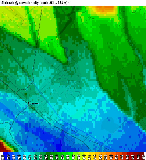
Below is the Elevation map of Slobozia, which displays elevation range with different colors. Scale of the first map is from 251 to 353 m (823 to 1158 ft) with average elevation of 280 meters (=919 ft) [note 1]
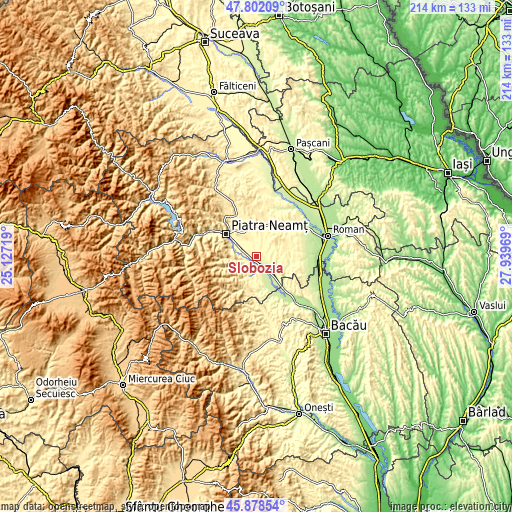
These maps also provides idea of topography and contour of this city, they are displayed at different zoom levels. More info about maps, scale and edge coordinates you can find below images.
| \ | Map #1 | Topo.Map |
| Scale [m] | 251..353 m | × |
| Scale [ft] | 823..1158 ft | × |
| Average | 280 m = 919 ft | × |
| Width | 6.68 km = 4.2 mi | 213.9 km = 132.9 mi |
| Height | 6.68 km = 4.2 mi | 213.9 km = 132.9 mi |
| ↑Max Latitude | 46.878967° | 47.80209° |
| Latitude at center | 46.84892° | 46.84892° |
| ↓Min Latitude | 46.818856° | 45.87854° |
| ← Min Longitude | 26.489495° | 25.12719° |
| Longitude center | 26.53344° | 26.53344° |
| →Max Longitude | 26.577385° | 27.93969° |
Nearby cities:
Cities around Slobozia sort by population:
• Roznov elevation 269 m
2.2 km,  216°
216°
• Piatra Şoimului 325 m
7.8 km,  257°
257°
• Zăneşti 261 m
3.8 km,  160°
160°
• Săvineşti 274 m
5.1 km,  271°
271°
• Podoleni 247 m
8.3 km,  130°
130°
• Ruseni 257 m
5.6 km,  175°
175°
• Luminiș 310 m
7.3 km,  237°
237°
• Dochia 306 m
7 km,  21°
21°
• Mastacăn 349 m
7.5 km,  208°
208°
• Izvoare 327 m
8.3 km,  324°
324°
• Traian 284 m
3.7 km,  117°
117°
• Chintinici 268 m
3.9 km,  232°
232°
Multilingual:
 En español:
Slobozia elevación 277 m.
 En France:
Slobozia élévation 277 m.
 Auf Deutsch:
Slobozia höhe über dem Meeresspiegel ist 277 m.

Sources and notes:
- [note 1] Map square and city borders are not equal. Map elevation data is calculated only from area inside that square.
- [src 1] Elevation data from geonames database provided with same terms of usage.
- [src 2] The elevation map of Slobozia is generated using elevation data from NASA's 3 arcsec (90m) resolution SRTM data.
- [src 3] Base (background) map © OpenStreetMap contributors tiles are generated by Geofabrik and OpenTopoMap.
Copyright & License:
This Slobozia Elevation Map is licensed under CC BY-SA. You may reuse any part from this page, if you give a proper credit by linking to this URL:
 More info on terms of use page.