Negrileasa elevation
Negrileasa (Suceava, Comuna Stulpicani), Romania elevation is 645 meters and Negrileasa elevation in feet is 2116 ft above sea level [src 1]. Negrileasa is a populated place (feature code) with elevation that is 393 meters (1289 ft) bigger than average city elevation in Romania.
Below is the Elevation map of Negrileasa, which displays elevation range with different colors. Scale of the first map is from 588 to 1058 m (1929 to 3471 ft) with average elevation of 809.1 meters (=2655 ft) [note 1]
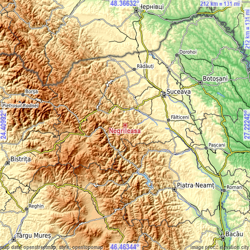
These maps also provides idea of topography and contour of this city, they are displayed at different zoom levels. More info about maps, scale and edge coordinates you can find below images.
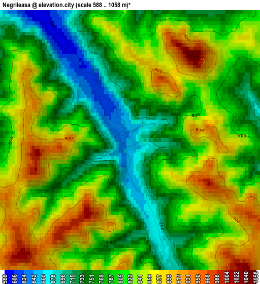
| \ | Map #1 | Topo.Map |
| Scale [m] | 588..1058 m | × |
| Scale [ft] | 1929..3471 ft | × |
| Average | 809.1 m = 2655 ft | × |
| Width | 6.61 km = 4.1 mi | 211.6 km = 131.5 mi |
| Height | 6.61 km = 4.1 mi | 211.6 km = 131.5 mi |
| ↑Max Latitude | 47.453204° | 48.36632° |
| Latitude at center | 47.42348° | 47.42348° |
| ↓Min Latitude | 47.393739° | 46.46344° |
| ← Min Longitude | 25.772225° | 24.40992° |
| Longitude center | 25.81617° | 25.81617° |
| →Max Longitude | 25.860115° | 27.22242° |
Nearby cities:
Cities around Negrileasa sort by population:
• Gura Humorului elevation 463 m
15.4 km,  24°
24°
• Frasin 505 m
12.3 km,  354°
354°
• Stulpicani 570 m
6.1 km,  322°
322°
• Slatina 454 m
15.4 km,  78°
78°
• Ostra 765 m
4.5 km,  234°
234°
• Capu Câmpului 453 m
15.5 km,  52°
52°
• Găinești 550 m
7.7 km,  93°
93°
• Bucșoaia 505 m
12.9 km,  358°
358°
• Mironu 440 m
16.2 km,  63°
63°
• Herla 476 m
14.9 km, 81°
• Poiana Mărului 472 m
16.9 km, 94°
• Plutonița 580 m
6.6 km,  343°
343°
Multilingual:
 En español:
Negrileasa elevación 645 m.
 En France:
Negrileasa élévation 645 m.
 Auf Deutsch:
Negrileasa höhe über dem Meeresspiegel ist 645 m.

Sources and notes:
- [note 1] Map square and city borders are not equal. Map elevation data is calculated only from area inside that square.
- [src 1] Elevation data from geonames database provided with same terms of usage.
- [src 2] The elevation map of Negrileasa is generated using elevation data from NASA's 3 arcsec (90m) resolution SRTM data.
- [src 3] Base (background) map © OpenStreetMap contributors tiles are generated by Geofabrik and OpenTopoMap.
Copyright & License:
This Negrileasa Elevation Map is licensed under CC BY-SA. You may reuse any part from this page, if you give a proper credit by linking to this URL:
 More info on terms of use page.