Ostroveni elevation
Ostroveni (Dolj, Comuna Ostroveni), Romania elevation is 31 meters and Ostroveni elevation in feet is 102 ft above sea level [src 1]. Ostroveni is a seat of a second-order administrative division (feature code) with elevation that is 221 meters (725 ft) smaller than average city elevation in Romania.
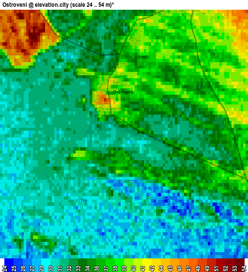
Below is the Elevation map of Ostroveni, which displays elevation range with different colors. Scale of the first map is from 24 to 54 m (79 to 177 ft) with average elevation of 33.6 meters (=110 ft) [note 1]
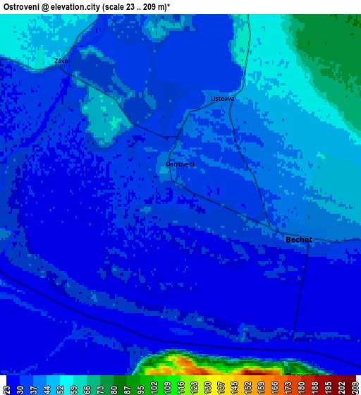
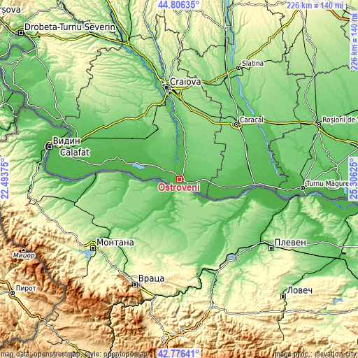
These maps also provides idea of topography and contour of this city, they are displayed at different zoom levels. More info about maps, scale and edge coordinates you can find below images.
| \ | Map #1 | Map #2 | Topo.Map |
| Scale [m] | 24..54 m | 23..209 m | × |
| Scale [ft] | 79..177 ft | 75..686 ft | × |
| Average | 33.6 m = 110 ft | 38.3 m = 126 ft | × |
| Width | 7.05 km = 4.4 mi | 14.11 km = 8.8 mi | 225.7 km = 140.2 mi |
| Height | 7.05 km = 4.4 mi | 14.11 km = 8.8 mi | 225.7 km = 140.2 mi |
| ↑Max Latitude | 43.83171° | 43.863402° | 44.80635° |
| Latitude at center | 43.8° | 43.8° | 43.8° |
| ↓Min Latitude | 43.768274° | 43.73653° | 42.77641° |
| ← Min Longitude | 23.856055° | 23.812109° | 22.49375° |
| Longitude center | 23.9° | 23.9° | 23.9° |
| →Max Longitude | 23.943945° | 23.987891° | 25.30625° |
Nearby cities:
Cities around Ostroveni sort by population:
• Dăbuleni elevation 55 m
14.7 km,  90°
90°
• Sadova 85 m
11.8 km,  19°
19°
• Călăraşi 57 m
12 km, 90°
• Bechet 37 m
5 km,  113°
113°
• Gighera 36 m
9.8 km,  304°
304°
• Gângiova 56 m
11.8 km,  340°
340°
• Sărata 34 m
11.1 km,  104°
104°
• Lișteava 42 m
4.1 km, 23°
• Nedeia 39 m
11.4 km, 299°
• Piscu Sadovei 55 m
9.1 km, 18°
• Comoșteni 45 m
8.7 km, 340°
• Zăval 51 m
7 km,  318°
318°
Multilingual:
 En español:
Ostroveni elevación 31 m.
 En France:
Ostroveni élévation 31 m.
 Auf Deutsch:
Ostroveni höhe über dem Meeresspiegel ist 31 m.

Sources and notes:
- [note 1] Map square and city borders are not equal. Map elevation data is calculated only from area inside that square.
- [src 1] Elevation data from geonames database provided with same terms of usage.
- [src 2] The elevation map of Ostroveni is generated using elevation data from NASA's 3 arcsec (90m) resolution SRTM data.
- [src 3] Base (background) map © OpenStreetMap contributors tiles are generated by Geofabrik and OpenTopoMap.
Copyright & License:
This Ostroveni Elevation Map is licensed under CC BY-SA. You may reuse any part from this page, if you give a proper credit by linking to this URL:
 More info on terms of use page.