Sadova elevation
Sadova (Dolj, Comuna Sadova), Romania elevation is 85 meters and Sadova elevation in feet is 279 ft above sea level [src 1]. Sadova is a seat of a second-order administrative division (feature code) with elevation that is 167 meters (548 ft) smaller than average city elevation in Romania.
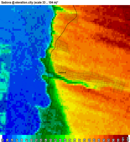
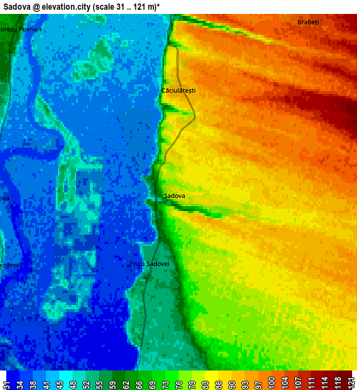
Below is the Elevation map of Sadova, which displays elevation range with different colors. Scale of the first map is from 33 to 104 m (108 to 341 ft) with average elevation of 66.4 meters (=218 ft) [note 1]
These maps also provides idea of topography and contour of this city, they are displayed at different zoom levels. More info about maps, scale and edge coordinates you can find below images.
| \ | Map #1 | Map #2 | Topo.Map |
| Scale [m] | 33..104 m | 31..121 m | × |
| Scale [ft] | 108..341 ft | 102..397 ft | × |
| Average | 66.4 m = 218 ft | 67 m = 220 ft | × |
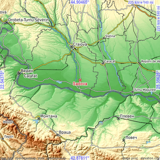
| Width | 7.04 km = 4.4 mi | 14.08 km = 8.7 mi | 225.3 km = 140 mi |
| Height | 7.04 km = 4.4 mi | 14.08 km = 8.7 mi | 225.3 km = 140 mi |
| ↑Max Latitude | 43.931656° | 43.963296° | 44.90465° |
| Latitude at center | 43.9° | 43.9° | 43.9° |
| ↓Min Latitude | 43.868327° | 43.836637° | 42.87811° |
| ← Min Longitude | 23.906055° | 23.862109° | 22.54375° |
| Longitude center | 23.95° | 23.95° | 23.95° |
| →Max Longitude | 23.993945° | 24.037891° | 25.35625° |
Nearby cities:
Cities around Sadova sort by population:
• Dăneţi elevation 110 m
12.2 km,  40°
40°
• Valea Stanciului 76 m
11.4 km,  324°
324°
• Ostroveni 31 m
11.8 km,  199°
199°
• Bechet 37 m
13.1 km,  177°
177°
• Gighera 36 m
13.2 km,  245°
245°
• Gângiova 56 m
8 km,  270°
270°
• Dobreşti 93 m
7.4 km,  0°
0°
• Lișteava 42 m
7.7 km, 198°
• Brabeți 103 m
8.5 km, 36°
• Piscu Sadovei 55 m
2.7 km, 202°
• Comoșteni 45 m
7.5 km, 247°
• Zăval 51 m
10.5 km,  235°
235°
Multilingual:
 En español:
Sadova elevación 85 m.
 En France:
Sadova élévation 85 m.


Sources and notes:
- [note 1] Map square and city borders are not equal. Map elevation data is calculated only from area inside that square.
- [src 1] Elevation data from geonames database provided with same terms of usage.
- [src 2] The elevation map of Sadova is generated using elevation data from NASA's 3 arcsec (90m) resolution SRTM data.
- [src 3] Base (background) map © OpenStreetMap contributors tiles are generated by Geofabrik and OpenTopoMap.
Copyright & License:
This Sadova Elevation Map is licensed under CC BY-SA. You may reuse any part from this page, if you give a proper credit by linking to this URL:
 More info on terms of use page.