Păuşeşti-Măglaşi elevation
Păuşeşti-Măglaşi (Vâlcea, Comuna Păuşeşti-Măglaşi), Romania elevation is 342 meters and Păuşeşti-Măglaşi elevation in feet is 1122 ft above sea level [src 1]. Păuşeşti-Măglaşi is a seat of a second-order administrative division (feature code) with elevation that is 90 meters (295 ft) bigger than average city elevation in Romania.
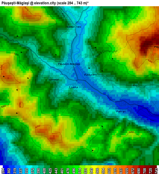
Below is the Elevation map of Păuşeşti-Măglaşi, which displays elevation range with different colors. Scale of the first map is from 284 to 743 m (932 to 2438 ft) with average elevation of 461.1 meters (=1513 ft) [note 1]
These maps also provides idea of topography and contour of this city, they are displayed at different zoom levels. More info about maps, scale and edge coordinates you can find below images.
| \ | Map #1 | Map #2 | Topo.Map |
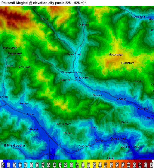
| Scale [m] | 284..743 m | 228..926 m | × |
| Scale [ft] | 932..2438 ft | 748..3038 ft | × |
| Average | 461.1 m = 1513 ft | 444.7 m = 1459 ft | × |
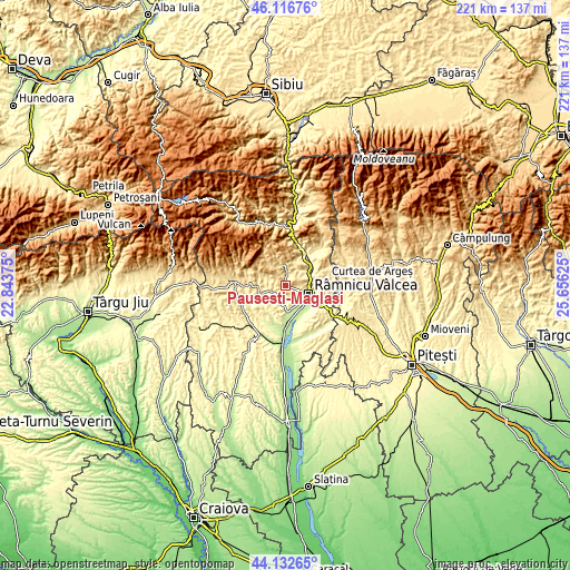
| Width | 6.89 km = 4.3 mi | 13.79 km = 8.6 mi | 220.6 km = 137.1 mi |
| Height | 6.89 km = 4.3 mi | 13.79 km = 8.6 mi | 220.6 km = 137.1 mi |
| ↑Max Latitude | 45.164323° | 45.1953° | 46.11676° |
| Latitude at center | 45.13333° | 45.13333° | 45.13333° |
| ↓Min Latitude | 45.10232° | 45.071293° | 44.13265° |
| ← Min Longitude | 24.206055° | 24.162109° | 22.84375° |
| Longitude center | 24.25° | 24.25° | 24.25° |
| →Max Longitude | 24.293945° | 24.337891° | 25.65625° |
Nearby cities:
Cities around Păuşeşti-Măglaşi sort by population:
• Băile Olăneşti elevation 566 m
7.5 km,  350°
350°
• Stoeneşti 307 m
6.8 km,  254°
254°
• Bujoreni 407 m
7.8 km,  90°
90°
• Băile Govora 363 m
7.6 km,  223°
223°
• Buneşti 327 m
5.5 km, 250°
• Muereasca 378 m
8.6 km,  49°
49°
• Prajila 387 m
8.5 km,  228°
228°
• Vlădeşti 284 m
4.3 km,  115°
115°
• Livadia 457 m
8 km,  355°
355°
• Gura Suhașului 261 m
6.3 km,  142°
142°
• Olănești 403 m
5.5 km,  8°
8°
• Cheia 469 m
6.1 km,  334°
334°
Multilingual:
 En español:
Păuşeşti-Măglaşi elevación 342 m.
 En France:
Păuşeşti-Măglaşi élévation 342 m.
 Auf Deutsch:
Păuşeşti-Măglaşi höhe über dem Meeresspiegel ist 342 m.

Sources and notes:
- [note 1] Map square and city borders are not equal. Map elevation data is calculated only from area inside that square.
- [src 1] Elevation data from geonames database provided with same terms of usage.
- [src 2] The elevation map of Păuşeşti-Măglaşi is generated using elevation data from NASA's 3 arcsec (90m) resolution SRTM data.
- [src 3] Base (background) map © OpenStreetMap contributors tiles are generated by Geofabrik and OpenTopoMap.
Copyright & License:
This Păuşeşti-Măglaşi Elevation Map is licensed under CC BY-SA. You may reuse any part from this page, if you give a proper credit by linking to this URL:
 More info on terms of use page.