Pietreni elevation
Pietreni (Constanța, Comuna Deleni), Romania elevation is 91 meters and Pietreni elevation in feet is 299 ft above sea level [src 1]. Pietreni is a populated place (feature code) with elevation that is 161 meters (528 ft) smaller than average city elevation in Romania.
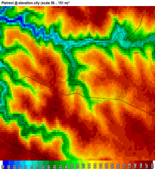
Below is the Elevation map of Pietreni, which displays elevation range with different colors. Scale of the first map is from 56 to 151 m (184 to 495 ft) with average elevation of 120.2 meters (=394 ft) [note 1]
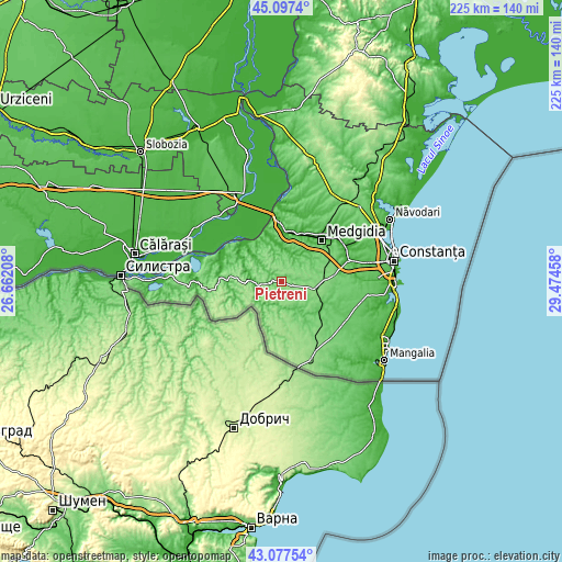
These maps also provides idea of topography and contour of this city, they are displayed at different zoom levels. More info about maps, scale and edge coordinates you can find below images.
| \ | Map #1 | Topo.Map |
| Scale [m] | 56..151 m | × |
| Scale [ft] | 184..495 ft | × |
| Average | 120.2 m = 394 ft | × |
| Width | 7.02 km = 4.4 mi | 224.6 km = 139.6 mi |
| Height | 7.02 km = 4.4 mi | 224.6 km = 139.6 mi |
| ↑Max Latitude | 44.127642° | 45.0974° |
| Latitude at center | 44.09609° | 44.09609° |
| ↓Min Latitude | 44.064521° | 43.07754° |
| ← Min Longitude | 28.024385° | 26.66208° |
| Longitude center | 28.06833° | 28.06833° |
| →Max Longitude | 28.112275° | 29.47458° |
Nearby cities:
Cities around Pietreni sort by population:
• Cobadin elevation 129 m
11.9 km,  96°
96°
• Rasova 30 m
19.8 km,  327°
327°
• Peştera 75 m
11 km,  28°
28°
• Independenţa 155 m
14.4 km,  175°
175°
• Aliman 63 m
19.9 km,  299°
299°
• Ciocârlia 130 m
17.2 km,  88°
88°
• Deleni 118 m
4.1 km,  276°
276°
• Adamclisi 103 m
9.6 km,  261°
261°
• Viișoara 136 m
10.3 km, 101°
• Plopeni 72 m
19 km,  147°
147°
• Saligny 38 m
20.7 km,  5°
5°
• Dumbrăveni 132 m
19.3 km,  200°
200°
Multilingual:
 En español:
Pietreni elevación 91 m.
 En France:
Pietreni élévation 91 m.


Sources and notes:
- [note 1] Map square and city borders are not equal. Map elevation data is calculated only from area inside that square.
- [src 1] Elevation data from geonames database provided with same terms of usage.
- [src 2] The elevation map of Pietreni is generated using elevation data from NASA's 3 arcsec (90m) resolution SRTM data.
- [src 3] Base (background) map © OpenStreetMap contributors tiles are generated by Geofabrik and OpenTopoMap.
Copyright & License:
This Pietreni Elevation Map is licensed under CC BY-SA. You may reuse any part from this page, if you give a proper credit by linking to this URL:
 More info on terms of use page.