Plătăreşti elevation
Plătăreşti (Călăraşi, Comuna Plătăreşti), Romania elevation is 40 meters and Plătăreşti elevation in feet is 131 ft above sea level [src 1]. Plătăreşti is a seat of a second-order administrative division (feature code) with elevation that is 212 meters (696 ft) smaller than average city elevation in Romania.
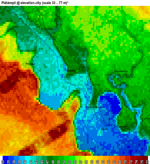
Below is the Elevation map of Plătăreşti, which displays elevation range with different colors. Scale of the first map is from 33 to 77 m (108 to 253 ft) with average elevation of 52.2 meters (=171 ft) [note 1]
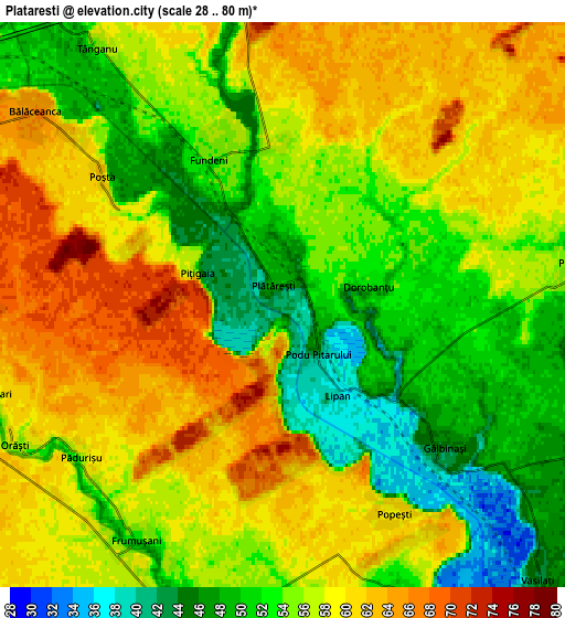
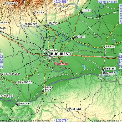
These maps also provides idea of topography and contour of this city, they are displayed at different zoom levels. More info about maps, scale and edge coordinates you can find below images.
| \ | Map #1 | Map #2 | Topo.Map |
| Scale [m] | 33..77 m | 28..80 m | × |
| Scale [ft] | 108..253 ft | 92..262 ft | × |
| Average | 52.2 m = 171 ft | 55.7 m = 183 ft | × |
| Width | 6.99 km = 4.3 mi | 13.98 km = 8.7 mi | 223.6 km = 138.9 mi |
| Height | 6.99 km = 4.3 mi | 13.98 km = 8.7 mi | 223.6 km = 138.9 mi |
| ↑Max Latitude | 44.381416° | 44.412815° | 45.34696° |
| Latitude at center | 44.35° | 44.35° | 44.35° |
| ↓Min Latitude | 44.318567° | 44.287117° | 43.33579° |
| ← Min Longitude | 26.322725° | 26.278779° | 24.96042° |
| Longitude center | 26.36667° | 26.36667° | 26.36667° |
| →Max Longitude | 26.410615° | 26.454561° | 27.77292° |
Nearby cities:
Cities around Plătăreşti sort by population:
• Cernica elevation 60 m
9.9 km,  318°
318°
• Vasilaţi 43 m
9.4 km,  137°
137°
• Glina 67 m
10 km,  291°
291°
• Fundeni 54 m
3.9 km,  340°
340°
• Frumuşani 50 m
6.8 km,  208°
208°
• Sohatu 50 m
11.2 km,  109°
109°
• Gălbinași 44 m
5.6 km,  130°
130°
• Tânganu 57 m
7.6 km,  325°
325°
• Bălăceanca 66 m
7.7 km,  307°
307°
• Progresu 55 m
7.6 km,  82°
82°
• Dorobanțu 53 m
2.2 km, 77°
• Căldăraru 65 m
10.8 km, 310°
Multilingual:
 En español:
Plătăreşti elevación 40 m.
 En France:
Plătăreşti élévation 40 m.
 Auf Deutsch:
Plătăreşti höhe über dem Meeresspiegel ist 40 m.

Sources and notes:
- [note 1] Map square and city borders are not equal. Map elevation data is calculated only from area inside that square.
- [src 1] Elevation data from geonames database provided with same terms of usage.
- [src 2] The elevation map of Plătăreşti is generated using elevation data from NASA's 3 arcsec (90m) resolution SRTM data.
- [src 3] Base (background) map © OpenStreetMap contributors tiles are generated by Geofabrik and OpenTopoMap.
Copyright & License:
This Plătăreşti Elevation Map is licensed under CC BY-SA. You may reuse any part from this page, if you give a proper credit by linking to this URL:
 More info on terms of use page.