Poiana elevation
Poiana (Dâmboviţa, Comuna Poiana), Romania elevation is 126 meters and Poiana elevation in feet is 413 ft above sea level [src 1]. Poiana is a seat of a second-order administrative division (feature code) with elevation that is 126 meters (413 ft) smaller than average city elevation in Romania.
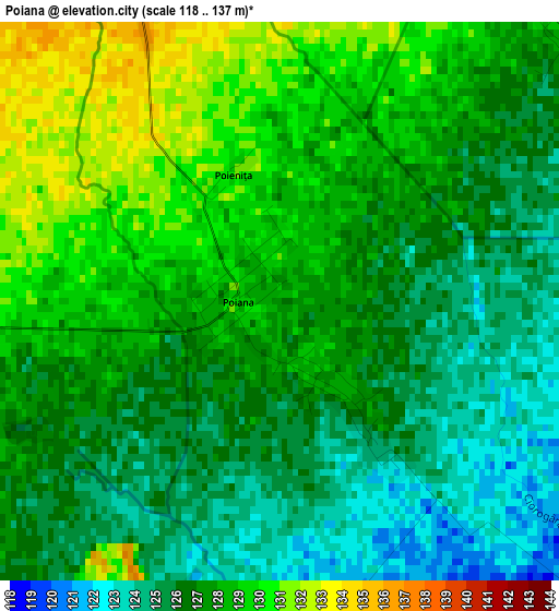
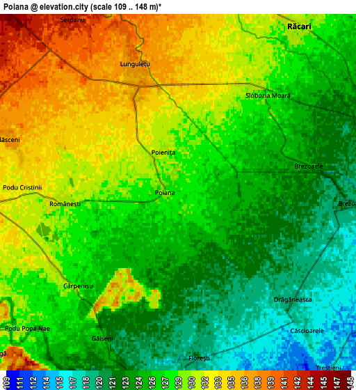
Below is the Elevation map of Poiana, which displays elevation range with different colors. Scale of the first map is from 118 to 137 m (387 to 449 ft) with average elevation of 126.9 meters (=416 ft) [note 1]
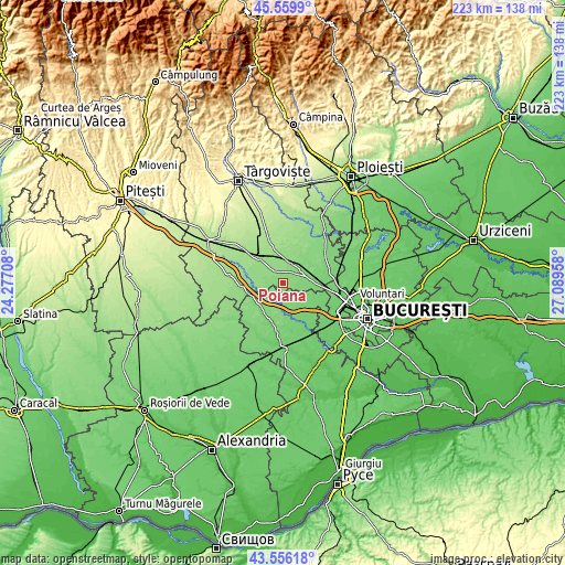
These maps also provides idea of topography and contour of this city, they are displayed at different zoom levels. More info about maps, scale and edge coordinates you can find below images.
| \ | Map #1 | Map #2 | Topo.Map |
| Scale [m] | 118..137 m | 109..148 m | × |
| Scale [ft] | 387..449 ft | 358..486 ft | × |
| Average | 126.9 m = 416 ft | 127 m = 417 ft | × |
| Width | 6.96 km = 4.3 mi | 13.92 km = 8.6 mi | 222.8 km = 138.4 mi |
| Height | 6.96 km = 4.3 mi | 13.92 km = 8.6 mi | 222.8 km = 138.4 mi |
| ↑Max Latitude | 44.59797° | 44.629253° | 45.5599° |
| Latitude at center | 44.56667° | 44.56667° | 44.56667° |
| ↓Min Latitude | 44.535353° | 44.50402° | 43.55618° |
| ← Min Longitude | 25.639385° | 25.595439° | 24.27708° |
| Longitude center | 25.68333° | 25.68333° | 25.68333° |
| →Max Longitude | 25.727275° | 25.771221° | 27.08958° |
Nearby cities:
Cities around Poiana sort by population:
• Potlogi elevation 133 m
8.1 km,  256°
256°
• Lunguleţu 138 m
6.2 km,  334°
334°
• Găiseni 125 m
6.5 km,  207°
207°
• Florești 119 m
6 km,  169°
169°
• Românești 132 m
5.3 km,  270°
270°
• Brezoaia 115 m
8.1 km,  97°
97°
• Slobozia Moara 129 m
4.6 km,  35°
35°
• Căscioarele 122 m
8.3 km, 205°
• Brezoaele 125 m
4.4 km,  64°
64°
• Serdanu 144 m
7.9 km, 328°
• Vlăsceni 136 m
7 km,  287°
287°
• Pitaru 140 m
8.3 km, 288°
Multilingual:
 En español:
Poiana elevación 126 m.
 En France:
Poiana élévation 126 m.


Sources and notes:
- [note 1] Map square and city borders are not equal. Map elevation data is calculated only from area inside that square.
- [src 1] Elevation data from geonames database provided with same terms of usage.
- [src 2] The elevation map of Poiana is generated using elevation data from NASA's 3 arcsec (90m) resolution SRTM data.
- [src 3] Base (background) map © OpenStreetMap contributors tiles are generated by Geofabrik and OpenTopoMap.
Copyright & License:
This Poiana Elevation Map is licensed under CC BY-SA. You may reuse any part from this page, if you give a proper credit by linking to this URL:
 More info on terms of use page.