Săgeata elevation
Săgeata (Buzău, Comuna Săgeata), Romania elevation is 68 meters and Săgeata elevation in feet is 223 ft above sea level [src 1]. Săgeata is a seat of a second-order administrative division (feature code) with elevation that is 184 meters (604 ft) smaller than average city elevation in Romania.
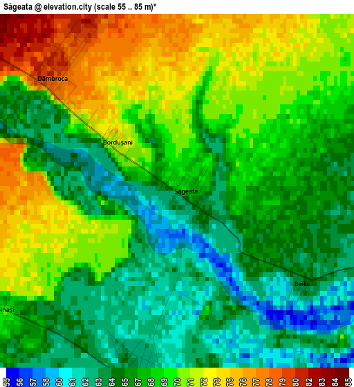
Below is the Elevation map of Săgeata, which displays elevation range with different colors. Scale of the first map is from 55 to 85 m (180 to 279 ft) with average elevation of 67.7 meters (=222 ft) [note 1]
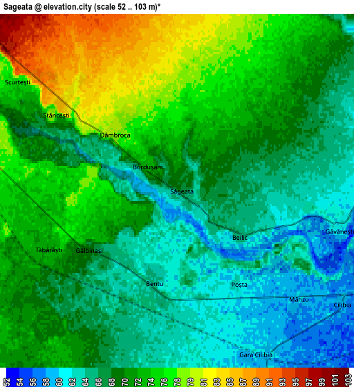
These maps also provides idea of topography and contour of this city, they are displayed at different zoom levels. More info about maps, scale and edge coordinates you can find below images.
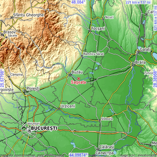
| \ | Map #1 | Map #2 | Topo.Map |
| Scale [m] | 55..85 m | 52..103 m | × |
| Scale [ft] | 180..279 ft | 171..338 ft | × |
| Average | 67.7 m = 222 ft | 69.6 m = 228 ft | × |
| Width | 6.9 km = 4.3 mi | 13.8 km = 8.6 mi | 220.7 km = 137.1 mi |
| Height | 6.9 km = 4.3 mi | 13.8 km = 8.6 mi | 220.7 km = 137.1 mi |
| ↑Max Latitude | 45.131011° | 45.162006° | 46.084° |
| Latitude at center | 45.1° | 45.1° | 45.1° |
| ↓Min Latitude | 45.068972° | 45.037927° | 44.09874° |
| ← Min Longitude | 26.939385° | 26.895439° | 25.57708° |
| Longitude center | 26.98333° | 26.98333° | 26.98333° |
| →Max Longitude | 27.027275° | 27.071221° | 28.38958° |
Nearby cities:
Cities around Săgeata sort by population:
• Vadu Paşii elevation 100 m
9.9 km,  318°
318°
• Ţinteşti 73 m
9.9 km,  247°
247°
• Gălbinaşi 73 m
5.6 km, 250°
• Scurtești 75 m
7.5 km,  304°
304°
• Maxenu 73 m
11.4 km,  241°
241°
• Cilibia 57 m
7.5 km,  119°
119°
• Tăbărăști 72 m
5.5 km, 245°
• Boboc 94 m
10.6 km,  359°
359°
• Stăncești 76 m
5.6 km, 302°
• Pogonele 81 m
9.4 km,  260°
260°
• Găvănești 62 m
6.5 km,  101°
101°
• Dâmbroca 78 m
3.4 km, 320°
Multilingual:
 En español:
Săgeata elevación 68 m.
 En France:
Săgeata élévation 68 m.


Sources and notes:
- [note 1] Map square and city borders are not equal. Map elevation data is calculated only from area inside that square.
- [src 1] Elevation data from geonames database provided with same terms of usage.
- [src 2] The elevation map of Săgeata is generated using elevation data from NASA's 3 arcsec (90m) resolution SRTM data.
- [src 3] Base (background) map © OpenStreetMap contributors tiles are generated by Geofabrik and OpenTopoMap.
Copyright & License:
This Săgeata Elevation Map is licensed under CC BY-SA. You may reuse any part from this page, if you give a proper credit by linking to this URL:
 More info on terms of use page.