Scânteia elevation
Scânteia (Iaşi, Comuna Scânteia), Romania elevation is 148 meters and Scânteia elevation in feet is 486 ft above sea level [src 1]. Scânteia is a seat of a second-order administrative division (feature code) with elevation that is 104 meters (341 ft) smaller than average city elevation in Romania.
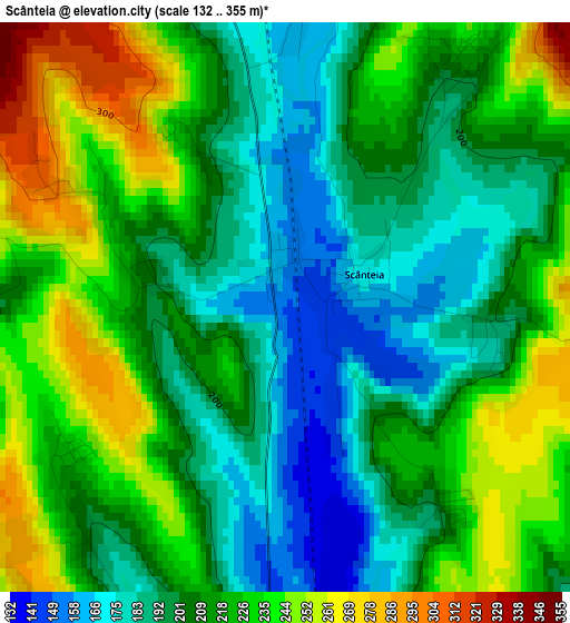
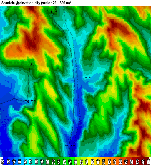
Below is the Elevation map of Scânteia, which displays elevation range with different colors. Scale of the first map is from 132 to 355 m (433 to 1165 ft) with average elevation of 213.4 meters (=700 ft) [note 1]
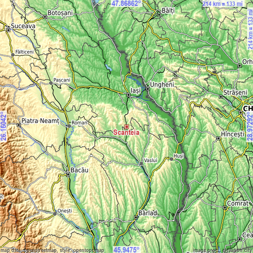
These maps also provides idea of topography and contour of this city, they are displayed at different zoom levels. More info about maps, scale and edge coordinates you can find below images.
| \ | Map #1 | Map #2 | Topo.Map |
| Scale [m] | 132..355 m | 122..399 m | × |
| Scale [ft] | 433..1165 ft | 400..1309 ft | × |
| Average | 213.4 m = 700 ft | 227.6 m = 747 ft | × |
| Width | 6.68 km = 4.2 mi | 13.35 km = 8.3 mi | 213.6 km = 132.7 mi |
| Height | 6.68 km = 4.2 mi | 13.35 km = 8.3 mi | 213.6 km = 132.7 mi |
| ↑Max Latitude | 46.946679° | 46.976671° | 47.86862° |
| Latitude at center | 46.91667° | 46.91667° | 46.91667° |
| ↓Min Latitude | 46.886644° | 46.856602° | 45.9475° |
| ← Min Longitude | 27.522725° | 27.478779° | 26.16042° |
| Longitude center | 27.56667° | 27.56667° | 27.56667° |
| →Max Longitude | 27.610615° | 27.654561° | 28.97292° |
Nearby cities:
Cities around Scânteia sort by population:
• Mogoşeşti elevation 89 m
13.2 km,  348°
348°
• Şcheia 257 m
4.2 km,  296°
296°
• Mironeasa 271 m
12.7 km, 296°
• Rebricea 188 m
5.7 km,  192°
192°
• Tăcuta 155 m
8.9 km,  90°
90°
• Grajduri 306 m
6.7 km,  325°
325°
• Dobrovăţ 265 m
10.8 km,  69°
69°
• Dăneşti 216 m
10.6 km,  134°
134°
• Vultureşti 157 m
11.4 km, 192°
• Ipatele 214 m
11.4 km,  270°
270°
• Emil Racoviță 243 m
9.9 km,  120°
120°
• Drăgușeni 164 m
4.5 km,  247°
247°
Multilingual:
 En español:
Scânteia elevación 148 m.
 En France:
Scânteia élévation 148 m.
 Auf Deutsch:
Scânteia höhe über dem Meeresspiegel ist 148 m.

Sources and notes:
- [note 1] Map square and city borders are not equal. Map elevation data is calculated only from area inside that square.
- [src 1] Elevation data from geonames database provided with same terms of usage.
- [src 2] The elevation map of Scânteia is generated using elevation data from NASA's 3 arcsec (90m) resolution SRTM data.
- [src 3] Base (background) map © OpenStreetMap contributors tiles are generated by Geofabrik and OpenTopoMap.
Copyright & License:
This Scânteia Elevation Map is licensed under CC BY-SA. You may reuse any part from this page, if you give a proper credit by linking to this URL:
 More info on terms of use page.