Subcetate elevation
Subcetate (Harghita, Comuna Subcetate), Romania elevation is 727 meters and Subcetate elevation in feet is 2385 ft above sea level [src 1]. Subcetate is a seat of a second-order administrative division (feature code) with elevation that is 475 meters (1558 ft) bigger than average city elevation in Romania.
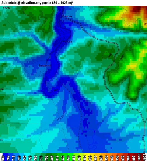
Below is the Elevation map of Subcetate, which displays elevation range with different colors. Scale of the first map is from 689 to 1023 m (2260 to 3356 ft) with average elevation of 758.7 meters (=2489 ft) [note 1]
These maps also provides idea of topography and contour of this city, they are displayed at different zoom levels. More info about maps, scale and edge coordinates you can find below images.
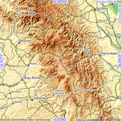
| \ | Map #1 | Topo.Map |
| Scale [m] | 689..1023 m | × |
| Scale [ft] | 2260..3356 ft | × |
| Average | 758.7 m = 2489 ft | × |
| Width | 6.68 km = 4.2 mi | 213.9 km = 132.9 mi |
| Height | 6.68 km = 4.2 mi | 213.9 km = 132.9 mi |
| ↑Max Latitude | 46.880046° | 47.80315° |
| Latitude at center | 46.85° | 46.85° |
| ↓Min Latitude | 46.819937° | 45.87963° |
| ← Min Longitude | 25.406055° | 24.04375° |
| Longitude center | 25.45° | 25.45° |
| →Max Longitude | 25.493945° | 26.85625° |
Nearby cities:
Cities around Subcetate sort by population:
• Gheorgheni elevation 816 m
18.2 km,  140°
140°
• Remetea 724 m
7.4 km,  180°
180°
• Ditrău 779 m
6.3 km,  126°
126°
• Joseni 741 m
17.1 km,  167°
167°
• Ciumani 744 m
19.2 km,  164°
164°
• Sărmaş 758 m
3.9 km,  18°
18°
• Lăzarea 775 m
12.8 km,  150°
150°
• Borsec 1064 m
14.2 km,  38°
38°
• Gălăuţaş 846 m
7.5 km,  350°
350°
• Vale 692 m
12.3 km,  333°
333°
• Hodoșa 699 m
1.8 km, 350°
• Zencani 663 m
12.3 km,  314°
314°
Multilingual:
 En español:
Subcetate elevación 727 m.
 En France:
Subcetate élévation 727 m.
 Auf Deutsch:
Subcetate höhe über dem Meeresspiegel ist 727 m.

Sources and notes:
- [note 1] Map square and city borders are not equal. Map elevation data is calculated only from area inside that square.
- [src 1] Elevation data from geonames database provided with same terms of usage.
- [src 2] The elevation map of Subcetate is generated using elevation data from NASA's 3 arcsec (90m) resolution SRTM data.
- [src 3] Base (background) map © OpenStreetMap contributors tiles are generated by Geofabrik and OpenTopoMap.
Copyright & License:
This Subcetate Elevation Map is licensed under CC BY-SA. You may reuse any part from this page, if you give a proper credit by linking to this URL:
 More info on terms of use page.