Teişani elevation
Teişani (Prahova, Comuna Teişani), Romania elevation is 473 meters and Teişani elevation in feet is 1552 ft above sea level [src 1]. Teişani is a seat of a second-order administrative division (feature code) with elevation that is 221 meters (725 ft) bigger than average city elevation in Romania.
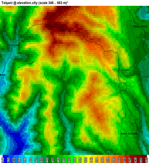
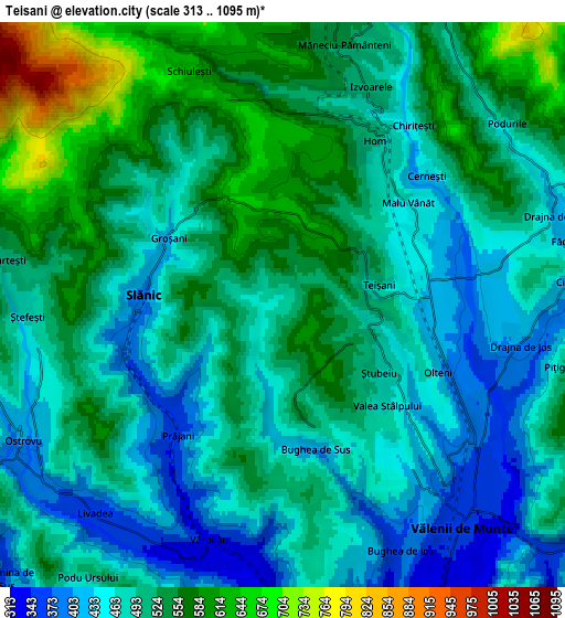
Below is the Elevation map of Teişani, which displays elevation range with different colors. Scale of the first map is from 348 to 663 m (1142 to 2175 ft) with average elevation of 500.3 meters (=1641 ft) [note 1]
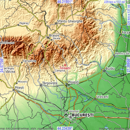
These maps also provides idea of topography and contour of this city, they are displayed at different zoom levels. More info about maps, scale and edge coordinates you can find below images.
| \ | Map #1 | Map #2 | Topo.Map |
| Scale [m] | 348..663 m | 313..1095 m | × |
| Scale [ft] | 1142..2175 ft | 1027..3593 ft | × |
| Average | 500.3 m = 1641 ft | 502.4 m = 1648 ft | × |
| Width | 6.88 km = 4.3 mi | 13.76 km = 8.6 mi | 220.2 km = 136.8 mi |
| Height | 6.88 km = 4.3 mi | 13.76 km = 8.6 mi | 220.2 km = 136.8 mi |
| ↑Max Latitude | 45.264269° | 45.295191° | 46.21501° |
| Latitude at center | 45.23333° | 45.23333° | 45.23333° |
| ↓Min Latitude | 45.202374° | 45.171402° | 44.23439° |
| ← Min Longitude | 25.939385° | 25.895439° | 24.57708° |
| Longitude center | 25.98333° | 25.98333° | 25.98333° |
| →Max Longitude | 26.027275° | 26.071221° | 27.38958° |
Nearby cities:
Cities around Teişani sort by population:
• Vălenii de Munte elevation 353 m
6.8 km,  144°
144°
• Vărbilău 394 m
6.1 km,  205°
205°
• Slănic 515 m
4.3 km,  295°
295°
• Drajna de Jos 381 m
5.5 km,  109°
109°
• Izvoarele 528 m
5.8 km,  13°
13°
• Groșani 425 m
3.2 km, 300°
• Homorâciu 490 m
4.8 km,  32°
32°
• Scurtești 500 m
6.3 km,  274°
274°
• Prăjani 365 m
4.1 km,  217°
217°
• Schiulești 621 m
6.2 km,  338°
338°
• Livadea 359 m
6.8 km, 219°
• Bughea de Jos 373 m
6.6 km,  153°
153°
Multilingual:
 En español:
Teişani elevación 473 m.
 En France:
Teişani élévation 473 m.


Sources and notes:
- [note 1] Map square and city borders are not equal. Map elevation data is calculated only from area inside that square.
- [src 1] Elevation data from geonames database provided with same terms of usage.
- [src 2] The elevation map of Teişani is generated using elevation data from NASA's 3 arcsec (90m) resolution SRTM data.
- [src 3] Base (background) map © OpenStreetMap contributors tiles are generated by Geofabrik and OpenTopoMap.
Copyright & License:
This Teişani Elevation Map is licensed under CC BY-SA. You may reuse any part from this page, if you give a proper credit by linking to this URL:
 More info on terms of use page.