Teșila elevation
Teșila (Prahova, Comuna Valea Doftanei), Romania elevation is 688 meters and Teșila elevation in feet is 2257 ft above sea level [src 1]. Teșila is a populated place (feature code) with elevation that is 436 meters (1430 ft) bigger than average city elevation in Romania.
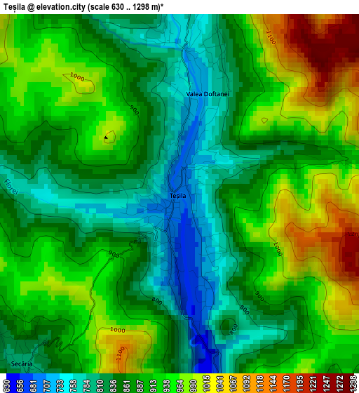
Below is the Elevation map of Teșila, which displays elevation range with different colors. Scale of the first map is from 630 to 1298 m (2067 to 4259 ft) with average elevation of 894.4 meters (=2934 ft) [note 1]
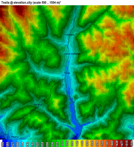
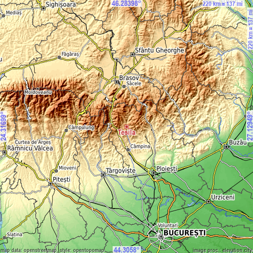
These maps also provides idea of topography and contour of this city, they are displayed at different zoom levels. More info about maps, scale and edge coordinates you can find below images.
| \ | Map #1 | Map #2 | Topo.Map |
| Scale [m] | 630..1298 m | 550..1554 m | × |
| Scale [ft] | 2067..4259 ft | 1804..5098 ft | × |
| Average | 894.4 m = 2934 ft | 971.5 m = 3187 ft | × |
| Width | 6.87 km = 4.3 mi | 13.75 km = 8.5 mi | 220 km = 136.7 mi |
| Height | 6.87 km = 4.3 mi | 13.75 km = 8.5 mi | 219.9 km = 136.6 mi |
| ↑Max Latitude | 45.334421° | 45.365304° | 46.28398° |
| Latitude at center | 45.30352° | 45.30352° | 45.30352° |
| ↓Min Latitude | 45.272603° | 45.241668° | 44.3058° |
| ← Min Longitude | 25.679295° | 25.635349° | 24.31699° |
| Longitude center | 25.72324° | 25.72324° | 25.72324° |
| →Max Longitude | 25.767185° | 25.811131° | 27.12949° |
Nearby cities:
Cities around Teșila sort by population:
• Comarnic elevation 641 m
9.2 km,  229°
229°
• Breaza de Sus 571 m
12.8 km,  204°
204°
• Brebu Mânăstirei 525 m
13.8 km,  165°
165°
• Poiana 746 m
8 km,  216°
216°
• Şotrile 731 m
9.7 km,  183°
183°
• Ghioșești 630 m
10.2 km, 227°
• Bertea 550 m
13.7 km,  124°
124°
• Trăisteni 793 m
3.9 km,  5°
5°
• Posada 749 m
8.4 km,  257°
257°
• Pietriceaua 671 m
11.5 km,  144°
144°
• Secăria 926 m
3.8 km, 234°
• Gura Beliei 538 m
11.8 km,  209°
209°
Multilingual:
 En español:
Teșila elevación 688 m.
 En France:
Teșila élévation 688 m.


Sources and notes:
- [note 1] Map square and city borders are not equal. Map elevation data is calculated only from area inside that square.
- [src 1] Elevation data from geonames database provided with same terms of usage.
- [src 2] The elevation map of Teșila is generated using elevation data from NASA's 3 arcsec (90m) resolution SRTM data.
- [src 3] Base (background) map © OpenStreetMap contributors tiles are generated by Geofabrik and OpenTopoMap.
Copyright & License:
This Teșila Elevation Map is licensed under CC BY-SA. You may reuse any part from this page, if you give a proper credit by linking to this URL:
 More info on terms of use page.