Țibeni elevation
Țibeni (Suceava, Comuna Satu Mare), Romania elevation is 329 meters and Țibeni elevation in feet is 1079 ft above sea level [src 1]. Țibeni is a populated place (feature code) with elevation that is 77 meters (253 ft) bigger than average city elevation in Romania.
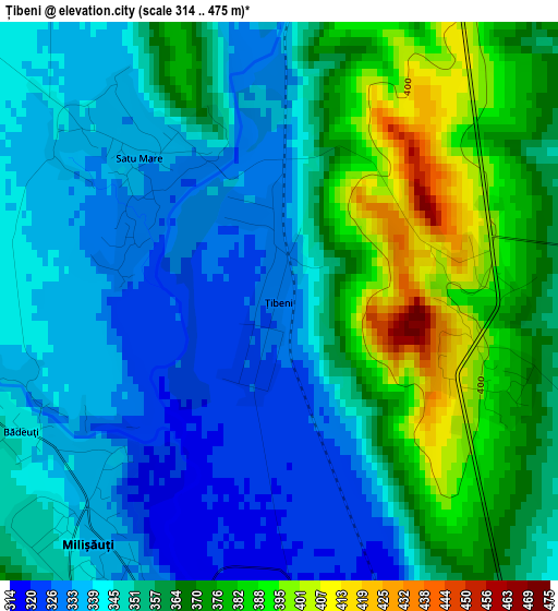
Below is the Elevation map of Țibeni, which displays elevation range with different colors. Scale of the first map is from 314 to 475 m (1030 to 1558 ft) with average elevation of 354.9 meters (=1164 ft) [note 1]
These maps also provides idea of topography and contour of this city, they are displayed at different zoom levels. More info about maps, scale and edge coordinates you can find below images.
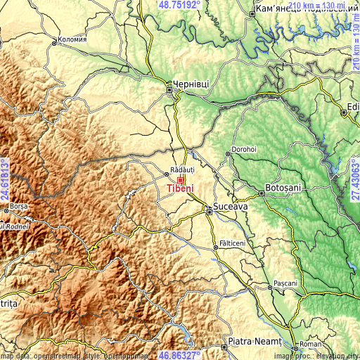
| \ | Map #1 | Topo.Map |
| Scale [m] | 314..475 m | × |
| Scale [ft] | 1030..1558 ft | × |
| Average | 354.9 m = 1164 ft | × |
| Width | 6.56 km = 4.1 mi | 210 km = 130.5 mi |
| Height | 6.56 km = 4.1 mi | 210 km = 130.5 mi |
| ↑Max Latitude | 47.845681° | 48.75192° |
| Latitude at center | 47.81618° | 47.81618° |
| ↓Min Latitude | 47.786662° | 46.86327° |
| ← Min Longitude | 25.980435° | 24.61813° |
| Longitude center | 26.02438° | 26.02438° |
| →Max Longitude | 26.068325° | 27.43063° |
Nearby cities:
Cities around Țibeni sort by population:
• Rădăuți elevation 368 m
8.9 km,  295°
295°
• Milişăuţi 334 m
4.1 km,  206°
206°
• Volovăţ 383 m
9.3 km,  270°
270°
• Calafindeşti 422 m
7.8 km,  61°
61°
• Grăniceşti 357 m
3.2 km,  89°
89°
• Dorneşti 346 m
6.4 km,  346°
346°
• Satu Mare 337 m
2 km,  343°
343°
• Bălcăuţi 374 m
9.1 km,  23°
23°
• Iaslovăț 361 m
7.3 km, 208°
• Șerbăuți 392 m
8.7 km,  82°
82°
• Burla 428 m
7.8 km,  248°
248°
• Bădeuți 342 m
3.4 km,  243°
243°
Multilingual:
 En español:
Țibeni elevación 329 m.
 En France:
Țibeni élévation 329 m.


Sources and notes:
- [note 1] Map square and city borders are not equal. Map elevation data is calculated only from area inside that square.
- [src 1] Elevation data from geonames database provided with same terms of usage.
- [src 2] The elevation map of Țibeni is generated using elevation data from NASA's 3 arcsec (90m) resolution SRTM data.
- [src 3] Base (background) map © OpenStreetMap contributors tiles are generated by Geofabrik and OpenTopoMap.
Copyright & License:
This Țibeni Elevation Map is licensed under CC BY-SA. You may reuse any part from this page, if you give a proper credit by linking to this URL:
 More info on terms of use page.